There are a number of websites that have historic older maps available for online viewing (I’ll list a few of these in an upcoming post), but these sites typically don’t have the maps in high-resolution downloadable formats. You can always zoom in to the highest resolution, do a screen capture, then mosaic the images together if you have the time and patience. But there are a number of websites that do offer downloads of historic (and recent maps) in a high-resolution format. For some maps, a download link will be offered; for others, you’ll have to either right-click on a link to save the map to your computer, or open the image in your browser and then save it to your computer by right-clicking on the image.
Some maps are available in uncommon formats, like MRSid (*.sid), ECW (*.ecw) or JPEG2000 (*.jp2). If your graphics editor can’t open these formats, you can use the TatukGIS Viewer or IrfanView (with the additional plug-ins) to open these files and convert them to a more familiar format like TIF or JPG. Many maps are also available at the highest resolution in PDF format, and you can use a program like PDFCreator to convert them to standard image formats.
Library Of Congress: The US Library Of Congress has an enormous online collection of maps, historic and modern, for the US and the world, searchable and browsable by geographic area, keyword, subject, creator, and title. Most maps are downloadable in the MRSid format in very high resolution, but can also be viewed at various zoom levels online.
The Perry-Castaneda Map Library: Based at the University of Texas in Austin, this site offers modern and historical maps of the entire world at a wide variety of resolutions, mainly in JPG format but some in PDF as well. There’s also a large number of Texas maps (no surprise), and links to additional web map resources. I found the Army Map Service topographical maps of particular interest: 1:250K topo maps of many areas for which topo maps are difficult to find (Africa, Burma, Siberia, and more).
Leen Helmink: Website of a dealer in rare and antique maps, with high-resolution scans of historic maps from around the world, many for sale.
Yale University Map Library: A number of their historical and current maps are available for download in the JPEG2000 format (with more being added all the time).
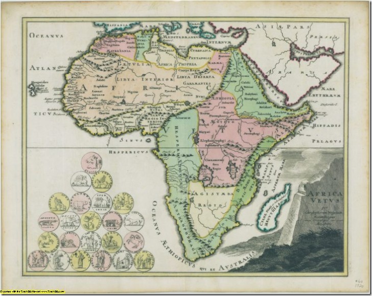
Africa map from Yale collection (resized 10x smaller than the original in pixel dimensions, 100x smaller in pixel area)
University Of Connecticut: Many historic maps, primarily of the New England and Mid-Atlantic region, most both viewable online and downloadable in MRSid format.
The Atlas Of Canada: Modern and historic maps of Canada, many (but not all) downloadable in JPG and PDF formats; check the bottom of the individual map pages to see if there are download links available. PDF maps are usually of higher quality than JPG.
Michigan State University: Primarily maps of Michigan, but some maps of Africa and North America.
Quebec National Library And Archives: In French, but you should be able to get around. Mainly maps of Canada and North America, browsable by titles (“titres”), authors (“autheurs”), by time (“chronologique”) and area (“toponyme”). Look for the link titled “la carte agrandie” to open the map image at full resolution in a new window, then right-click on the image to save it.
W. M. Keck Earth Sciences and Mining Research Information Center: Large selection of historic and modern maps of Nevada and surrounding areas.
Know of a good site that I’ve missed? Post it in the comments, and I’ll do a follow-up post later.