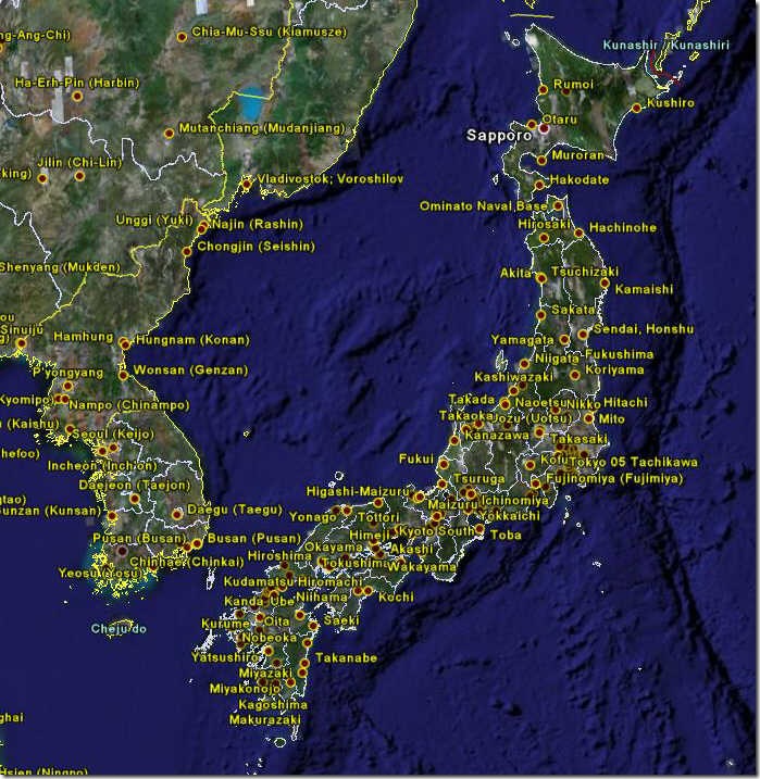
In a previous post on large-format downloadable historical maps, I noted that the Perry-Castaneda Map Library has an interesting digital collection of Army Map Service topographic maps dating from the 1940s and 1950s, covering large areas of Asia and Africa, along with city maps for Japan, China, Korea and Taiwan (Formosa). Over on the Google Earth Community, “PriceCollins” has been creating a KMZ index file for these maps. So far, he has indexed all 435 city maps:
And 413 1:250K maps covering most of India, Pakistan and Southeast Asia:
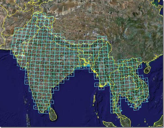
Each city and rectangle placemark contains a direct download link to the map image at the Perry-Castaneda Library. From the post, it sounds like eventually all the maps will be indexed in this fashion, so it’s worth bookmarking the site and checking it regularly for updates.