After the fall of the Soviet Union, a large number of topographic maps covering much of the world became available in the West; the story behind these maps is told on the informative Soviet Maps website. There are dealers who will sell you sets of maps on CD or DVD, but there are also some websites that allow you to download some individual maps for parts of Europe and Asia for free.
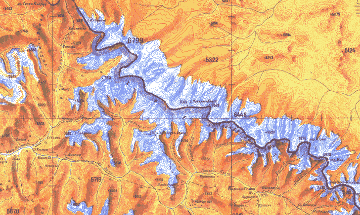
Some of the maps have a graphic style more colorful and visually appealing than many topographic maps from Western countries. Here’s an example of one of those maps, showing the Himalayas along the Nepal-Tibet border:

The Soviet Maps website has a few maps from England available for download, but there are far more available at two other sites linked to from there.
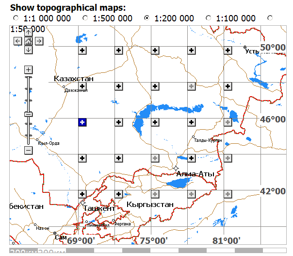
The Poehali website, connected with the MapStor dealers website, has a Google-Maps-based interface:

Scroll and zoom to the area you’re interested in, and select a map scale you’re interested in at the top. Solid black plus signs in the map subsquares indicate that maps covering the entire subsquare at that scale are available; ghosted plus signs indicate part of the area is covered by available maps; minus signs indicate that no maps at that scale are available for the area. Click on the plus sign, and a list of links to those maps will appear below. Click on a link, wait a few seconds while you look at a MapStor ad, enter a numeric code, and you can then download the map in GIF format (not georeferenced).
You might also try ????? ??????? (Karta Ukraine?); it’s only in Cyrillic, so if you don’t read Russian (and I don’t), it’s kind of tough to figure out all of what’s available on it. From poking around the site, and from a very limited knowledge of Cyrillic, I can see that there are topographic maps and orthophotos (not georeferenced) for Ukraine, and apparently parts of Belarus and Moldova as well, in JPEG format. They also aren’t georeferenced, and you’ll have to do that to use them in a GIS program. Explore the site I’ll be posting about free georeferencing software and techniques in future posts.
Soviet maps don’t necessarily use the same symbology as Western maps. But you can download explanatory guides to Soviet topo map symbology from the Armchair General website or a Stanford Library website.
Hello,
I’m searching for maps covering a large area in Tibet. And i got on freegeo site to read you.
Some of the maps covering the area i m looking for are available on http://www.lib.utexas.edu/maps/ams/china/
Who could have these soviet maps free, what about universities ? I search in berkeley and the famou sone, but nothing very intersting.
My search is for a 1:200000 scale from chengdu to west of nepal. I m going to trek for weeks with a friend.
My mail is mat26@hotmail.com
any answer is welcome.
Thank
http://www.topomaps.eu/asia/index.shtml