1:24,000 scale topographic maps from the United States Geological Survey (USGS) are a convenient cartographic resource, readily available from regional state GIS agency archives or the Internet Archive / Libre Map Project. However, many of the maps are seriously out of date, as much as twenty years or more.
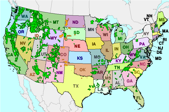
However, if the maps cover USDA National Forest areas, updated versions of the maps, revised in the late 1990s, are available from the US Forest Service GeoData Clearinghouse. Since most National Forest areas are west of the Mississippi, coverage is heavily skewed towards the western United States, but there are some National Forest areas in the eastern US as well:

Click your way through the maps until you reach a listing of links to map files, then download them to your computer. The files are in tar.gz compressed format, which requires a file compression/decompression utility capable of opening them. In Windows, you can use WinZip if you have it, but 7-Zip and ZipGenius are free utilities that can handle files in that format. There will be two separate TIFF maps in each downloaded file, one with the map collar or border in place, the other “de-collared”. The maps aren’t georeferenced (GeoTIFFs), but .tfw world files in UTM NAD27 are included for both, so they can be opened and used in most GIS programs.
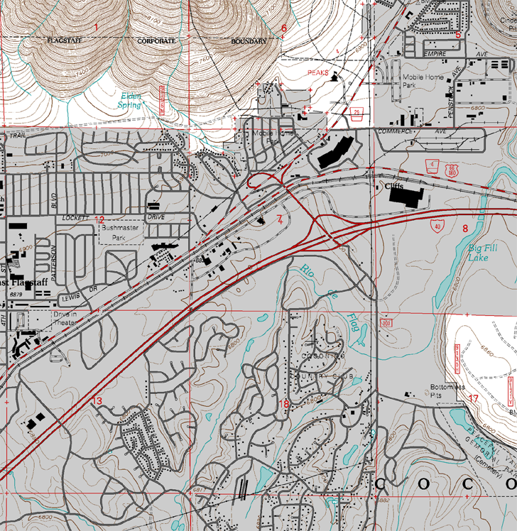
Updates include:
- New roads and features
- Improved typography
- No green shading for forested areas (all white on the revised maps)
- Better-defined boundaries for National Forest areas
- Updated magnetic deviation data
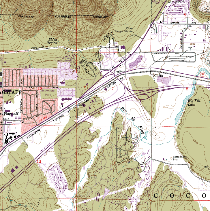
Here’s a section from an older USGS topo:

And here’s the updated Forest Service version of the same area:

So why is the TerraServer service “pushing” the old version of the Arizona comparison you have posted above???
BT
They probably got all of their topo maps in one batch, and that batch was strictly the older ones. Since only a small part of the US is covered by these updated versions, I suppose that makes sense. Or maybe they just don’t know that these updated versions exist, or didn’t want to mix old and new maps. Take your pick.