There’s been a mini-craze online for creating tilt-shift photos, where the focus position and depth of field on a landscape/cityscape are manipulated to make the picture look like a miniature reproduction. For authentic tilt-shift photos, you need a special lens, but you can re-create the effect using Photoshop filters, or by following tutorials online. Now there’s an online website called TiltShiftmaker that lets you upload your own photos, and applies a tilt-shift effect to them:
Original photo from the island of Santorini (from Flickr):

Run through TiltShiftmaker:

The process works best on images that don’t have a few objects much taller than the rest of the scene, as that can result in the base of the object being at a different focus/blur than the top.
Via Lifehacker.
MapChannels writes to announce a few new features:
Holiday Maps: Create an embeddable Google Maps window with the option for additional information layers:
- Panoramio photos
- Geo-tagged Wikipedia articles
- Google Street View
- Traffic Layer
- Weather Information
- User-defined KML or GeoRSS Layers
- Index sidebar
- Hotel search using the Map Channels Hotel Directory
- Google search
- Slide Show
- Google Earth 3D (note: currently buggy, doesn’t work for me in Firefox 3)
MapChannels For Virtual Earth: Create an embeddable Virtual Earth window with KML or GeoRSS feeds (an analogue to Google Maps’ MyMaps feature, also supported by MapChannels in embeddable format).
StreetCities: New tools to combine Google’s Street View with a second view in the Google Earth plugin. This doesn’t work in Firefox 3, either.
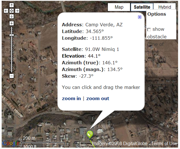
Here’s a slick little online geographic tool called DishPointer. Enter your position (latitude/longitude), or your address, then select from a list of broadcast satellites in geosynchronous orbit. DishPointer will bring up a Google Maps display showing the proper orientation for your dish antenna for optimal reception from the selected satellite:
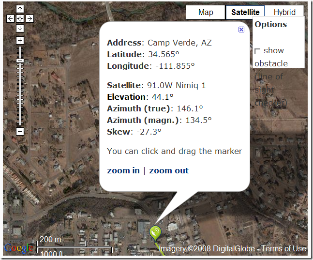
Check the box marked “Show obstacle”, and you can move the marker to show the maximum height an obstacle (like a tree or a neighbor’s house) can have without blocking your satellite dish’s line-of-sight view.
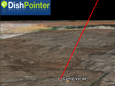
Click on the Google Earth icon, and have the line-of-sight to the satellite shown in 3 dimensions:
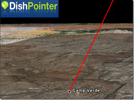
If your view of the satellite is blocked by terrain, that will be visible in Google Earth; if there are 3D buildings for your area, you’ll also be able to see whether your view is blocked by adjacent buildings as well.
Via OgleEarth.