blankblank blank


Archive for the 'ESRI' Category

Search And Catalog Your Local GeoData (ArcGIS Users Only)

When I saw this post at the WeoGeo blog on Voyager, I was psyched. The free version of Voyager searches your hard drives for up to 5000 geodata files, catalogs/indexes them, thumbnails them, and makes them easily searchable and retrievable; paid versions increase that data limit, and offer more features (concurrent users, network storage searches, etc.). You can even add links to online data sources like WeoGeo that support the Web Catalog Service (CSW) (live web demo here).

voyager

I’ve got data files scattered all over the place, so this would be a perfect organization tool for me. But I was bummed to find out that you need to have ESRI’s ArcGIS Desktop 9.3 or higher installed on your system, which I don’t. Nuts. But if you do have a supported version of ArcGIS, you’d be crazy not to at least try out the free version.


Quick “Hand-Annotated” Maps With Sketch-A-Map, Plus A Bonus Geocoder

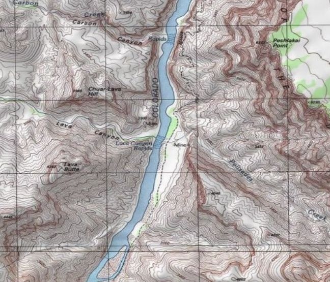
If you need to quickly bang out a “hand-annotated” map, you could do worse than ESRI’s Sketch-A-Map site. You have the choice of three different map backgrounds to draw on:

  • USGS topographic maps, with the scale type (1:24K, 1:100K, or 1:250K) determined by your zoom level

topo

  • Standard street maps (with some terrain shading)

street

  • Satellite maps / aerial imagery

aerial

All three images above are at the highest zoom level available, so don’t expect to do house-by-house annotations.

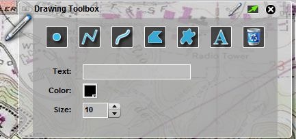
You can zoom in to an area with pan/zoom, or use the “Locate” tool to specify latitude/longitude or address to go immediately to that location. Once there, select your desired drawing tool from the Toolbox:

toolbox

And annotate your map:

map

The “Trash Can” icon wipes the map clean of all annotations; unfortunately, there doesn’t seem to be a way to remove a single added object, not even the most recently-added one. So think of this as drawing in pen on a paper map, where you just have to deal with any mistakes you’ve made or start over completely.

Once done, you can use the “Drawing” menu to select “Print or Save”; this gives you the option of either directly printing the map, or saving it in PNG format. Images are saved at the same pixel dimensions they have in your browser window, which will depend on your display monitor, and whether the browser fits the full screen.

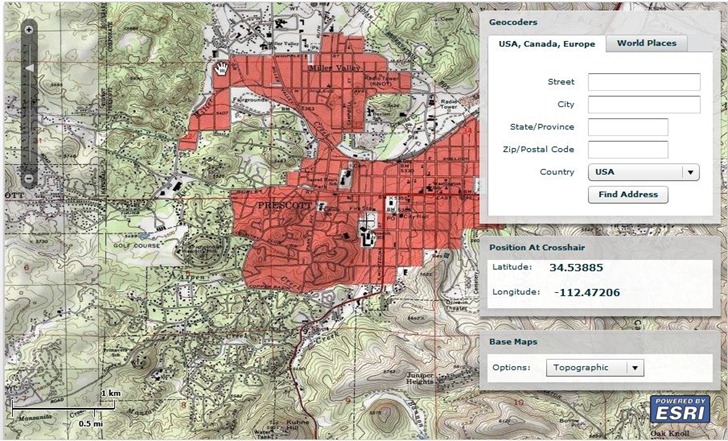
The same ESRI site offers a basic geocoder, which lets you pull latitude/longitude coordinates up by address, or the center spot on a map:

geocoder

Via Very Spatial.


Government GeoData In ArcGIS-Compatible Form From GovMaps.Org

ESRI’s GovMaps.Org website (currently in beta), currently offers a searchable catalog of 88  data layers (and presumably growing) hosted at ArcGIS.com, mainly from the US Government, covering a wide variety of subjects areas. A random sampling:

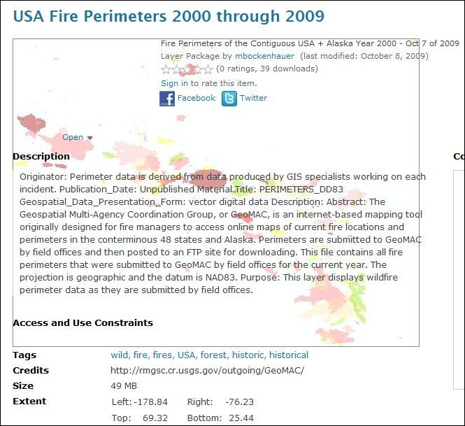
Click on a link, and it takes you to that data page at ArcGIS.com with more info, metadata links, and download links:

govmaps_1

Clicking on the arrow next  to the “Open” link gives you a number of options, depending on the kind of data:

– “Open in ArcGIS.com Viewer”: Opens up the data directly in ArcGIS.com’s web-based map viewer. Oddly, this option isn’t available for all datasets; hopefully, it will be soon.

– “Open in ArcGIS Desktop”: Downloads an item.pkinfo or .lyr file that ArcGIS Desktop can use to load/download the info.

– “Download”: Downloads the full data in a layer package file (.lpk) that ArcGIS Desktop can open directly.

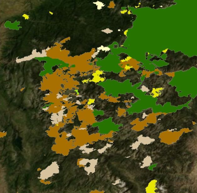
If you don’t own the expensive ArcGIS Desktop software, and want to view data that isn’t viewable at ArcGIS.com, any of the item.pkinfo, .lyr or .lpk files you download can also be opened up in ESRI’s free ArcGIS Desktop Explorer software, like the wildfire data shown below on top of the Bing Maps aerial basemap:

fire_data


ShareGeo: Open Geo Data Repository

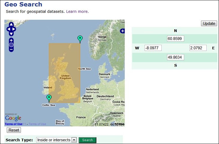
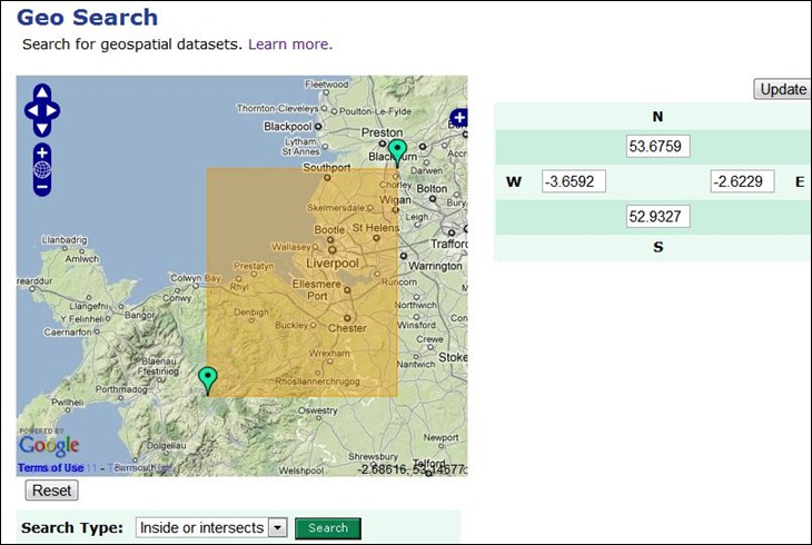
Addy Pope of the University of Edinburgh writes to announce ShareGeo, a data repository for open geo data that is freely shareable and distributable. While it’s open for use by anyone, the datasets currently available show a not-surprising bias towardsUK-related data. You can search for data by date, subject, source, title, or more generally by defining geographic extents:

sharegeo_1

The initial view shows the defined area of interest as the yellow rectangle; you can adjust the extents by modifying the lat/long coordinates directly, or drag/drop the green markers to redefine the extents directly:

sharegeo_2

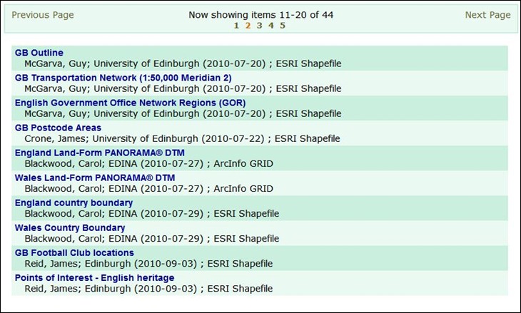
Once done, click on Search, and get both a list of available datasets for that area:

sharegeo_4

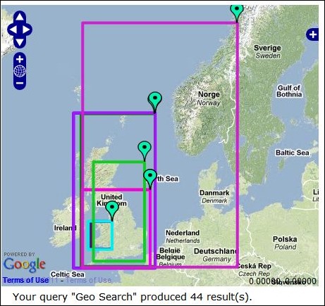
And a map that shows the extents of all datasets listed below it:

sharegeo_3

Click on a maker to identify which dataset’s extents it corresponds to. If you move to another page of results, this map will update automatically to show the extents of the new results listing.

Registered users (free) can upload data directly to the repository, or use a free extension to upload directly from ArcGIS.


Useful ArcGIS Explorer Add-Ins III

One final set of add-ins for the excellent GIS data viewer ArcGIS Explorer, discovered by searching the site (since there doesn’t seem to be a gallery/catalog section for these on the site). Here’s the link to Part I, and here’s Part II.

Table Viewer – Supposedly adds the ability to view tabular database data, a feature sorely missing from the default installation. But I tried to figure out how to open a shapefile’s DBF table (supposedly supported by this option) without success; maybe you’ll have better luck. Also supposedly supports online geodatabases.

Query FeaturesExplorer has a built-in Query function (available on the Tools tab) that creates a classic SQL query, and then highlights all matching features in the map view:
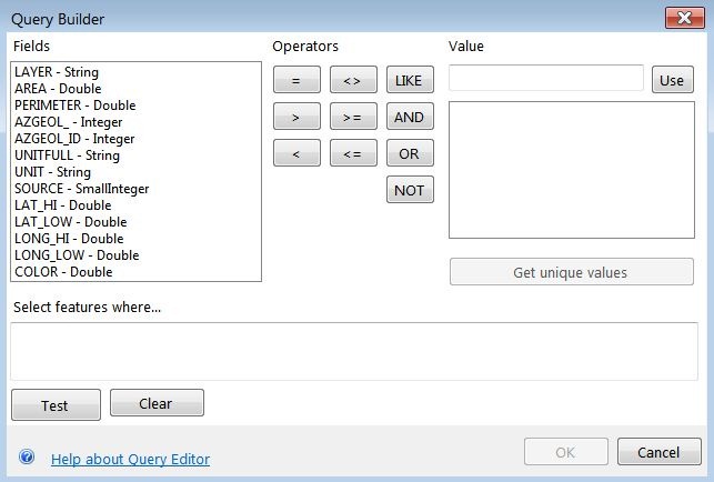
query1

The Query Features add-in works somewhat differently – it creates a tabular view of matching features, and then clicking on a table entry zooms you in to that single feature on the map:
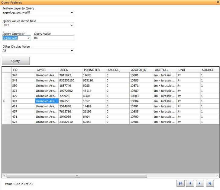
query2

You can use both query functions at the same time, and they complement each other quite well.

AGX2KML – Takes the current map view, and converts it into a KMZ image overlay file for use in Google Earth. Here’s a queried selection for the Jurassic Morrison format in Arizona, viewed in Explorer and then converted to a KMZ overlay:
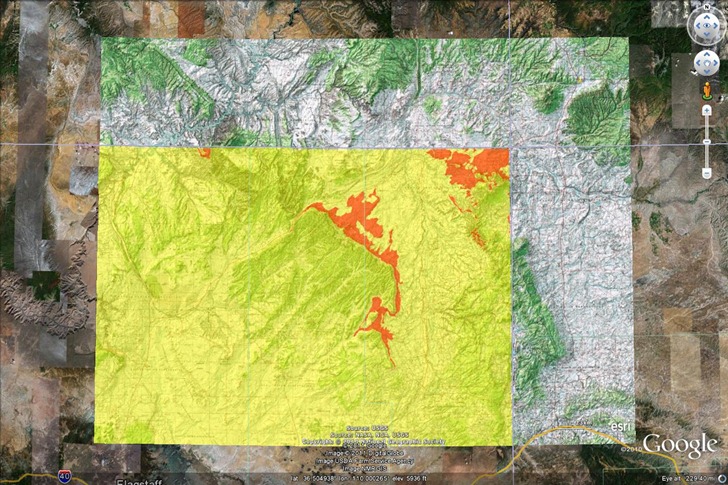
agx2kml

PhotoOverlay – Lets you create a KMZ overlay from an input image. Bit clunky to use, as it requires you to enter the N/S latitude and E/W longitude limits for the image manually, or by clicking on the map; would work better if you could georeference any points on the map image to points in Explorer; as is, you’d probably be better off loading the image directly into Google Earth and manually calibrating the image.
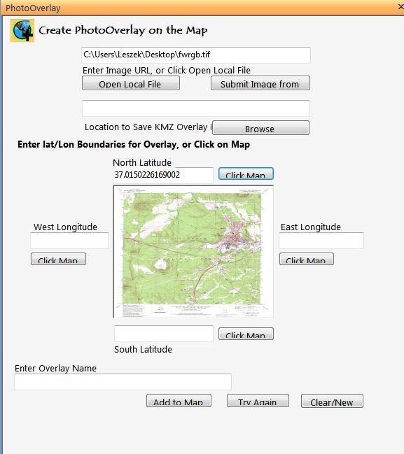
po

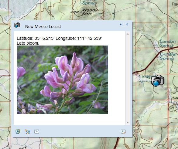
PhotoPoint – A utility to simplify (somewhat) the adding of picture data to a map. In the main add-in input window, you specify the picture (either URL or local file), and add additional descriptive data; you can specify coordinates by clicking on the map, or typing them into the box.

pp

This utility does not recognize embedded geotagging data, nor will it embed coordinate data into the photo; it just creates a photo content file on the map, with a pop-up that includes the entered data:
pp_popup

If you want to geotag images, or use geotagged photos, the Image Geotagger add-in (described here) might be a better choice; no popup text data entry options, but it will use embedded geotagging data to place the photo.

Finally, there are some expansion packs that add additional capabilities to ArcGIS Explorer; links to the downloads can be found on the main ArcGIS Explorer Desktop download page.

Projection Engine Expansion Pack – The default install of ArcGIS Explorer Desktop comes with geographic coordinates as the default (lat/long/WGS84); in the Display section, you can select MGRS or USNG grid directly from the Coordinates dropdown, or choose “More” to get a full list of available coordinate systems. The Projection Engine Pack adds some more coordinate systems to this “More” section.

Fonts Expansion PackLike it says, makes more font choices available for labels.

Data Access Expansion Pack – “Expands geodatabase functionality by allowing direct connections to multi-user geodatabases.” No personal experience with this.


Useful ArcGIS Explorer Desktop Add-Ins II

Continued from Part I yesterday …

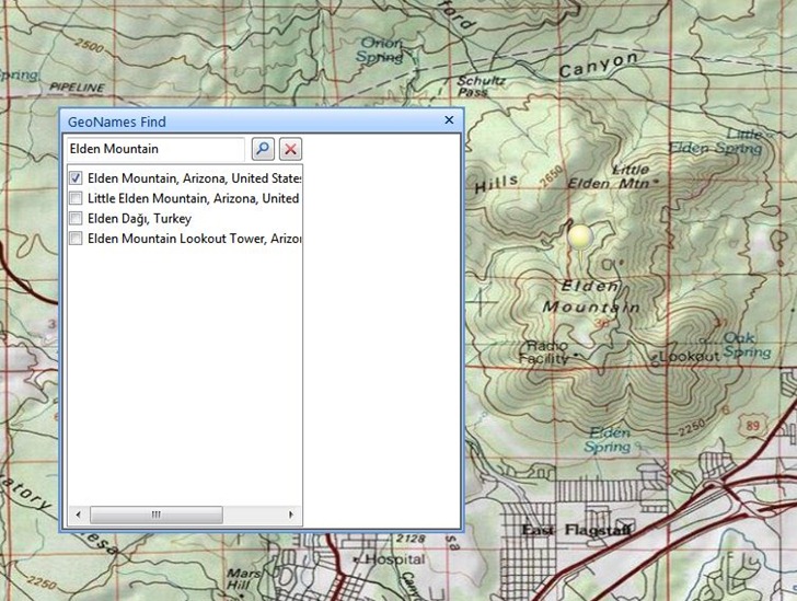
GeoNames Find – Enter the name of a geographic feature, and ArcGIS Explorer will go the best fit for the entered name, as well as offering a full set of options.

geonames_find

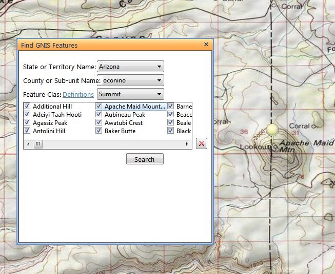
Find GNIS Features – Select a US state/county, and a feature type from the Geographic Names Information System (GNIS), like town, arch, summit, mine, reservoir, etc., and get all such features in that area plotted:

find_gnis_1

Double-click on any of the names listed, and the map will zoom in on the selected feature:

find_gnis_2

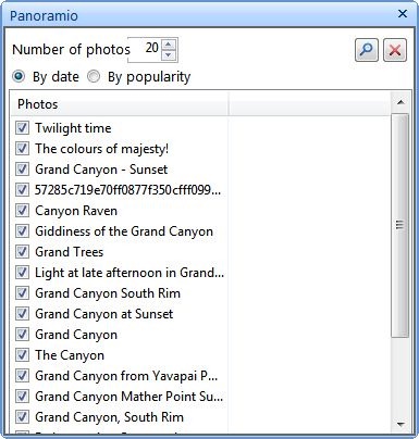
Panoramio – Pan/zoom to your desired area, and get photos from Panoramio:

panoramio

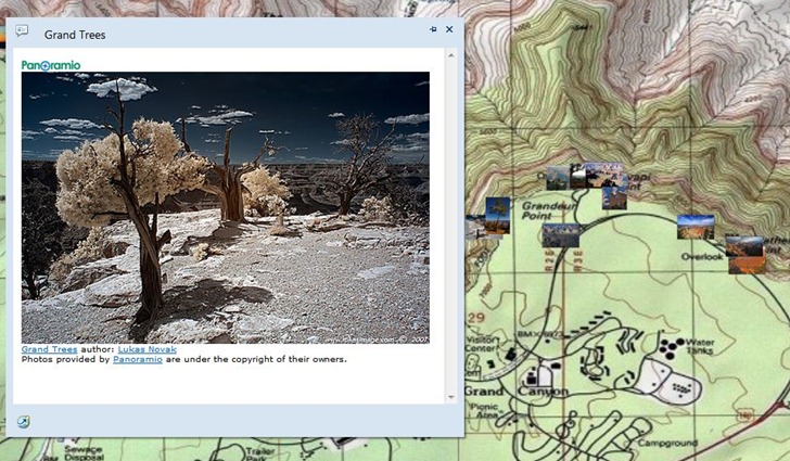
Photo thumbnails will be plotted on the map; double-click on a thumbnail to get a larger-sized image in a pop-up:

p_gc

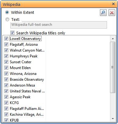
Wikipedia – Same general idea as Panoramio; go to the desired area, and search for Wikipedia entries geotagged to that location (or search by text):

wikipedia

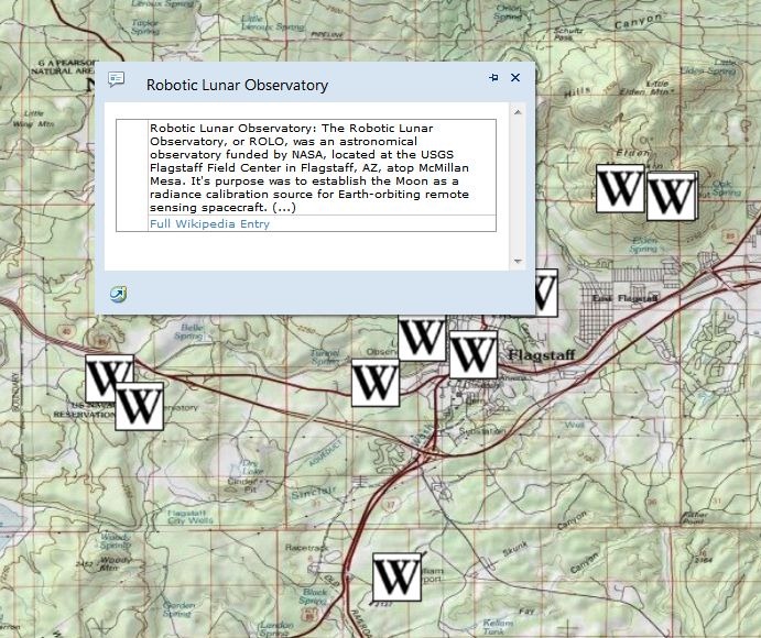
Entries will be plotted on the map; double-click on a “W” icon to get the start of the Wikipedia entry, and a link to go to the full article:

wiki_pop

Set Transparent Color For Image Overlay – Image overlays are graphics that sit at a constant spot in the view; examples might be a logo graphic or map legend. This add-in lets you set a transparent color, useful if you have a logo/legend on a white background, and you want the background to disappear. Unlike the map transparency feature, this will work with graphics with indexed colors (TIFFs, GIF, PNG).

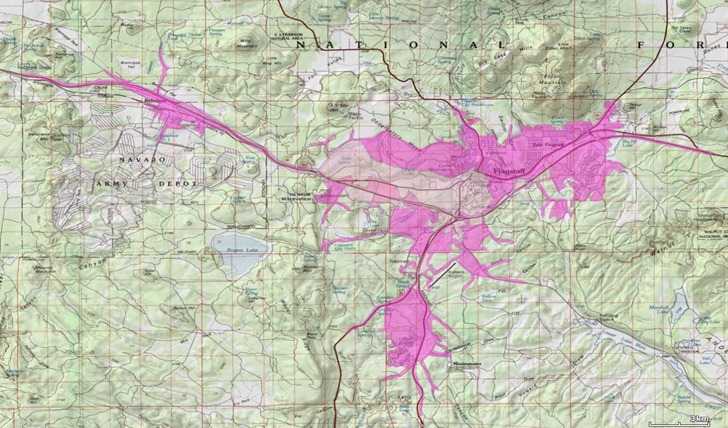
Drive Time Analysis – An interesting example of the kinds of analysis tools that can be created using the ArcGIS Explorer SDK. This add-in calculates areas within a certain driving time of a user-specified starting point (up to 15 minutes driving time in this sample add-in). Below, the lightest color is 5 minutes, next is 10, darkest color is 15 minutes away.

drive_time

Still a few left; I’ll save those for Part III.


Useful ArcGIS Explorer Add-Ins I

Yesterday’s post was about the latest version of ArcGIS Explorer Desktop, ESRI’s digital globe and GIS data viewer. One of its major advantages over Google Earth is the ability to create “add-ins”, user-programmable plug-ins that add functionality. But there doesn’t seem to be a catalog/gallery of these add-ins at the ArcGIS site. Searching around, I found a bunch of potentially useful ones. Install them by downloading the “eaz” file, then go to the Display ribbong, Options section, click on the Resources link, select “Manage Add-Ins”, and choose the downloaded eaz file. Add-ins will show up either on the Add-Ins ribbon, or in some cases in the Analysis section of the Home ribbon.

Garmin Tools – Converts an ArcGIS display into a KMZ overlay file compatible with newer Garmin units; there was a post on this tool a while back on this site.

Georeferencing – Import a raster image, and then georeference it using a three-point affine transformation. Works well with Mercator-based map projections. Limited support for some raster formats (e.g. doesn’t work with indexed-color TIFF files), and parts of the image can disappear after georeferencing. Finally, you can’t export the georeferenced image, though you can save it as part of the default view in ArcGIS Explorer. Addendum: Whoops – just found a world file and XML file that go with the image file. However, the world file is in geographic coordinates regardless of what the original image’s projection is in; it also includes non-zero rotation parameters, which a fair number of GIS programs can’t handle.

Capture Presentation Slides, Convert Presentation to PPT – Explorer Desktop lets you create presentations from map views. “Capture Presentation Slides” automatically creates a basic presentation by zooming in to every data layer loaded, creating a title from the data name, then generating a slide. “Convert Presentation to PPT” captures the slides as JPGs, then creates a PowerPoint file to display them.

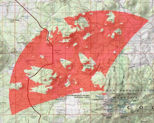
Visibility Analysis – Generate a viewshed from a chosen point using 90m DEM data (maximum distance is 20 km), which is added to the data layers.

viewshed

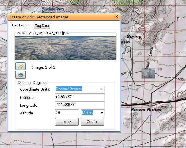
Image Geotagger – Add a previously-geotagged image, or geotag a new image and have it saved under a different name.

geotag1

The image will show as a small thumbnail on the map; click on it to bring up a pop-up window with a full-scale view of the picture.

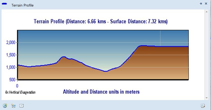
Terrain Profile – Draw a single track line, or series of track line segments, and get an elevation profile along that track.

terrain_profile

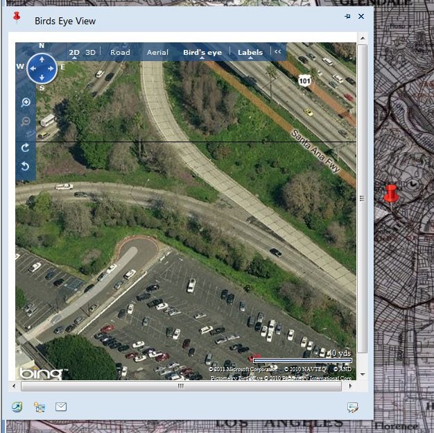
Bing Birds Eye View – Click on the map, and get a pop-up with a Bing Maps window; not just Birds Eye oblique views, but the option for standard Bing Maps as well.

bing

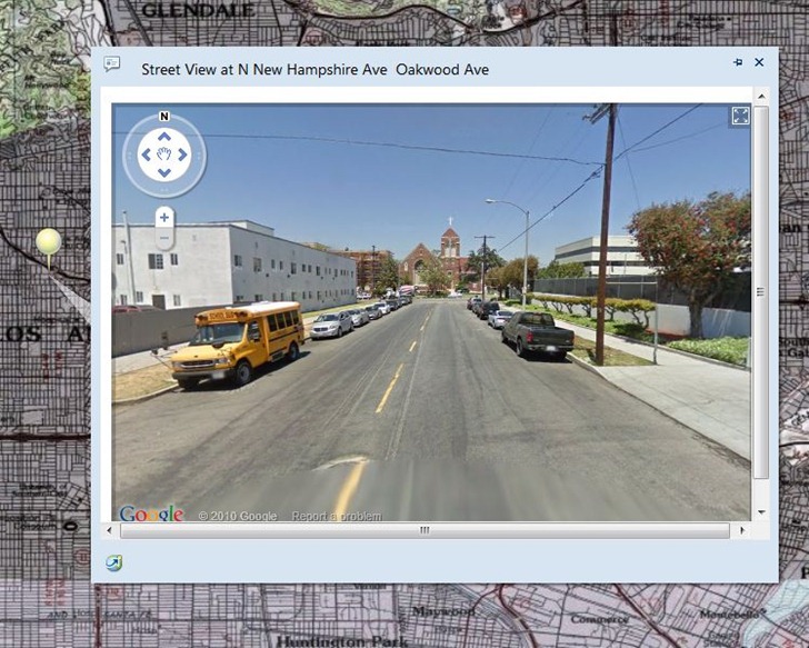
Street Viewer – Similar to the above, but brings up a pop-up window with the Google Street View display (and interactive viewer)

streetview

More tomorrow …


Hey, ArcGIS Explorer Desktop Has Turned Out Pretty Good!

Yeah, that’s not news to a lot of you, but it is to me. My last significant exposure to ESRI’s ArcGIS Explorer digital globe software (Windows only) was back when it came out, quite a few years ago. I tried it, and found it inferior to Google Earth in performance in 3D, and too complicated to bother learning it; since then, I’ve stuck strictly with Google Earth. A recent post on the free Garmin Tool application, which creates Garmin Custom Map overlays using ArcGIS Explorer, forced me to look at it again, and I was surprised to discover that it’s turned into a pretty cool, and pretty useful tool. Not perfect – the 3D performance is still pretty weak compared to Google Earth, and the out-of-the-box configuration isn’t as strong. But it has it’s own very strong set of features, and when used in 2D mode, is a good addition to any geography toolbox. Nice re-organization of tools/features in a MS-Word-like ribbon format, much better than the original interface.

  • A good selection of basemap imagery sets, including Bing Maps (aerial/road/hybrid), general world imagery/topographic/road maps, OSM, general terrain shading and National Geographic shaded topo maps:

natgeo

No vector basemap data, like the roads you’ll find in Google Earth.

  • Add raster/vector data from multiple data sources and types: ArcGIS Online, GIS web services (ArcGIS servers, GeoRSS, WMS), ArcGIS lyr files, shapefiles, KML, GeoDatabases, text files, georeferenced raster imagery (e.g. GeoTiffs), and GPS data files (GPX).
  • Vector editing tools: Point, Line Area, Circle, Rectangle.
  • Export data in KML format (for user-created vector data), nmc map content packages for other ArcGIS Explorer users, or lpk layer files for ArcGIS.
  • Driving directions/routing
  • Add links to non-geographic data (documents, images)
  • Measurement tools for distance/area
  • Create a slide presentation by saving a series of map views
  • Time/flight animations

Oh the “needs work” side:

  • In the default install, I can’t find a way to set shapefile colors/sizes/symbols to depend on attribute values. For example, if you have an area shapefile with multiple subareas, each depicting an area with a separate property, they’re all displayed with the same color. For a GIS data viewer, this is a major missing feature. No selection/filtering by attribute either. The only way to view attribute data is through an on-screen pop-up; no tabular views of the DBF data.
  • I initially thought there was no adjustable transparency for raster/vector layers, but it’s under the Appearance ribbon tab, instead of in the Properties window for each layer, which is where you’d normally expect to find it.
  • Zoom and tilt controls are the opposite of every other digital globe I’ve used; scroll the mouse wheel away from you to zoom in, click the center button and move the mouse away from you to tilt the view to an oblique angle. And boy, can it be unresponsive sometimes in 3D mode! I usually only use the program in 2D mode only, so as not to have to deal with those issues.
  • There’s a nice interface for querying/previewing datasets available in ArcGIS Online, but there’s no comparable gallery of pre-packaged content files (NMC/NMF files) anywhere on the ArcGIS website, at least that I could find.
  • The app comes with the ability to add GIS-like analysis tools, as well as utilities like the Garmin Tool mentioned above (created with .Net and a free SDK kit from ESRI). By default, it comes with a buffer tool only; the process for adding additional tools isn’t explained very clearly in the help file. And while there’s a fair number of tools available, they’re hard to find; there doesn’t seem to be any systematic directory or catalog of them on the ArcGIS site. With some work, I tracked down some of them, and will post on them tomorrow.