USGS digital orthoquads are black-and-white aerial photos covering most of the continental United States, with a resolution of up to 1 meter per pixel. You can download orthoquad imagery from the USGS Seamless Server as well as other online archives, but the maximum extent of individual images from those sources is limited; if you need an image covering a large geographical area, you’ll need to assemble them piecewise from smaller images. Terraserver also provides digital orthoquad imagery, and there are some programs that will download Terraserver imagery for small geographic extents, but not large ones at the full resolution of one meter per pixel. If you don’t need the imagery to be georeferenced, or can georeference it yourself later on, TerraClient lets you download digital orthoquads covering extents of tens of miles on a side at up to one meter per pixel resolution in a single image file (the maximum area covered depending on your computer screen resolution).
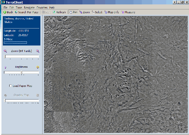
After installing and running TerraClient (see addendum at bottom concerning downloads), you select the center of your area of interest by either entering the coordinates directly, or using a search box that lets you center on gazetteer features like cities, bodies of water, peaks, etc.. After selecting the center location, TerraClient will zoom to that location, and load in Terraserver imagery at an on-screen resolution of 64 meters per pixel (it says yards, but Terraserver data is in meters).
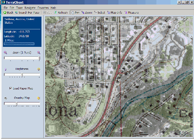
The slider controls in the left sidebar let you zoom in to up to one pixel per meter onscreen resolution, and also adjust the overall brightness of the image. Check the “Load Paper Map” box, and TerraClient will overlay a USGS topo map on top of the digital orthoquad, with the transparency of the map set by the bottom slider:
The controls at the top let you:
Pan – Move the image around by clicking and dragging
Zoom – Zoom in to an area by clicking and dragging on the map to select an area
Measure – Click on two points on the map, and find out the distance between them
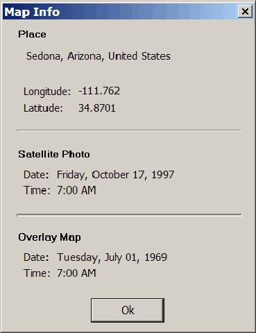
Map Info – Click on the map, and get an info window that tells you when the aerial photo (mislabeled “satellite”) was taken, and when the topo map dates from:
Select – You can use this to select an area to download an entire image from, but you can also use Ctrl-A (or Edit => Select All) to choose the entire on-screen image.
To create an image covering the widest area possible, you would set the zoom level to 64 meters, and then use Ctrl-A to select the entire image. Then choose File => Save As to get the save options:
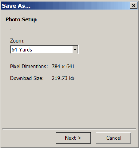
Use the zoom dropdown to select the image resolution, and TerraClient will give you the image size in pixels, and the total download size for the data used to create the final image. For the example above, the image size and filesize are fairly small; but if I set the zoom to 1, the image dimensions mushroom to 50129 x 41022 pixels, and the download size is a whopping 446 MB. You will have the option to save the image in JPG form (smaller filesize, but degraded resolution) or BMP (full resolution, filesize essentially the same as the download size). If the download size is too large for your system’s resources, you’ll get an error message to that effect, and you’ll have to reduce either the zoom level or the size of the selected area.
I don’t need a large, non-georeferenced orthoquad image that often, but when I do, TerraClient is a convenient way to get it. But it’s also an easy way to find the date when orthoquad aerial photos were taken, along with the date of the overlaid topo map data, and the blending of topo map images with aerial imagery can also be handy. It would be great if the program allowed you to save blended images, but it doesn’t.
Tomorrow, I’ll start a series of posts on another free Terraserver imagery program, one which in many ways is more useful than TerraClient.
Addendum: In comments, Raj points out that the download link on the TerraClient homepage doesn’t work, and offers a Softpedia download link that does work. You can also download it from the BetaNews FileForum.
The link to the installer on Friedrich’s site is not working. You can instead download it from SoftPedia.
http://www.softpedia.com/get/Others/Home-Education/TerraClient.shtml