

DigiPoint is a great site for selecting points in Google Maps, and then exporting them as a CSV file for import into a GPS as waypoints using GPSBabel. Once loaded into the GPS, you can create a route using those waypoints, but it would be easier and more convenient if you could create both the points and the route in Google Maps, and then create a GPX route file automatically. And there’s a website that lets you do that.
Author Archive for Leszek Pawlowicz Page 66 of 79
A brief summary, with pictures, of all the posts in my 3DEM series.
DEM Terrain Depiction Using 3DEM
Visualizing digital elevation model (DEM) data as colored, shaded terrain.
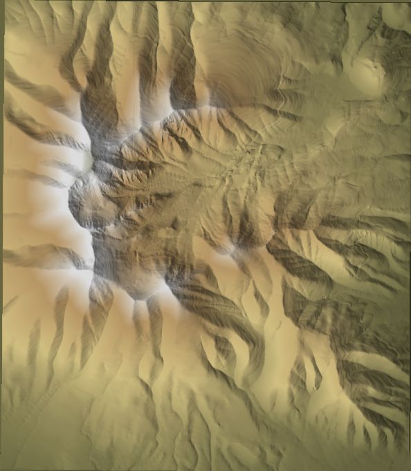
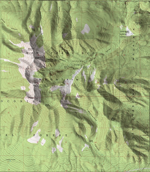
Easy Map Relief Shading Using 3DEM
Combining DEM data with a flat map, to convert this:
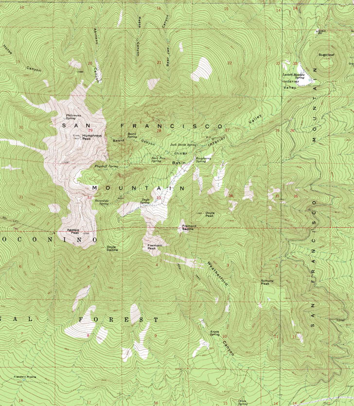
to this:
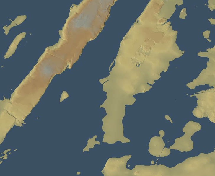
Sea Level Rise, Storm Surge, And Flooding Effects Using 3DEM
Using 3DEM to show the effects of sea level rise on the coastline. For Manhattan today:
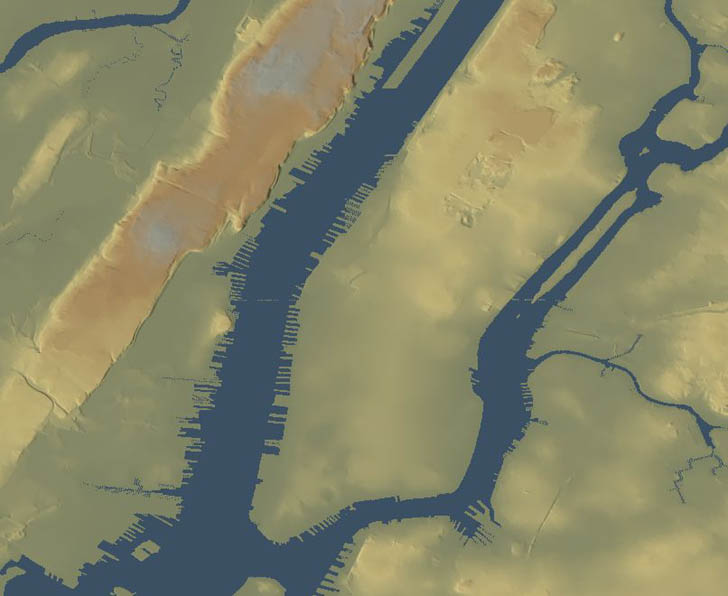
a rise in sea level of 8 meters due to storm flooding or sea level rise will result in this new coastline:
3D Perspective Views With 3DEM
Overlaying maps or photos on top of terrain with 3DEM to create either static perspective views:
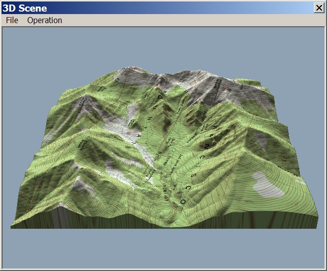
or animated rotating perspectives:
VRML Worlds Using 3DEM
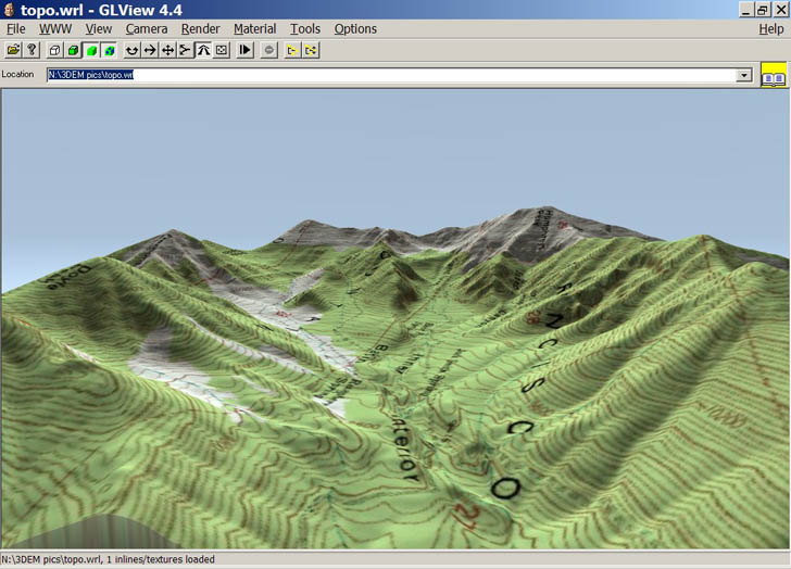
How to create interactive, 3D VRML worlds for terrain, with or without map/photo overlays:
GPS Track Elevation Profiles With 3DEM
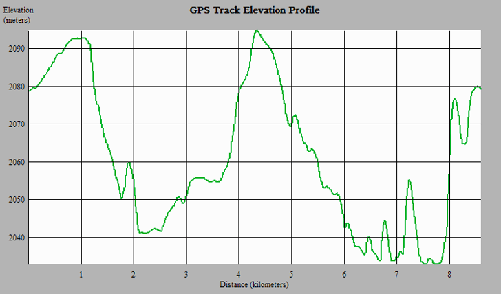
Generating a terrain profile from a GPS track:
Animated Flybys Using 3DEM
Creating an animated flyover of terrain, with or without map/photo overlays:
A reader from Canada asks, “Is it possible to load an AutoCAD file (dxf?) into my Garmin GPSMAP 60csx?”. I don’t know of a free one-step solution, and if any reader knows of one, I’d appreciate. However, using some of the procedures described in previous posts on this blog, it can be done fairly easily.
1. Convert the DXF file to a shapefile using the MapWindow DXF To Shape Converter. Points, lines and areas will have to be converted into separate shapefiles.2. If the coordinates of the DXF are not in the native coordinate system for most GPS units (latitude/longitude, WGS84), you’ll need to re-project the new shapefiles from their current coordinate system (e.g. UTM) to the GPS native system using MapWindow.
3. Load the shapefile into the GPS using one of several programs available. Points and lines will be imported as waypoints and tracks, respectively, while areas will be imported as tracks that describe the perimeter of the area.
It’s even less painful than it sounds; should take no more than about five minutes to put a DXF file into a GPS, once you have all the software you need installed.
Addendum: You would also follow the same basic procedure if you wanted to display a DXF file in Google Earth, but instead of step 3 above, you would convert the shapefile created in step 2 into a Google Earth KML file using one of the converters I’ve posted about previously.
In addition to the standard image overlays of Map, Satellite and Hybrid for Google Maps, the Active Trails website has an additional overlay button – Topo, for topographic maps. At lower zoom levels, the 1:100K scale USGS topo maps are visible, but if you zoom in close enough, the larger-scale 1:24K maps become visible. Comparing Map, Satellite and Topo overlays, there appears to be a good position match between the three. Active Trails also has placemarks for many kinds of outdoor trails across the country (hiking, biking, equestrian, etc.) entered by site users. You can also install a network link in Google Earth that will let you view the trails there, similar in nature to the new Google Earth layer from Trimble.
Addendum: Fixed the Active Trails links (sorry about that). In the comments, MH points out the ACME Mapper 2.0 site, which is a better choice. It displays black-and-white USGS aerial photos, and also lets you print out a copy of the on-screen map with the push of a button.
If you were wondering how I created the Google Earth rainfall plot in yesterday’s post on FAO climate data, I didn’t use one of the shapefile to KML converters I’ve posted about. Instead, I used a free program called GE-Graph that takes tabular data and lets you plot it in colors and polygons that depend on the value you’re plotting.
Continue reading ‘Plotting Data In Google Earth Using GE-Graph’
Via OgleEarth, a relatively new blog called Census KML Data Visualization has been posting visualizations of US Census data in Google Earth, with links to the KML files. Newer posts have branched out to visualizing campaign contributions by congressional district and time. Nice stuff, and a good complement to the gCensus site.
The United Nations Food And Agriculture Organization (FAO), AgroMet division, has compiled a database of climatic information gathered between 1961 and 1990 from close to 30,000 observation stations. This database, and applications designed to extract, analyze and map the data, are available online.
If you’ve ever needed to convert a file from one format to another and didn’t have the necessary software, you may find these two sites handy:
Zamzar – Probably the best-known free online file conversion site. Converts more than 100 file formats (document, spreadsheet, video, audio, graphic) from one to another. Biggest drawback is that you have to upload the file to Zamzar, then wait for an email that sends you a download link for the converted file. I use this a lot for converting Excel files to CSV and back, converting PDF documents to Word files, and converting documents to PDF format on computers that don’t have PDFCreator installed. But there are lots more conversions available.
iConv – Not as many conversions as Zamzar, but has some specialized ones that Zamzar lacks, and you also get your file right away (no wait for an email). Useful conversions include: