3DEM ostensibly comes with a number of GPS interface capabilities, including the ability to download waypoints, routes, and tracks, and upload waypoints created in the program. I say ostensibly because I could only get one of the features to work with my Garmin 60Cx, downloading tracks; maybe you might be able to get more to work with your GPS model. But even that one feature allows you to do something more than just display the track on top of a terrain image: it lets you see the elevation profile for the entire track.
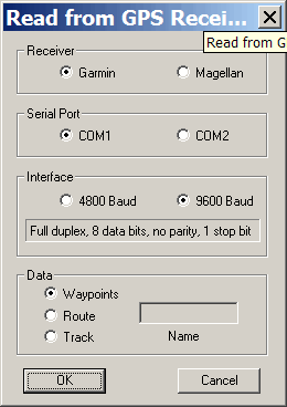
3DEM‘s direct GPS interface only works with Garmin and Magellan receivers set to their proprietary interface, and only with a serial connection (COM1 or COM2). Start by opening a DEM (digital elevation model) in 3DEM that covers the same area covered by your GPS track. Make sure your GPS is connected and turned on, and select GPS => Transfer GPS Points => Receiver To Screen from the menu:

Select the appropriate parameters, including track at the bottom, and click OK; the track will be transferred from your GPS to your computer and laid on top of the terrain representation:

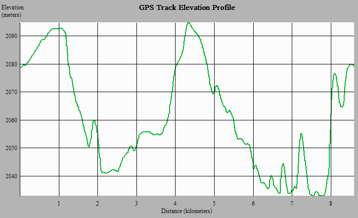
Now select GPS => Profile GPS Track from the menu, and you’ll get a graph showing the elevation profile along the points of the track:

You can supposedly create points using the GPS => Enter GPS Points By Mouse command, then upload the GPS points you’ve entered to your GPS receiver, but I wasn’t able to do so successfully; if it works for you, please leave a note in the comments.
If you already have a GPS track saved in GPX or most other GPS data formats, you can’t read it directly into 3DEM to create a track profile, since 3DEM only accepts GPS data in one of two formats, text or the uncommon FAI/IGC Flight Recorder Data Format (*.igc). But GPSBabel can convert most standard GPS data formats into the *.igc format, which you can then open with 3DEM, display on the terrain image, and use to generate an elevation profile for that particular track. Given the quirks with the GPS interface, you might be better off downloading the track data from you GPS with some other program like EasyGPS or GPSTrackmaker in GPX format, then converting it to *.igc before importing it in 3DEM.
Its interesting do moving mapping with MapSource (it give you cartography) GoogleEarth (it give you Satellital image) and a port splitter to send MNEA data to both aplications.
Check http://geodatum.blogspot.com/2007/01/mapsourcegoogleearth.html
Regards from Buenos Aires
Javier