blankblank blank


Author Archive for Leszek Pawlowicz Page 29 of 79


Using The Demo Version Of Global Mapper As A Raster/Vector Data Viewer

Global Mapper is a first-rate program for viewing and converting GIS data, raster (image and elevation) and vector. It opens over 100 different raster/vector formats, with on-the-fly support/display conversion of virtually every coordinate system / projection / datum you can think of, and some you might not (the Moon, Mars, the moons of Jupiter). It comes in a demo version with the following limitations (from the help file):

  • You will be unable to export data to any format.
  • You will be limited to loading a maximum of 4 data files at a time. With the full version, you can load any number of data files simultaneously.
  • No 3D capabilities (full version supports 3D views, viewsheds, line of sight, cut-and-fill volumen
  • You will be unable to load workspaces.
  • You will be unable to work with map catalogs.
  • You will be unable to download data from WMS map servers.
  • You will be unable to save rectified imagery to fully rectified files.
  • You will not be able to print to a specific scale (i.e. 1:1000).
  • You will have to endure a nagging registration dialog every time that you run the program.
  • You will not be eligible for free email support.

There’s one more, which is you don’t have the option of printing/exporting the screen display as an image file (though you can still print to a printer what’s visible on screen; zoom in to get a higher-resolution printout). Global Mapper’s display options for vector objects are also more limited than a standard GIS data viewer (e.g. no coloring by attribute for shapefiles). For those two reason, the TatukGIS viewer may be a better choice, since it lets you export the data view, raster or vector, as a high-resolution georeferenced raster image. But TatukGIS Viewer only supports about 30-odd raster and vector file formats, and doesn’t do on-the-fly re-projection. For examining the occasional odd data format you run across, in unusual projections/coordinate systems, and making a quick print, Global Mapper is good to have in your toolbox.

As a bonus, it also has a great line/area measurement function, which lets you modify the measurement units from metric to English and back on the fly, and copy them into the clipboard:
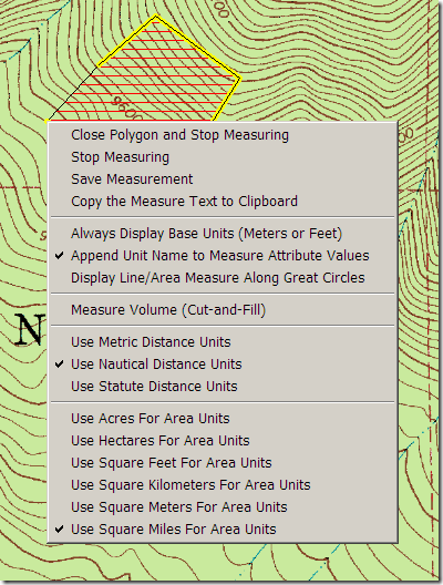
gmmeasure

The TatukGIS Viewer has a measure function, but it gives area only in the data’s native projection, less than useful if it’s in the geographic coordinate system (e.g. square degrees for area).

Finally, if you’re looking for an all-purpose data format converter with batch conversion capabilities, don’t need the considerable power (or expense) of FME, and don’t want to deal with the GDAL command-line utilities, you could do far worse than the $299 fully-registered version of Global Mapper.
Quick Country Information With The World Gazetteer

If you need a quick rundown of basic information about any country, the World Gazetteer is one option. From the site’s homepage:

  • Current population figures and area size for all countries and important territories
  • Population figures and area size of administrative divisions
  • Population figures for the largest cities, towns and places as well as for metropolitan areas
  • Historical population data (census or estimates; mostly from last or last two censuses)
  • Overview maps that show the position of the country or the administrative divisions
  • Summary statistics for countries and territories as well as for the largest cities and agglomerations
  • Current national flags
  • Summary maps for various subject
  • A pronunciation guide for some languages
  • There is a downloadable file for offline research
  • A population clock that show the current population of the world
  • Comprehensive meta information about statistics and the project

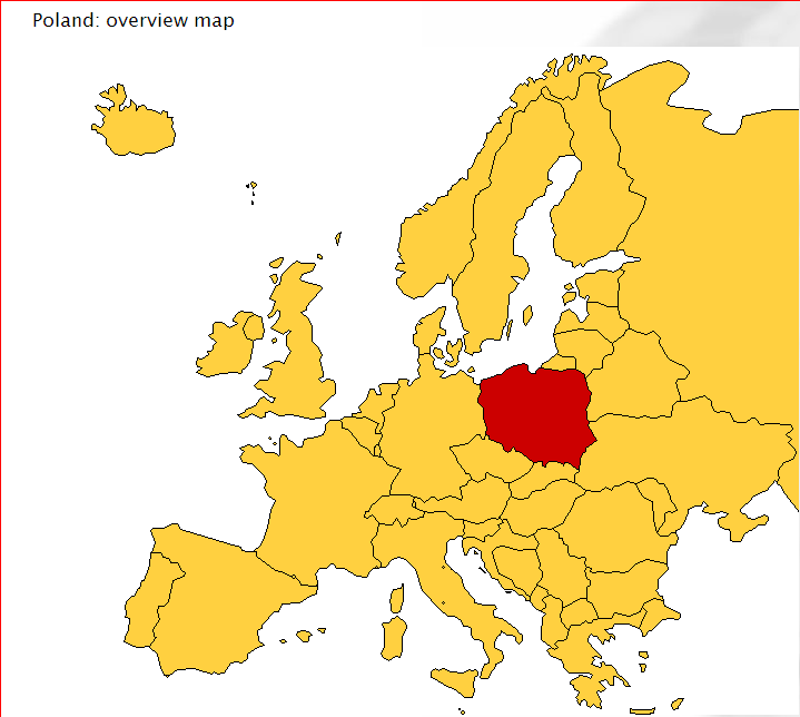
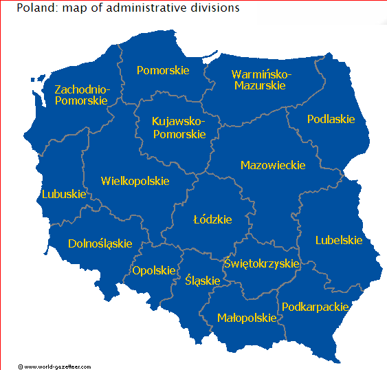
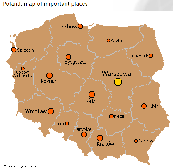
Sample maps from the website (for Poland):

overview map of Poland

Poland administrative divisions

Poland map of important places


Geotagging Photos With GPSed

In the comments to my post on GeoSetter, someone suggested I take a look at GPSed Photo Take’n’Pin as an option for geotagging photos. GPSed itself is a service for uploading and sharing GPS track and point data. From the website’s FAQ:

GPSed, a location-based and geotagging service, is designed to enable real-time tracking from mobile devices and collecting track data in an online archive.
The service is designated for hikers, bikers, drivers, tourists, adventure travelers, sportsmen, photographers and GPS/GIS professionals working in various industries such as forestry, fishery, transportation and others. GPSed can also be used just for having fun.

GPSed Photo Take’n’Pin is their free application designed to use GPS track data to geotag photos. Gave it a spin, and wasn’t terribly impressed:

  • You apparently can’t use a local GPX track file on your computer to geotag the photos, only one that you’ve already upload to the GPSed website. Since you likely already have that track on your computer, there’s no reason not to use a better geotagging program that supports local GPX files like GeoSetter. By way of contrast, the similar service locr provides a free application that does let you use your own GPS data to geotag your photos.
  • I say “apparently” above because I couldn’t get the program to geotag my standard test photoset even with an online track, and there’s no help file in either the program or the website to help me sort out what the problem might be.
  • Even if I could successfully geotag a photo with the GPSed Take’n’Pin application, there’s nothing I can do with it on the GPSed website. You can take the photos and export them to Google Earth, Picasa, or Flickr, but you don’t need this program to do that. With locr, you can upload the photo to the website and share it and its location with others.
  • The program crashed on me several times (I’ll cut it some slack on that, since it’s labeled as a beta).

Given those issues, I’ll stick with my previous statement that GeoSetter is the best geotagging application I’ve seen to date, with GPicSync a worthy alternative. Even if GPSed Photo Take’n’Pin worked as advertised, it doesn’t offer any features to make it worthwhile.


Calculate New Coordinate Position From Current Position, Bearing And Distance

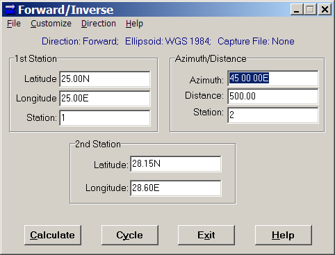
If you regularly work with bearing and distance from a coordinate position, you might find Forward/Inverse from Mentor Software a useful tool. Just enter the starting position (latitude/longitude), the bearing and distance to the destination, click Calculate, and get the coordinates of the destination:

forwardinverse

In this example, the distance is in kilometers, and the bearing in degrees, but you can customize those units: degrees or grads for angle, and a full range of English and metric units for distance. You have the choice of 26 different ellipsoids, and a selectable lat/long format (decimal degrees, DM, DMS).

You can also capture the results in a text file, useful if you have a list of them to calculate. The Cycle option is especially useful in such a case, as it puts the destination coordinates (2nd Station) automatically into the origin coordinates (1st Station). So, you can continually input azimuths and distances, calculate the next destination, make that the new “1st Station” with the Cycle button, and capture all the data for all points in a text file. Finally, if you choose “Inverse” under the Direction menu, you can calculate the azimuth and distance from the 1st station to the second one.


Put USGS Topographic Maps, Aerial Imagery, And Other Raster Imagery On Your Garmin Handheld GPS

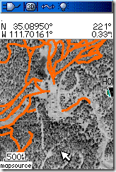
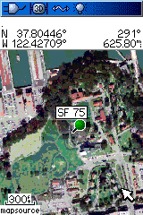
Garmin handheld GPS units use vector graphics to display imagery, so it’s generally been considered impossible to view raster imagery on them, like USGS topo maps or aerial photographs. But I’ve figured out a way, and created a program that lets you convert free USGS topo maps downloaded from the Seamless Server, black-and-white DOQQs, color satellite imagery, any georeferenced raster imagery, to a Garmin-compatible format: Moagu – the Mother Of All GPS Utilities. Rich Owings has the first review at GPS Tracklog (he likes it!).

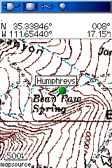
Here’s a few screenshots from my Garmin 60Cx:

h trails-thumb sf


You can download a demo version at the website. Introductory price is $19.95.


Online Raster Map Georeferencing/Registration With Map Rectifier

This has been around for a while, but I’ve just gotten to it. Metacarta Labs’ Map Rectifier lets you georeference/register an uploaded image file to geographic coordinates/WGS84 using data from a variety of sources. Default data layers, selected by clicking on the “+” sign in the right map window, include:

  • OpenLayers WMS
  • OpenStreetMap
  • Satellite
  • TIGER
  • Google Maps (roads)
  • Google Maps (satellite)

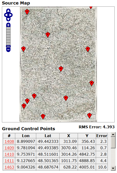
But you can add layers from any WMS server. The process is incredibly straightforward. Upload your map image to Map Rectifier, and it will appear in its own window:

Source Map, Map Rectifier

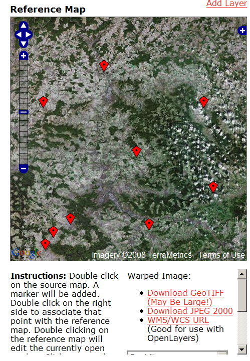
Add control points as markers on one side by double-clicking, then add them to the corresponding point in the data layer on the other side:

4-19-2008-4.46.31 PM

Double-click on an existing marker to move it to your desired point; the table on the left keeps track of the Ground Control Points and the estimated error. Select your warping method (Best Fit, Linear, Quadratic, Cubic, Thin Spline), then click the “Warp” button. You can display the warped map on top of the reference image as a semi-transparent overlay. Download a GeoTiff or JPEG2000 file of the registered image in geographic/WGS84 projection, or get a URL for a WMS. Uploaded images are publicly available, so don’t upload anything you wouldn’t want someone else to see. Final accuracy will depend on the accuracy of the registered image, which can vary. Still, very slick. There’s supposedly a more advanced version under development.


Updates For Two Garmin-Related Programs

POILoader: A long and involved post of mine from a few weeks back described methods for managing multiple custom POI files on a Garmin GPS, to get around the limitation that POILoader erased the current POI set when uploading a new one. The process was mildly painful, involving going into the GPS’s memory, then copying and renaming the *.gpi POI files to prevent them from being erased; I refer you to that post for the gory details. The latest version of the POILoader makes this process a lot simpler: you now have the option of saving the *.gpi files directly on your computer, where you can rename and manage them directly before copying them into the /Garmin/POI directory on your GPS unit. A lot easier.

Curiously, there’s one additional option in the program, which lets you install the POIs into Garmin’s MapSource program under a specific name. It’s curious because there’s no current support in MapSource for POI uploading; I’d look for that capability in an upcoming release.

DNRGarmin: In comments on this post, Thomas notes that the bug that kept USB connectivity in DNRGarmin non-functional unless you installed with administrator rights has been fixed; it now works with any installation. If you have a Garmin handheld GPS, the latest version of DNRGarmin is a must. You can upload data from GPX, Google Earth’s KML format, text, DBF and shapefile to your Garmin using this program, and conversely save data from your GPS in these formats; it can even re-project data in UTM, Lambert, etc. to geographic coordinates for. Even if you don’t have a Garmin, it’s a handy program to have for converting from one format to another.


Another Shapefile Repair Tool

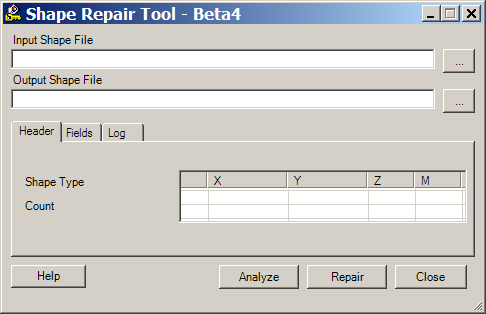
A while back, I posted on the Shape Checker utility, a program that can supposedly fix damaged shapefiles. I say “supposedly” only because I haven’t been able to check it out myself, fortunately never having had that problem, but Simon Jackson in the comments says he’s used it several times successfully. I’ve found another similar tool, the Shapefile Repair Tool. It claims it will:

  • Read and validate SHP and DBF files.
  • Retain null shapes.
  • Fix misnumbered and out of sequence SHP records.
  • Correct invalid shape types.
  • Correct a DBF record count mismatch is by either padding the DBF file or truncating extraneous records.
  • Write a new shapefile, and a log file to document the changes.

Two caveats on my end. First off, it requires .Net 1.1 to install and run, and Microsoft in its infinite wisdom decided that Windows Vista would not support .Net 1.1. applications. So you’ll have to install it on a Windows XP system, or do without. Second, while I can vouch for the fact that it installs successfully on a Windows XP system …

Shapefile Repair Tool

…I still don’t have a bad shapefile to test it with! If you try it, and it works for you, please let me know in the comments. Thanks!