This has been around for a while, but I’ve just gotten to it. Metacarta Labs’ Map Rectifier lets you georeference/register an uploaded image file to geographic coordinates/WGS84 using data from a variety of sources. Default data layers, selected by clicking on the “+” sign in the right map window, include:
- OpenLayers WMS
- OpenStreetMap
- Satellite
- TIGER
- Google Maps (roads)
- Google Maps (satellite)
But you can add layers from any WMS server. The process is incredibly straightforward. Upload your map image to Map Rectifier, and it will appear in its own window:
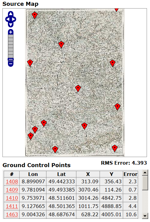
Add control points as markers on one side by double-clicking, then add them to the corresponding point in the data layer on the other side:
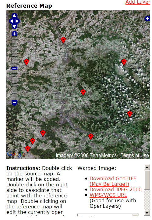
Double-click on an existing marker to move it to your desired point; the table on the left keeps track of the Ground Control Points and the estimated error. Select your warping method (Best Fit, Linear, Quadratic, Cubic, Thin Spline), then click the “Warp” button. You can display the warped map on top of the reference image as a semi-transparent overlay. Download a GeoTiff or JPEG2000 file of the registered image in geographic/WGS84 projection, or get a URL for a WMS. Uploaded images are publicly available, so don’t upload anything you wouldn’t want someone else to see. Final accuracy will depend on the accuracy of the registered image, which can vary. Still, very slick. There’s supposedly a more advanced version under development.
1 Response to “Online Raster Map Georeferencing/Registration With Map Rectifier”