Not exactly new information anymore, but a few weeks ago, Google discontinued Google Earth Plus, their $20/year enhanced version of the free Google Earth program. These enhancements included:
- Enhanced performance – a faster download speed for data.
- Printing – A 40% improvement in printing quality (1400 pixels versus 1000 pixels).
- GPS Data Import (read only) – Download waypoint, track and route data directly into GE from a GPS
- Real-Time GPS Tracking – Put an icon in Google Earth to mark your current position as measured by a connected GPS.
- Spreadsheet data import – Import a .csv file with coordinates into Google Earth, and do address coordinate lookup (geocoding) as well.
- Advertisements – Optional in the Plus version.
One of the very first posts I did on this blog was on Google Earth Plus, but in a bit of foreshadowing, it was titled “Google Earth Plus – Do You Really Need It?”. It kicked off a multipart series describing ways you could duplicate, and even exceed, most of the important capabilities of Google Earth Plus using free or inexpensive software. Even though Google has dropped the Plus version, it’s steering people who need its capabilities to the $400 Pro version, which in addition to spreadsheet import allows opening GIS data like shapefiles and georeferenced imagery. I’ve covered programs that mimic some of those functions, like converting shapefiles to KML format, and creating Google Earth image overlays from georeferenced imagery; I’ll be covering some cheap and free options for creating image superoverlays before too long. And while Google says they will add GPS tracking to the free version of Google Earth in the near future, my Google Earth Plus For Free series covers several options available now, and I’ll have a post with two more options soon. For that matter, just take a look through the Google Earth category on this blog for dozens of useful Google Earth data tools that do things that no version of Google Earth can do, like export KML files to GPS receivers.
Digital Geography suggests a neat way to quickly add voice annotation to Google Earth placemarks. Record your message at Vocaroo.com, and when you’re done, click on the “Post on the internet” link. You can then copy and paste the HTML code directly into the placemark Description section: right-click on the placemark, choose Properties, click on the Description if it isn’t showing, then directly paste the Vocaroo code there. When you click on the placemark, the pop-up balloon will display a Flash player for your audio message.
For more advanced annotation, it would probably be better to record and edit your message in MP3 format, upload it to a web location, then try one of the free embeddable Flash MP3 players described on this page. For example, for the Google Reader MP3 player, take the code:
<embed type=”application/x-shockwave-flash” src=”http://www.google.com/reader/ui/3247397568-audio-player.swf?audioUrl=MP3_FILE_URL” width=”400″ height=”27″ allowscriptaccess=”never” quality=”best” bgcolor=”#ffffff” wmode=”window” flashvars=”playerMode=embedded” />
Note: Don’t copy and paste the above code, as that doesn’t work – copy and paste it from the code box on this website. Replace the “MP3_FILE_URL” section with the full link to your uploaded MP3 file, and then copy and paste the code into your placemark’s description section (same as above). Clicking on the placemark will bring up the balloon showing the MP3 player:
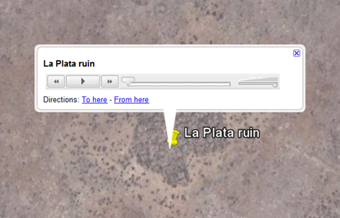
Just click on the play button to hear the message.
Want to learn KML by example, or see examples of the features you can display in Google Earth? The Google Geo APIs team has developed a KML Interactive Sampler page that uses the Google Earth Plugin to demonstrate various features, while simultaneously displaying the KML code used to create the feature:
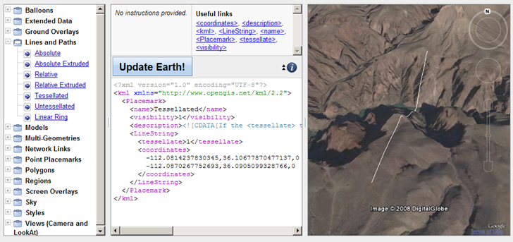
Always wondered what “tesselated”meant …
Modify the code in the text window and click on “Update Earth!”, and the displayed feature will be updated to reflect the new code. You can copy the text from the window, and then save it as a KML file locally on your computer.
Doesn’t support time yet, but neither does the Google Earth Plugin.
Don’t have access to Access (ha ha), but stumbled across this and thought some might find it useful: a VBA macro for Microsoft Access that exports a table/query with latitude and longitude to Google Earth’s KML format. The original code has disappeared, but a page that offers explanations and augmentations to the original code can be found here.
Also tucked away in my bookmarks was this link to a Google Earth community post offering an XSL-based tool for exporting from Access to KML. The link to the downloadable file seems to be missing, but I snagged it at the time, and you can download it from this link.
As I said, haven’t tried any of these – use at your own risk/discretion.
This is one of the neater online mapping applications I’ve seen in a while. Create a list of addresses and related information in a Google Docs spreadsheet, and map a list will geocode the addresses (convert the address to latitude/longitude), and plot the location and data in a Google Maps interface:
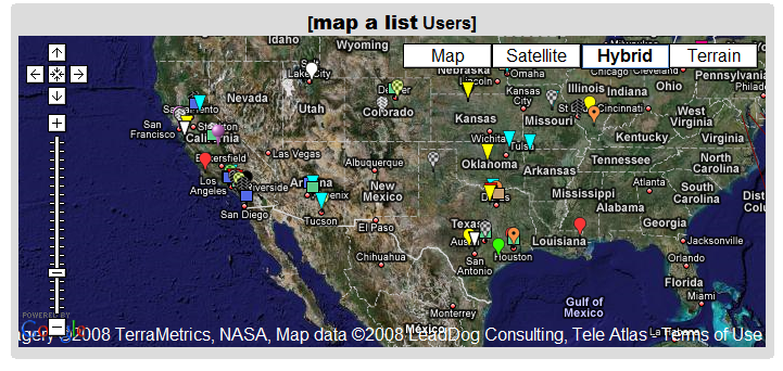
You can also export the data as a KML file for use in Google Earth.
- User-selectable icons
- Also plots latitude/longitude locations
- Includes data in other spreadsheet columns in the data bubble
- Lets you embed images and hyperlinks as well
- Data can be public or private
- As you update the spreadsheet, the map data is updated as well (daily, or on demand)
- Not a lot of documentation, but it’s fairly easy to use, and a healthy number of example spreadsheets will show you how it’s done (scroll through the list at the bottom, and click on the link to see the sample spreadsheet for each list item)
- Completely free (though they’ll take donations, and offer premium consulting services for a fee)
Definitely worth bookmarking.
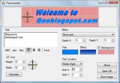
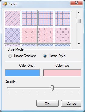
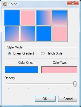
Placemarker, a custom placemark creator for Google Earth, was covered on this blog a few weeks ago. Valery Hronusov, one of its authors, writes to say that additional features have been added, and it’s pretty much complete. The new features include the options for linear gradient, crosshatch and custom backgrounds:
Bjorn Sandvik, creator of the Thematic Mapping Engine for generating thematic prism/choropleth/bar/proportional symbol KMZ files, has just announced the first version of his Earth Atlas, an augmented viewer for the Google Earth plugin (Windows only for now). A tile on the right lets you choose one of 6 internal thematic demographic datasets to display in the globe, or two external ones (icecover and recent earthquakes). But you also have the option to enter the URL for multiple external KML or KMZ file, and have them added to the display as well. Here’s an external KML file from the Google LatLong blog showing photo overlays of flooding in the Kosi River region in India:
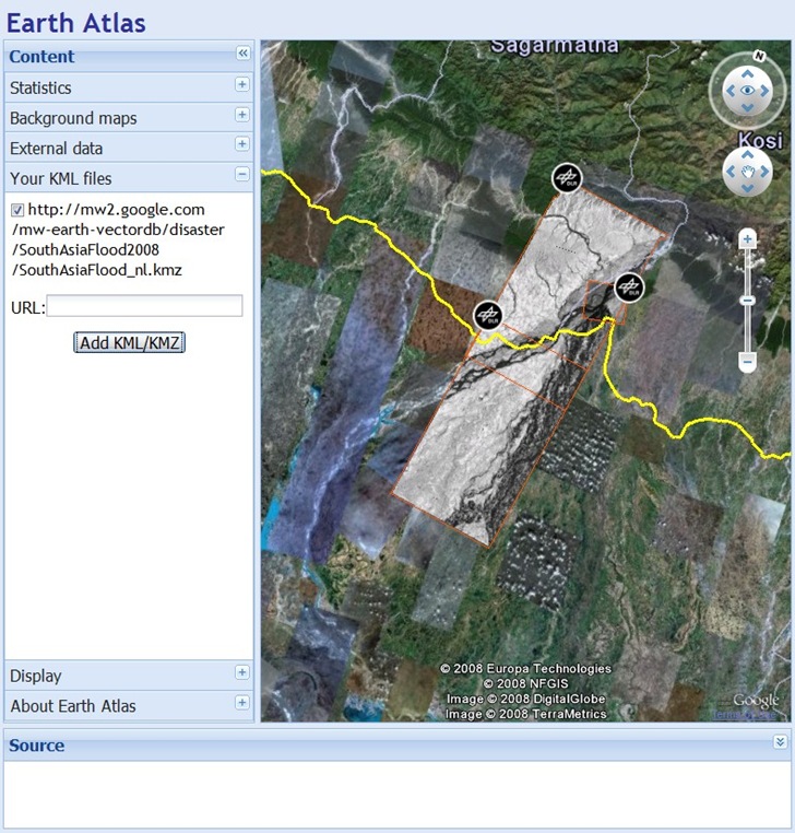
Note: you may have to manually scroll to the area covered by an overlay to see it.
In his announcement, Bjorn says “…to be continued!”, and based on his improvements to the Thematic Mapping Engine since its original release, that probably means a lot more capabilities will be available soon.
Last week, I posted on David Tryse’s Google Earth Position application for Windows, which can capture and save the geographic position in the center of the Google Earth view window. The biggest issue with the application is that it was difficult to figure out how to place a geographical object exactly at the center of the Google Earth window, since there’s no crosshair or marker in the application to indicate where it is. I linked to a KMZ file that places a crosshair at the Google Earth screen center, but that’s no longer necessary. The latest version of Google Earth Position now has the option to add such a crosshair to the screen. After starting the program, just right-click on it, and select the Show Crosshair option:
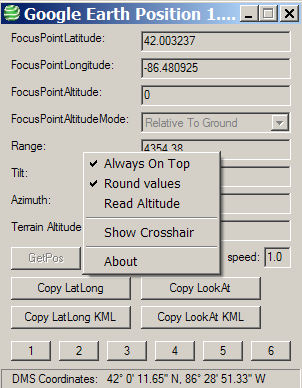
This will open up a crosshair screen overlay in Google Earth, at the center of the screen; this is the position displayed/captured in the Google Earth Position app:
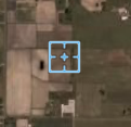
Non-Windows users can use the KML link described in this post, or this one suggested by Maarten in comments (though I’ve had problems getting it to work).

