blankblank blank


Archive for the 'Google Maps' Category Page 7 of 15


Simple Online Form For Creating An Embeddable Google Map

GEarthHacks has a new online tool called YourMap that simplifies the job of creating embeddable Google Maps. Enter the name, address (or lat/long), zoom level, desired map dimensions, and other information into an online form, and YourMap automatically generates the code to embed it in your website; you don’t even need your own Google Maps API key. Here’s an example for a great hole-in-the-wall Thai restaurant in Flagstaff, AZ:

View in Google EarthDownload Google Earth
Powered by YourMap from Google Earth Hacks.

Via All Points Blog.

Addendum: Just noticed that the location plotted above for the restaurant about 500 yards south of the actual location. Double-checked the address used for geocoding, and it was entered correctly, so you may want to check the results of YourMap’s geocoder to make sure it’s right.


Quick Zip Code Information

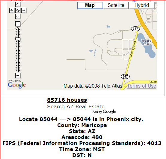
From the comments to my post on Mapping Zip And Area Code Boundaries comes a link to another, simpler site: ZipCodesMapped.Com. Type in a zip code, and get back the approximate location, area code, FIPS code, and timezone, along with a Google Maps window for the approximate area covered:

zipcode

The Google Maps window isn’t always 100% accurate – the example above is for my old neighborhood, and the displayed map doesn’t cover the entire area (though it is close). While it has less information than the USNaviguide website described in the original post, for quick lookups ZipCodesMapped.Com may be more convenient to use.


Modifying EXIF Headers (Including Geocoding) With TagMyJPGs

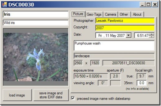
Yet another photo geotagging application, TagMyJPGs (aka EXIF Geotagging), this one with some helpful EXIF editing capabilities, and a nice Google Maps interface for geotagging. If you’re running Internet Explorer, the website has a link that lets you install the software automatically; otherwise, download and unzip the program into its own directory, then run the EXIFGeotagging.exe application:

Pictures

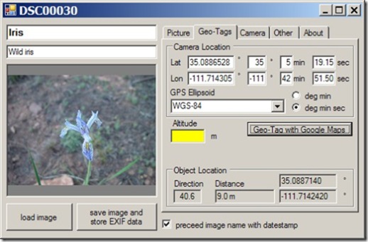
TagMyJPGs lets you view much of the EXIF data embedded in the photo, and you can add/edit EXIF tags like the name, description, photographer, keywords, etc.(but not basic photo info like exposure, aperture, etc.). Tags in white or yellow are usually editable, those in gray not. Click on the Geo-Tags tab, and you can manually enter the coordinates where the photo was taken:

geotags

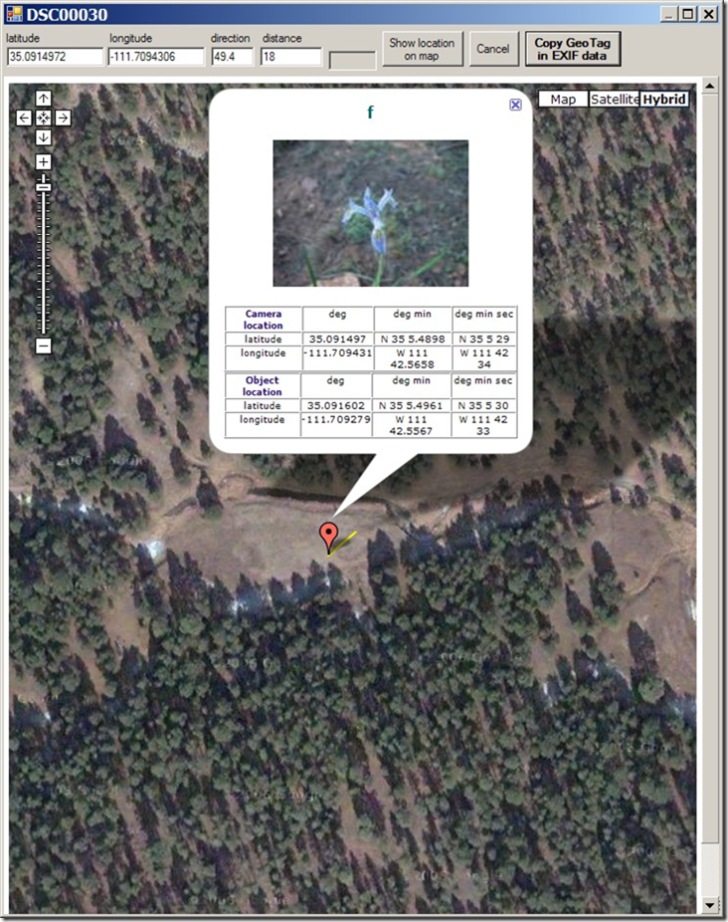
Click on the Geo-Tag with Google Maps button, and a Google Maps interface will open up with a marker indicating the camera position:

TagMyJPGS

Click and drag the marker on Google Maps until it corresponds to the position of the camera when the photo was taken. You can also click on the object being photographed, and TagMyJPGs will mark the distance between camera and object with a yellow line, and enter the distance and bearing into the boxes at the top. The website claims that it will also draw the camera’s field of view, but I haven’t seen that in the several cases I tried. If the photo was already geotagged, it will be displayed at its geocoded position. Click “Copy Geo-Tag in EXIF Data”, and you’ll return back to the main program with the camera and object locations entered into the appropriate boxes.

If you’re satisfied, press the “save image and store EXIF data” button to write the coordinates and other entered data into the photo’s EXIF header. If the “preceed (sic) image name with datestamp” box is checked, the program will create a new image file with the date as a prefix to the original filename. If it’s not checked, it will overwrite the original with the new version.

The biggest drawback is the inability to geotag photos with a GPS track, but the author indicates on the website that he’s planning to add that feature in the future.


Altitudes And Terrain Profiles In Google Maps

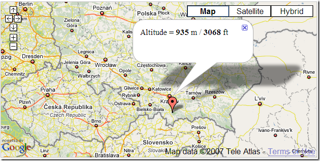
As a demonstration of their altitude information service, the Topocoding API website has a Google Maps demo. Click on a location on Google Maps, and get a placemark with altitude information for that point:

altitude

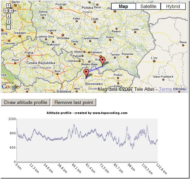
Click multiple points to get a path, and you can then generate a terrain profile for that path:

profile

It uses a combination of SRTM-90 data (roughly 90-meter resolution), and GTOPO30 (1-kilometer resolution) where other data is missing. All continents except Antarctica are included.

They’ve also created an XML Google MyMaps tool that you can add to your collection of MyMaps mapping functions; click on this link, and then click on the appropriate button to add it to your MyMaps collection.


Mapping Zip And Area Code Boundaries, And More

The USNaviguide website has an assortment of Google-Maps-based services for mapping the boundaries of various geographic parameters:

Zip Code: Enter a 5-digit zip code, or the first three digits of a zip code, and get a map of the area covered by that zip code. Or click on the map, and get a map of the all the zip codes in that area, with a placemark at the location you clicked on with the zip code for that area in the info bubble:

clickzips

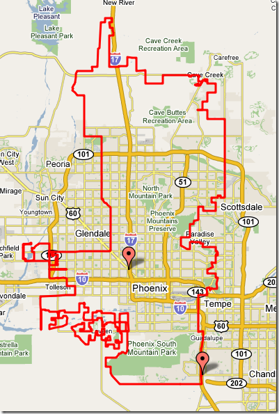
City/town boundaries: Enter a zip code, or click on the map, and get the boundary of the city/town jurisdiction for that area where appropriate:

phoenix

County/FIPSCSA: Enter a zipcode, or click on a spot, and get a map similar to the one above for either a county or a FIPS (Federal Information Processing Standard) Core-Based Statistical Area, with a placemark near the center of the polygon with the relevant information, including code numbers.

There is also a US geocoders (get a latitude/longitude for an address), and a reverse geocoder (enter the lat/long or click on an address, and get back the closest addresses to a point).

The related Maps.Huge.Info site has links to most of the above services, but also a few more as well:

  • US telephone area code maps
  • Plotting zip codes by line boundary instead of overlay map (as at the top)
  • Australian post codes
  • A zip+4-based reverse geocoder

Finally, there’s a page of the free PERL code they use for converting a polygon of points into a Google Maps polygon.

Via GoogleMapsMania.


KML Circle Generator

Site appears to be down; try theĀ GE Path program as an alternative.

KML-Circles is an online app that creates open or filled polygons around a specified center point. With the default number of 60 vertices, you essentially create circles, but by selecting a small number, you can create other polygons (e.g. 3 for a triangle, 4 for a square), but with no control over their orientation. It operates in two different styles:

Continue reading ‘KML Circle Generator’


Google Maps Mapplets From Zonums Software

Zonums Software has just released several Google Maps mapplets; click on a link to add it to your Google Maps MyMaps applets list:

UTMFlyer: Enter a UTM coordinate, and Google Maps will display that location. Zonums also has a Google Earth equivalent function, also called UTMFlyer.

Pointer: Click on a Google Maps point, and get the coordinates in latitude/longitude or UTM.

Digitizer: Click on points in the map window, and create a list of their coordinates (UTM or lat/long) for export to another application.

The last two functions are also available at Zonums in the stand-alone Google Maps app Digipoint 2, which offers additional features like data export in multiple formats (KML, GPX, shapefile, etc.).


Geographically-Linked Video With VeoGeo

Javier writes (and Mapperz posts) about VeoGeo, a new website that lets you post videos, link them to a GPX file, and have the position where the video was taken be plotted in Google Maps. If your position changes during the video, the position plotted on the map will move as well. The process is fairly straightforward:

1. Register (for free) at VeoGeo. You’ll also need to be able to upload video files at any online site that allows embeddable video content (e.g. YouTube, Revver, MetaCafe, etc.)

2. Upload the GPX file to VeoGeo; this will have to be a continuous track file with the timestamps intact.

3. Upload the video file to the site of your choice, and copy the video link into the appropriate box at VeoGeo

4. Use VeoGeo to sync up the GPX track with the video.

You’re ready to go; the page for your “tour” will have the video window at upper-left, an altitude profile at lower left, and the Google Maps display at the right. Click on the video “play” button, and as the video plays, the marker on the map will reflect the position at the time the video was shot.

It’s a fun and clever concept, and has great promise for creating geographically-linked video tours. But there is some room for improvement:

– There’s no ability currently to edit the files to only show sections of a video; you have to upload (and watch) the whole thing. Most of the trips I take would have seconds of interesting footage interspersed with minutes (or hours) of boring footage of getting to that area.

– Initial Google Maps zoom level is too high; there’s no imagery initially visible on some pages. Zoom out a bit, and it should appear.

– There aren’t a large number of videos posted yet, but from the ones currently up, it’s clear that the most successful videos have the video shot with a camera firmly mounted so that there’s minimal shake. Walking and biking videos are less successful; without good image stabilization, they can be unwatchable for more than a short period of time.

– No help section yet (but they are in Beta)

– Small number of videos, so their current method of browsing for videos isn’t a problem (markers on a Google Map). But as the number of videos increases, they’re going to have to come up with a better browsing interface.

This site is a great match for Pict’Earth, and I hope the Pict’Earth people post some of their videos up on the VeoGeo site soon (hint, hint).