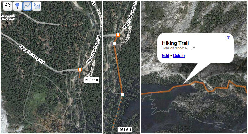
The official Google LatLong blog has announced that the Google Maps line tool in MyMaps now displays the total line length as you draw it, and also adds the line length to the pop-up info box for that line:
Exploring the world of free tools for GIS, GPS, Google Earth, neogeography, and more.


The official Google LatLong blog has announced that the Google Maps line tool in MyMaps now displays the total line length as you draw it, and also adds the line length to the pop-up info box for that line:
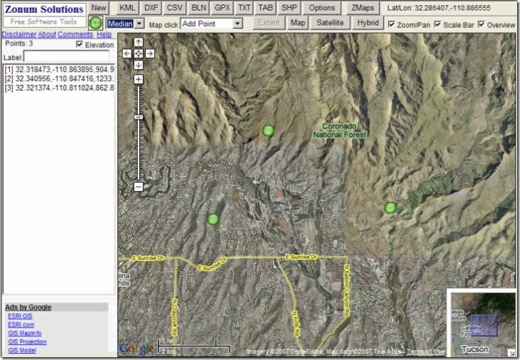
Quite a while ago, I posted about Digipoint, a website that let you plot points in Google Maps automatically get the coordinates of the points, and export the data in text (TXT), AutoCad (DXF), comma-separated values (CSV), BLN (Golden Software blanking format) and tab-delimited (TAB). The Digipoint website has been upgraded to version 2 since then, enhancing the old features and adding new ones:
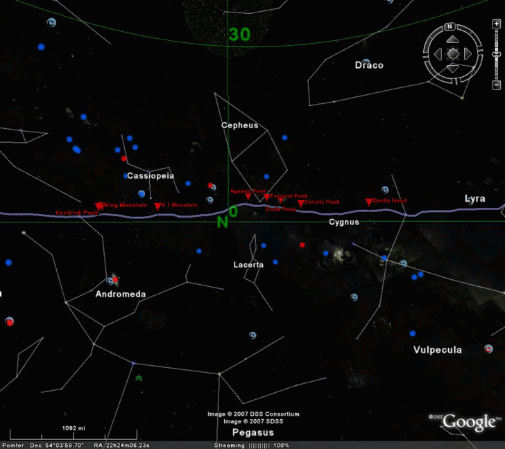
The creators of HeyWhatsThat, a site that generates panoramas and viewsheds for Google Maps and Google Earth and described in an earlier post, have added another cool feature. Generate a panorama, click on the “View in Google Earth … at night” link, have it open in Google Earth in Sky mode, and the horizon line will be plotted against the sky for the specified location, labeling each of the features. Lots of good stuff at the HeyWhatsThat site!
Not as useful as it was before Google Maps MyMaps came along, but quikmaps.com has many of the features that MyMaps does, and a few it doesn’t:
– Draw lines on a map, either with line segments or arbitrary freehand (no polygons, unlike MyMaps)
– Add points to the map using a larger variety of full-color icons than MyMaps
– Add text labels directly to the map (not in MyMaps)
– Embed the map and your content in your website
– Export the map data directly into either KML format or GPX format for downloading into your GPS
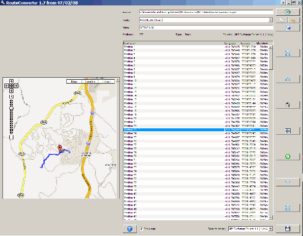
Just posted about RouteConverter, a Java-based GPS route/track manager, last Friday, and Christian has already updated it:
– The updated version for Java6 now includes a Google Map interface that displays the GPS track/route and the selected point position:
– There’s an executable for Windows, as well as a standard Java6 .JAR file for Windows and Linux
– A Java5 version with fewer features, but which is compatible with Macintosh, Windows and Linux
I’ve been meaning to post on the MyMapsPlus website for a while; they offer a simple tool for embedding a Google Maps MyMaps page on your own website, similar to this one I posted about a while back. Just as well I waited – they have a more advanced site out now called MapChannels that lets you do a lot more:
All for free, but they offer a paid service for developing special customized maps or features (check the About section for more information). Not a lot of documentation now apart from some basic tutorials, but that will probably come with time.
Got an email from 192.com, a UK mapping website, announcing some new enhancements to the site:
The interface is Flash, proprietary and a bit small in size, but useable. I’ll defer to any UK readers as to the quality of the OS maps, but the aerial photography is very impressive. Here’s shot of Stonehenge at maximum zoom, clearly showing individual visitors:
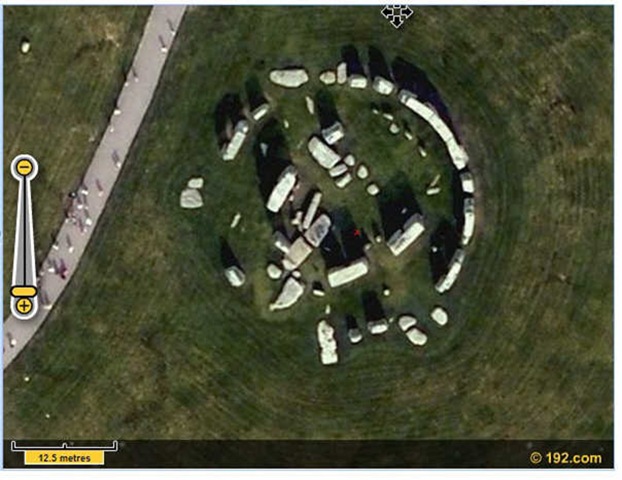
Note: There’s no separate settings for maps or aerial photography. As you zoom in, you first get OS Maps, and when you zoom in very close, it switches over to aerial photography. I tried three locations at random in the UK, and they all had high-res aerial imagery, so I’ll believe their claim that it covers the entire country.
192.com has other mapping service features, like people and address search, business search, local search, etc.. Doesn’t have all the capabilities of Google Maps, but the OS Maps and high-res aerial photography could make this a useful alternative to GM for UK residents.
In Statetris, you rotate and position the state shapes so that they fall into the correct position, a la Tetris. Brings back not-so-fond memories of all the time I used to waste on computer games. Other useless geographic activities include Smoke Signals (animated smoke messages in Google Maps), and Crop Circle (personalized crop circles).