blankblank blank


Archive for the 'Google Maps' Category Page 4 of 15


Draw Freely On Google Maps, Export In Multiple Formats

ScribbleMaps is one of the slickest Google Maps apps I’ve ever seen. Draw and/or place any of the following on a Google Map view:

  • Freehand lines
  • Straight lines
  • Circles
  • Rectangles
  • Arbitrary shapes
  • Text
  • Images (needs a web link to the image)
  • Standard Google Map/Earth placemark icons (select from multiple sets):
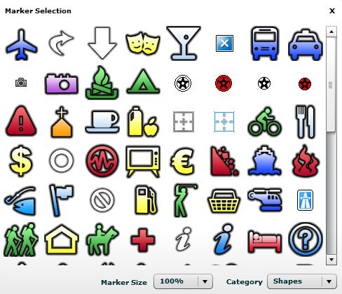
placemarks

You also have control of the color, opacity and line thickness from the toolbar, along with the ability to search for locations:

scribblemapcontrols

Once the shapes are created, you can move them, modify them by shifting vertices, rotate them, or erase them. Once done with your map, you have multiple export options:

  • JPEG
  • Print directly from browser
  • Embeddable widget (no Google Maps API key required):

  • Facebook map
  • Regular Google Maps view
  • Google Earth plugin (though this didn’t work for me)
  • KML file (for viewing in Google Earth)
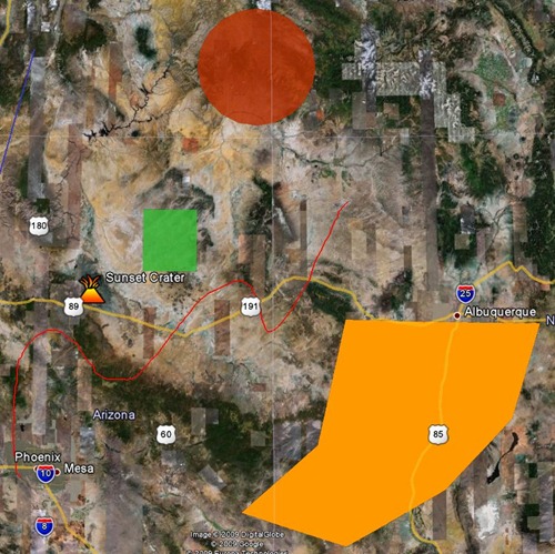
scribblemapsGE

  • GPX (for export to your GPS); only exports points and lines, the only geometric shapes that GPX files support

You can also save your map for future editing, and get a dedicated web link for it; you choose a password for it so that only you can edit it, or delete it later.

Very slick, and very cool; I’m putting ScribbleMaps into my main bookmarks list.


One-Click Reverse Geocoding In Google Maps

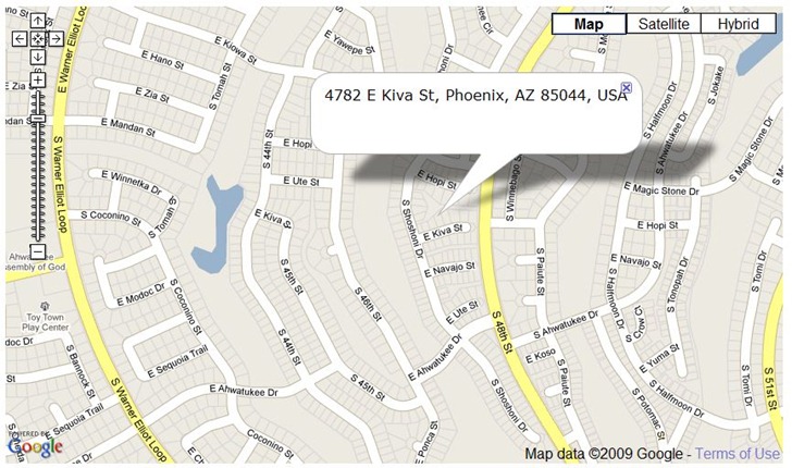
Digital Inspiration’s Find Postal Address … site is a one-trick pony, but does it well. Zoom to a location in Google Maps, click on the map, and a pop-up will give you the closest postal address to the point you’re clicking on:

postaladdressinGoogleMaps

A search box aids in zooming in quickly to a desired city or zip code.


Quick GPX Viewing In A Google Maps Interface With GPXViewer

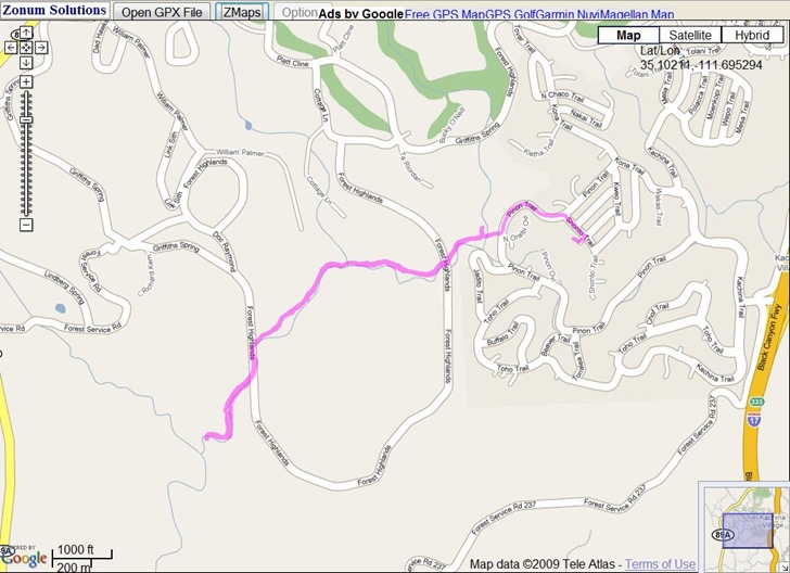
It’s nothing fancy, but Zonum’s GPXViewer website lets you upload a GPX file (points and tracks), and then quickly plots it in a Google Maps interface:

gpxviewerz

No editing, export or additional info in this app, just display; but Zonums has other web apps like Digipoint and MapTool for that.


Get A Point Position With GetLatLon

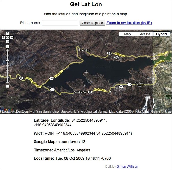
GetLatLon pretty much does exactly what its name implies – gives you the latitude/longitude of a point in a Google Maps interface. A crosshair at the center of the display marks the position for which coordinates are given at the bottom:

getlatlon

Digipoint can perform the same function, plus many more, but if all you need is a coordinate position, GetLatLon has a stripped-down simplicity that makes it easier to use. Just keep in mind that coordinate positions in Google Maps can be tens of meters off from the true position (see here and here).

Via Download Squad.


Plot KML And KMZ Points And Paths In A Stand-Alone Google Maps Viewer

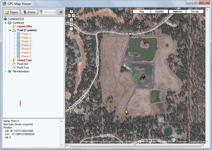
The stand-alone GPS Map Viewer plots points and paths from a KML or KMZ file in a Google Maps view. While you can do this with any number of online apps, including the My Maps feature in Google Maps itself, the GPS Map Viewer offers a couple extra functions not available in some of those.

gpsmapview

  • Get a list of all the individual points in a KML path in the info pane at left. Clicking on any of them, or on a individual waypoint, will bring up their position info in the bottom left pane, where you can copy and paste it somewhere else.
  • Move the cursor over any point plotted at right, and its name will show as a pop-up
  • Double-click on any path point to highlight it in red, and re-center the map on it; same effect by dragging and dropping a point from the list onto the map.
  • Clicking on the small vertical red line brings up a toolbar

gpsmapviewtoolbar

Functions from left to right are to save the view as a JPG, Print Setup, Print Preview, and print the map view with plotted data directly. You can drag and drop this toolbar anywhere it’s convenient.

Here’s a YouTube video demonstrating the program:


Georeferencing A General Textual Location With BioGeomancer

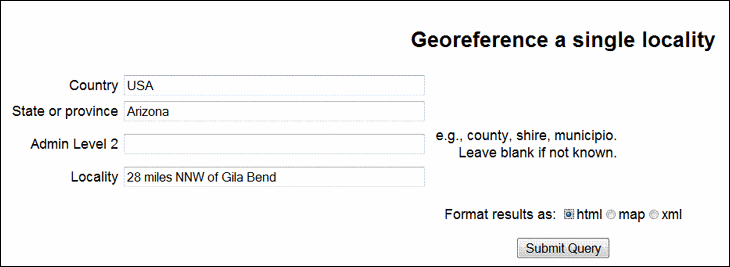
In the good old days, before 1994 or so, when commercial handheld GPS units first came onto the market, locations were often described in general textual terms, like “28 miles NNW of Gila Bend”, or “5 kilometers east of Mount Whitney”. BioGeoMancer Classic and BioGeomancer Workbench can parse these kind of textual descriptions, and convert them to a set of geographic coordinates.

The older Classic version has a text-only interface with limited options:

classic

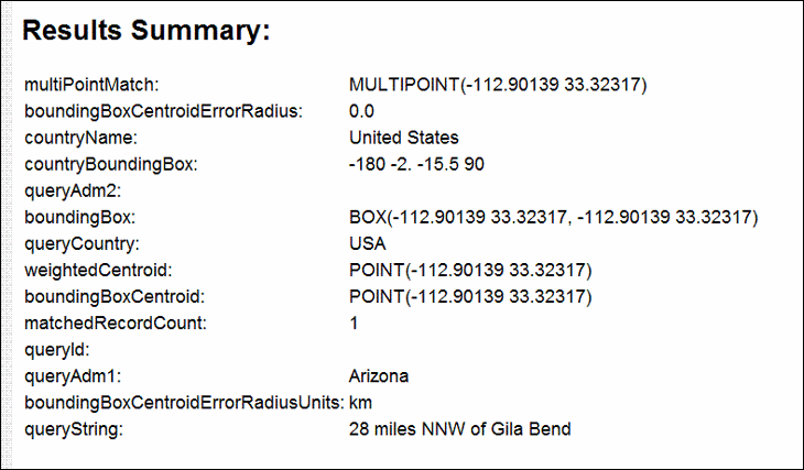
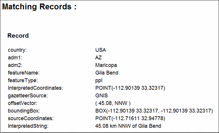
And gives a text output:

results

matching

The “Map” option in Classic doesn’t seem to work, but the XML option does. Since the Classic version is no longer under development, it’s likely to stay in this format

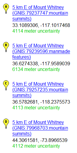
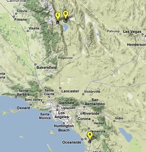
The newer BioGeomancer Workbench version, still under development, has a Google Maps based interface. Enter a locality like “5 kilometers east of Mount Whitney”, and get a list of localities with their locations plotted in Google Maps:

WhitneyList

In this case, I was looking for Mount Whitney in CA, but it came up with an additional one in NY. By using “5 kilometers east of Mount Whitney, CA” as the location reference, the NY locality would be dropped:

CAWhitney

The more general geographic info you can add, the better you will be able to narrow down the possibilities. It looks like you need commas to delimit geographic data, since “5 kilometers east of Mount Whitney CA” won’t return any results.

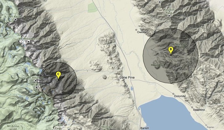
Zooming in on the northern localities shows them plotted, along with the location uncertainty as a darker circle:

closeup

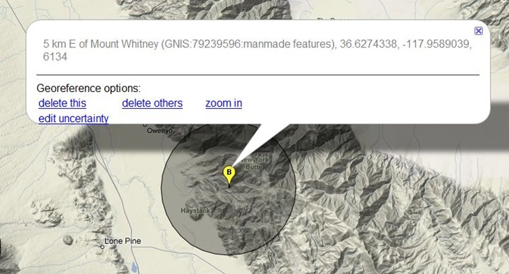
Clicking on a placemark brings up options to change the uncertainty radius, delete the placemark, delete all the other placemarks, or zoom in:

bgbubble

The only way to save the data now is to copy it from BioGeomancer and paste it into a different application. The help page indicates that in the future, you’ll have the option to save the data in spreadsheet format, and also do batch text georeferencing.


MapTool Goes To Version 2– Elevations, Areas, And Distances In Google Maps

I’ve covered Zonums Software free online application MapTool before; the original version let you determine the elevation of a point in a Google Maps interface, as well as measuring the length of a multi-segment path or drawn polygon, but not much more. Zonums has recently updated this application to  MapTool 2, which adds some really nice new functions (most accessible by clicking on the Options link at top):

  • Create vertices by manually entering coordinates, in addition to previous option of clicking on map (use Input link at the top for this)
  • Continuous coordinate read-out in both latitude/longitude and UTM
  • Divide a drawn line into equal parts by automatically adding equally-spaced vertices, or add vertices with a user-defined spacing
  • Convert a drawn polygon into a polyline, and vice versa
  • Edit individual vertices in a line or polygon
  • Get a count of the total number of vertices in the drawn feature
  • Get an elevation profile for all the vertices on a line

profile

  • Determine the extents (bounding box) for the drawn feature
  • Export the vertex coordinates as a text file
  • Export the line or polygon directly as a GPX, DXF or shapefile in latitude/longitude/WGS84, with the option to include vertex elevations


Easy Google Maps Route Creation With NetKvik

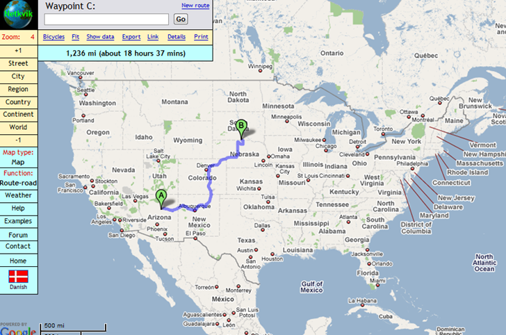
NetKvik offer an alternate interface to Google Maps for creating routes from one location to another, with easier access to some of Google Maps’ standard options, plus a few added features.

netkvik

Probably the most confusing feature of NetKvik is the zoom function, or the apparent lack of one at first inspection; there’s no standard Google Maps zoom slider. But you can use the +1 and –1 buttons at upper left to zoom in and out, and use the level buttons to jump to gross zoom levels like city, region, or continent; the mouse wheel also  zooms the map in and out. Once you get past that quirk, NetKvik offers a lot.

Like Google Maps, you can drag and drop the destinations and track to modify the route; you also have the option to bypass highways (using the Function menu to select that option. You can also create a link to the map with the route drawn. But unlike Google Maps:

– You can add successive destinations not only by entering the location in a search box, but also by clicking on the map

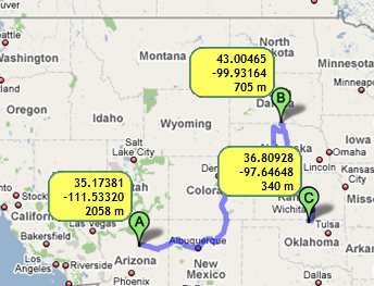
– Click on Show Data to get coordinates and elevations for your destinations:

nkdetails

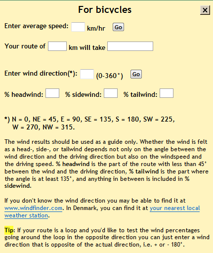
– Click on Bicycles to enter details like travel speed and wind direction to get travel time and headwind/tailwind details for a bike trip:

nkbicycle

– Use Details to toggle on/off driving directions; total travel distance is always shown. Print prints out driving directions.

– Option for Point to point routes (great circle routes plotted between destinations)

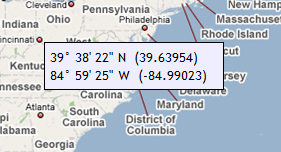
– A coordinate function option displays latitude/longitude next to the cursor:

5-10-2009-9.40.21 PM

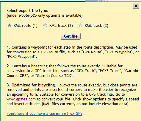
– Export a KML file for your trip in one of three formats:

nkexport

– Weather brings up a weather map from Weather Underground for the location you’re viewing.

– Moving the mouse over every button/feature pops up a concise but useful help screen; when those pop-ups get to be too annoying, you can turn them off.

HT to Carl DK.