blankblank blank


Archive for the 'Garmin' Category Page 6 of 13


Convert OCAD Maps Into Garmin Format

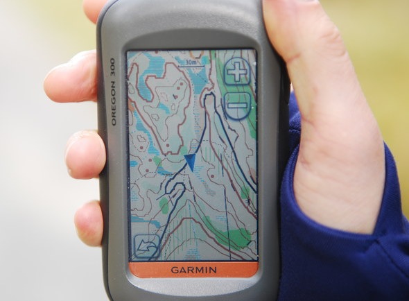
As with yesterday’s posts on TomTom GPS units, this is another in my series of “stuff that looks cool, but I don’t have everything I need to try it out”. OCAD is a vector-based map-drawing program (current version 10 is not free; version 6 has been released as freeware, available on the Download page). I believe the “O” in OCAD originally stood for orienteering, the sport of navigating with map and compass especially popular in Europe, but the program has evolved into a more sophisticated mapping program. The World Of O website has an article on the free utility ocad2img that converts the vector OCAD format into a Garmin-compatible vector .img format. A bit technical, and the maps don’t look exactly the same, but they have the speed and file size advantages of vector data. Like I say, I can’t try it out, but the photo (from the website) looks good:

DSC_9954_s


Put Custom Startup Graphics On Your Garmin GPSr Unit

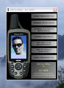
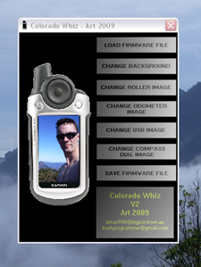
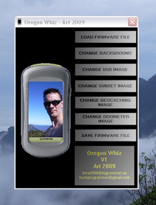
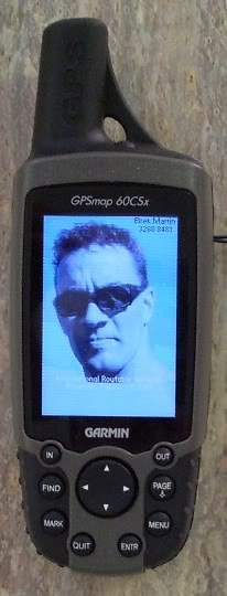
Art writes about his programs Garmin 60CSx Whiz, Garmin Colorado Whiz and Garmin Oregon Whiz, which modify the firmware on a Garmin GPSMap unit to display a custom startup image and other alternate graphics. 60CSx-supported units include:

  • Garmin 60Cx
  • Garmin 60CSx
  • Garmin 76Sx
  • Garmin 76CSx

The interface looks straightforward enough (graphics from the program website):

60CSxWhiz_Art colwhiz Oregon_Whiz

Sample graphic images are provided for the 60CSx whiz, but you can also use your own (love the kookaburra):

60CSx_Examples

And apparently they do what they’re supposed to:

60CSx_Mod

I say “apparently” because I’m too chicken to try it out, even though Art has a pretty solid hack programming resume. But if any braver souls want to give it a try and post their results in the comment section, have at it!


A Review Of The Magellan Triton 2000 GPS Receiver – Part II: Out In The Field

Yesterday’s post reviewed some of the hardware and software characteristics of the Magellan Triton 2000 GPS receiver, comparing it to my old Garmin 60Cx.  But the real test of any GPS receiver comes out in the field – how good a job does it do at determining your position, and recording data? I took both units out on field work in the southern Arizona desert in August (yes, I’m crazy), and also for a hike in my neighborhood, to compare the two.

Continue reading ‘A Review Of The Magellan Triton 2000 GPS Receiver – Part II: Out In The Field’


A Review Of The Magellan Triton 2000 GPS Receiver – Part I: Hardware And Software

Not too long ago, Magellan announced that they had upgraded the firmware and PC software for their Triton line of handheld GPS receivers, noted for their ability to display raster imagery, and offered to send out review units to interested people. There are several free utilities for the Triton series that I’d been interested in posting on, plus I’d always been interested in the raster map capabilities of these units. I requested a review unit, and they were good enough to send a Triton 2000 to me a few weeks ago. I’ve had the opportunity to evaluate it in both recreational and field work environments, comparing it with my current GPS receiver of choice (Garmin 60Cx), and thought I’d post a review of the GPS unit itself before posting about free utilities.

Continue reading ‘A Review Of The Magellan Triton 2000 GPS Receiver – Part I: Hardware And Software’


Garmin Maps On A Windows Mobile Pocket PC Or Smartphone

In a previous post, I covered the PC version of gpsvp, a program that lets you view Garmin vector maps on your PC, and plot your live GPS position on them; it also has multiple other functions like waypoint/track management, raster maps from the Internet, and more. In addition to the PC version, there are also versions available for a number of Windows Mobile Platforms that turn them into the functional equivalent of Garmin GPS devices :

  • PocketPC 2003
  • Pocket PC 5, 6
  • Smartphone 2003
  • Smartphone 5, 6

The look and feel of the app, and most of the functionality, are virtually identical to that of the PC version:

gpsvpppc

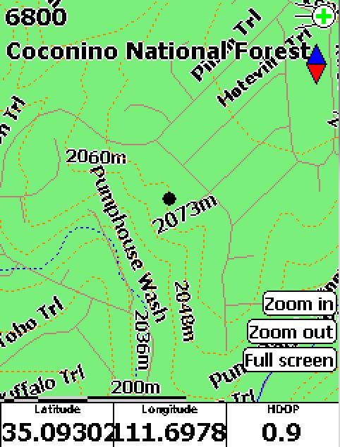
This is the Pocket PC / Windows Mobile 5 version, with a free Garmin topographic map of Arizona loaded (available at GPS File Depot), with my current GPS position plotted as the black dot. Obviously, you’ll need either a built-in GPS receiver in your Windows Mobile device, or a Bluetooth-connected GPS receiver, to get this full functionality.

Getting the maps on your mobile device involves copying them over onto the device using the ActiveSync File Explorer. While you can put it into the device’s main RAM, you’re probably better off installing it on the device’s SD card if it has one, since it likely has more memory space available. gpsvp will automatically search the device and SD memory to find Garmin .img map files, and let you select either an individual file or a folder full of files. Don’t load too many files in, as gpsvp can choke on large numbers of files; I was able to have all the Arizona topo map files loaded up, but it took a while to load them in. As described in this post, you can use GMapTool to select the map tiles you plan to use, then copy just that limited set of files over.

There’s also a version for Java VM enabled portable devices listed as GPS4Mobile.jar in the file list; don’t have such a device, so I don’t know what it’s functionality is.


Identify Garmin Map Tiles And The Area They Cover

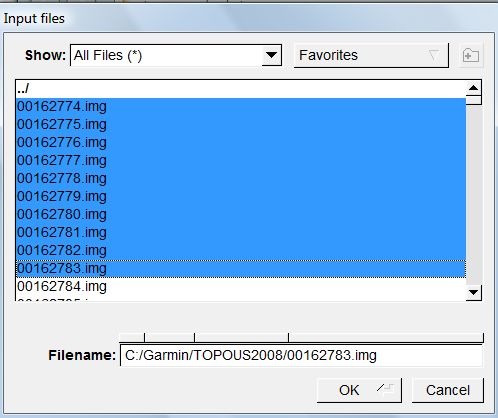
If you load a Garmin mapset into MapSource, individual tiles are identified by a geographically-related name, and they area they cover plotted on a map. But the tile files themselves (*.img) have cryptic 8-digit filenames that don’t correlate with their name or the area they cover. But there’s a simple way to look at a file, or multiple files, and determine both their name and the geographic area they cover using the freeware utility GMapTool.  Start up the program, click on the Add Files button, and go to the directory containing the .img files, here from the Garmin Topo 2008 mapset:

selectfiles

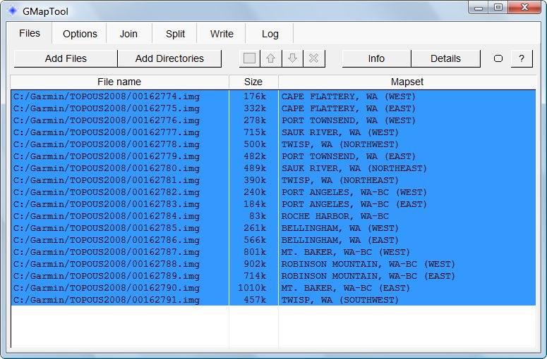
Select one or more files, click OK, and you’ll get a listing of the filenames, their sizes, and their names in the Garmin mapset:

listing

To determine the geographic area covered by a map tile, click on the tile, then press the Details button:

details

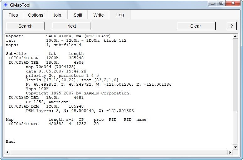
The geographic extents of the tile in latitude and longitude are buried in the middle of this listing:

N: 48.499832, S: 48.249722, W: -121.501236, E: -121.001186

Useful if you want to create a mapset that’s a subset of a much larger mapset, and want to figure out which tiles you need.


A PC GPS Application That Lets You Use Garmin Vector Maps For Live Navigation (OSM, Google And Bing Maps, Too)

I’ve used Garmin’s MapSource long enough to remember when you could display a live GPS position in it on a standard Garmin vector map. A few years ago, Garmin removed GPS functionality from MapSource, and put it into a separate free application called nRoute. nRoute could display your live GPS position on a Garmin vector map, do routing, and more. But just a few months ago, Garmin pulled all links to nRoute, and now sells an application that does basically the same thing. Edit: In comments, Thomas Larsen offers this still-active Garmin download link; grab it while you can.

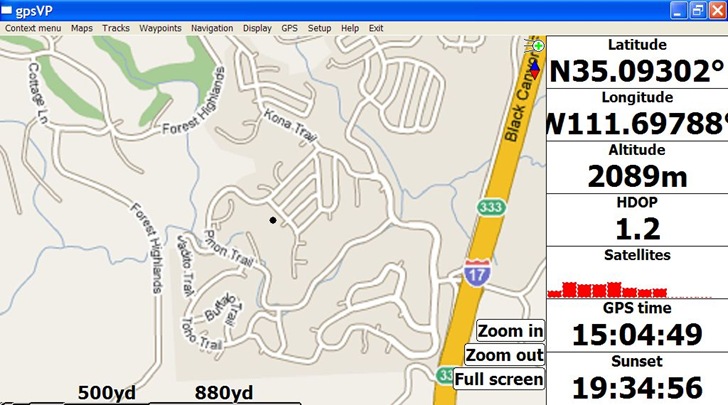
But if you have an NMEA-capable GPS receiver, like a Bluetooth GPS module, and a Bluetooth-enabled Windows PC, there’s a full-featured application that will let you plot your live GPS position on standard Garmin vector maps: gpsvp. Using gpsvp, you can:

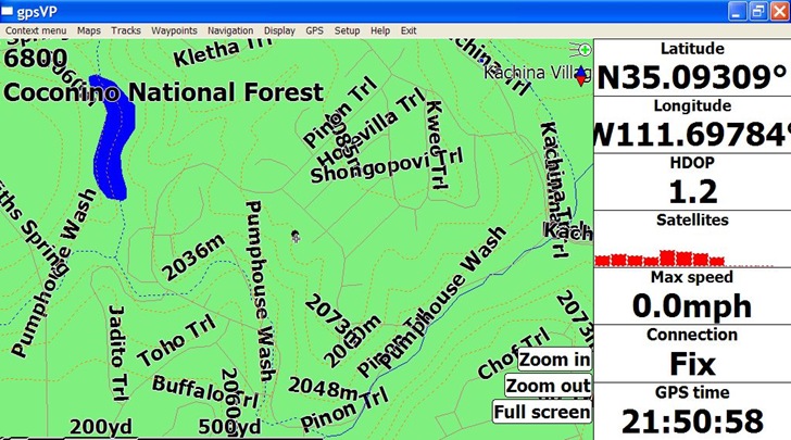
  • Load Garmin .img files, and display them on your PC with your current position plotted on top:
gpsvpgarm

This is a free Garmin Arizona topo map, available at the GPS File Depot along with free maps for most of the rest of the US; a search for “Garmin maps” on this website will bring up sources for free maps for much of the rest of the world.

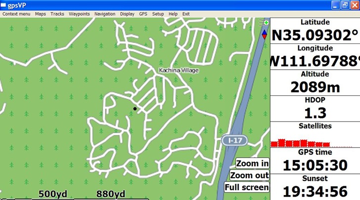
  • If you have an Internet connection, you can download raster map tiles for a location from Google Maps, Bing Maps, and OSM (including satellite, terrain and hybrid views):
gpsvposm

OSM Map

gpsvpgoogle

Google Map

  • Display position, GPS status, time, altitude and other data in the monitor bar at left; you can customize this to show whatever you want
  • You can also drop the map display, and only display parameters in a full screen monitor bar
  • Open, create and export waypoint and track files in GPX and PLT formats
  • The website documentation seems to suggest that you can convert your own raster imagery, or WMS imagery, into a format compatible with this program, but I’ll be danged if I can figure it out.

Documentation overall is a bit weak, so you’ll have to figure it out by experimentation; but, most of the menu items are fairly easy to understand.

Here’s a few tips:

  • To download and view raster maps, you have to turn off the Garmin maps (from the menu: Maps => Garmin Maps, and uncheck the “Show Garmin maps” item), and also set a folder to use as a cache folder for downloaded imagery (Maps => Raster maps => Set raster cache folder). Then set the Raster map type you want (Maps => Raster maps => Raster map type), and download the maps (next menu item down from the previous one). It looks as though map tiles can be cached for use offline, but I’m not sure about how that works.
  • You select the Garmin .img maps to use, either by individual .img map file (Maps => Garmin maps => Open map), or all the maps in a folder (Maps => Garmin maps => Open map folder). Be careful with the latter option if you have a large number of maps, as this can crash the program. For example, I could load the entire folder of Arizona topo maps into gpsvp at once, about 150 MB of maps; trying to load all of the US Topo 2008 Garmin maps in froze the application.

Unfortunately, all Gamin .img map files are identified by an eight-digit number that offers no real clue as to what area is covered by the map. But there is a way to find out what area is covered by a specific numbered map file, and its name as well, and I’ll cover that in a future post.

One final irony: the program only works with NMEA GPS data, and if you own a Garmin unit that doesn’t output in that format, you can’t use this program directly; you’ll need to buy a copy of GPSGate, which can convert the proprietary Garmin protocols into an NMEA-compatible data stream.

gpsvp is an open source project, with access to the source code available anonymously via svn.



Evaluating GPS Receiver Accuracy With VisualGPS

The last post dealt with VisualGPS, a program that monitors NMEA GPS connections, plots measured positions as a function of time, lets you average those position measurements for improved accuracy. I took a laptop with VisualGPS and two GPS receivers out to a National Geodetic Survey benchmark with a well-defined position to see how well it works at position averaging, and to compare results from the two receivers.

Continue reading ‘Evaluating GPS Receiver Accuracy With VisualGPS’