blankblank blank


Author Archive for Leszek Pawlowicz Page 16 of 27


waze: Free Crowd-Sourced Traffic Phone Apps

From email comes a link to waze, a free mobile phone app (iPhone, Android, Windows Mobile, Blackberry) that sends back real-time GPS-or-cell-tower-derived position/speed data from phones to determine where traffic problems might be occurring, and then alerts you to potential traffic issues. Here’s their video guided tour (click on “Go” to start):

Seems like a clever idea, but I see some problems:

  • Chicken-and-egg: the service only really becomes useful when lots of people use it in a specific area, but if they won’t use it until it become useful, it will never achieve critical mass. On the home page is a dropdown list of current areas at least partially covered by waze, and most of them show the project as being in the very earliest phase, with limited utility.
  • The business model relies on taking user-driving tracks, and using it to create updated navigation maps for sale; they also intend to rely on users to manually make road database updates. The OpenStreetMap project has already captured a large mind-share for this concept based on generating a freely-available database, and I wonder if people will do the same for a commercial service. They plan to offer rewards points and rankings to encourage this, but who knows?
  • The initial database is derived from US Census Tiger data, and doesn’t use OpenStreetMap data; they say it’s because of OSM’s data license, but I hear that may be in the process of changing. Tiger data isn’t bad, but OSM is better (since it’s Tiger data refined).
  • It’s not a navigation app, only a traffic app; this may put some people off since they may expect to nav app.
  • Finally, Google Maps, Bing Maps (and probably others) already offer real-time traffic data, although not with the same granularity as Waze might (i.e. local street data). But I don’t see why Google couldn’t add this particular feature to their Android navigation app fairly easily, and their large installed database would make it almost immediately useful.

But hey, it’s free – worth a look. Could be successful in the end.


Status Of The Garmin Map Compiler cgpsmapper – ?

Both GPSTracklog and GPSFix link to a page on the cgpsmapper website that indicates development will be ceasing on that Garmin map compiler. This is a real shame; over the past decade, this compiler has driven the creation of thousands of freely-available maps for Garmin GPS units, as well as being a boon for creating your own personal custom maps. I use it all the time – just posted about it again recently. Even some international Garmin units have sold maps created with cgpsmapper.

In a more detailed post at the Yahoo Map Authors group, Stan Kozicki, the author of cgpsmapper, talks about this issue in greater detail. His biggest problem appears to be his inability to keep up with changes in the Garmin binary map format, since Garmin doesn’t formally document it; I know they recently made a change that broke map “locking” in his commercial version of the program. He’s apparently still talking to Garmin about some kind of continuation of the program for use in non-commercial independent map creation, with them possibly supplying more detailed information about the Garmin format. But Garmin appears to want the commercial versions of cgpsmapper to go away in favor of their commercial (and expensive) Map Product Creator.

I really hope that Stan and Garmin can come to some kind of agreement; I think the availability of cgpsmapper and the Garmin maps it creates helps drive commercial demand for Garmin units. Ten years ago, Garmin and Magellan had comparable market shares in the handheld GPS field; today, Garmin overwhelmingly dominates that arena, and is also far more popular than Magellan in the automotive arena as well. I don’t know how much the ability to create custom Garmin maps with free software had to do with that (creating custom Magellan maps is far more difficult, and requires proprietary software), but it certainly didn’t hurt.

In any case, there’s no indication from Stan that he will withdraw the last free version of cgpsmapper from availability anytime soon, and maps created with that version should work fine on most current Garmin models. Other free options for compiling Garmin map files include mkgmap, MapTk and MapDekode. I’ve been playing quite a bit with mkgmap recently, and am pretty impressed; it’s command-line only (like cgpsmapper), but I’m working on a GUI that  will support most of its features/options.


Desktop Earth: Dynamically-Updating Geographic Windows Wallpaper

This is pretty cool! Desktop Earth is a geographic wallpaper background for Windows that:

  • Displays seasonal NASA Blue Marble Imagery, or a fixed Blue Marble image
  • Displays day/night regions; options for city light displays in the night regions
  • Gives you the option of overlaying current cloud imagery, with variable opacity
  • Set the center of the image to any time zone
  • Update interval for day/night from one minute to one hour

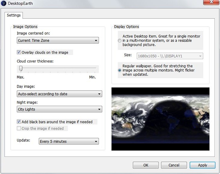
Control panel:

desktopearth

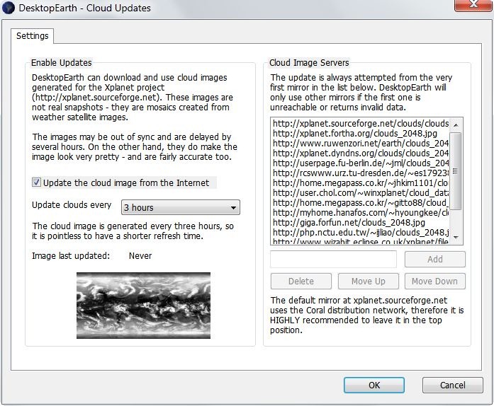
Cloud imagery is from the XPlanet project, and updates need to be specifically enabled (off by default):

cloudupdate

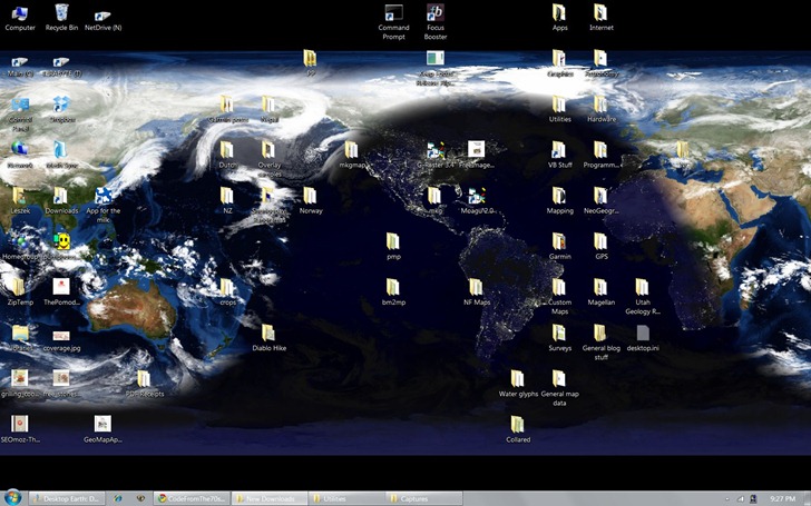
And how it looks on my desktop:

fulldesktop

If you’re not using Windows, you can use the Desktop Earth Online page to generate a static image that you can save to your computer and use as the wallpaper.

Via Lifehacker.


Removing Time Data Out Of A GPX Or KML File To Make It Work Right In Google Earth

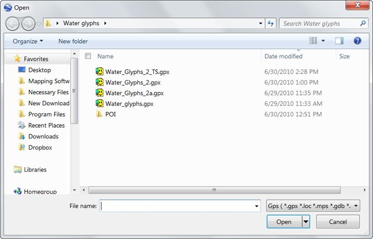
In the process of writing yesterday’s post on Garmin Basecamp, I found an annoying flaw on how Google Earth handles GPX files. In a recent GPS talk I gave, I surprised some people when I told them that Google Earth can open some GPS-related formats like GPX, LOC and others directly; you just need to select the type of files you want to open with the drop-down in the lower-right corner:

open_gpx

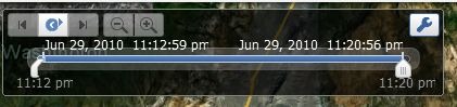
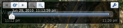
But if the waypoints in GPX files come time-stamped, either with the time you created them in the field or in a program, Google Earth assumes that you want to use this time-related data, and brings up a time slider in the upper-left-hand corner:

timeslider

The first time you open the file, the time slider will run from start to finish, with waypoints popping up and disappearing as the time indicator hits their creation time. You only see all the waypoints when the time slider has run all the way through to the end. Very annoying.

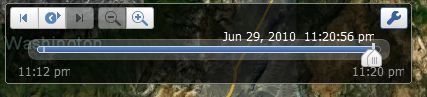
But it gets worse. If you uncheck the GPS data box in the Places pane to hide the data, then check it again, you’ll see nothing at all except the time slider:

timeslider1

Hitting the play button on the time slider will make the waypoints appear and disappear quickly, and at the end the only waypoint visible will be the last one created; the time slider will look like this:

timeslider2

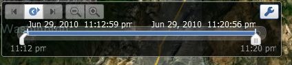
To see all the waypoints, you’ll need to move the “start-time-extent” slider all the way to the left:

timeslider3

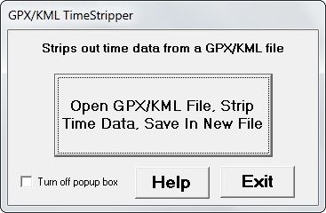
Same behavior if you save the data permanently to “My Places”. This is pretty retarded behavior; I hope Google adds the option to turn off time-related data display when it’s not wanted. Until then, I banged together a simple Windows-only program called GPXTimeStripper that will remove all time-related data from a GPX file (KML files, too, although this may not work in every case).  Download the file at this link; it’s a zipped stand-alone executable. Run the program (won’t win any interface awards):

Click on the main button, choose the GPX or KML file you want to process, and the program will remove the time data from the file, and save it with “_TS” appended to the filename. You’ll get a pop-up box with the name and location of the new file, which should always be the same location as the input file.  If the pop-up becomes annoying (which it will), check the box in the lower-left-hand corner to turn it off. Help button takes you to this page; Exit does what you’d expect.

No real checks for overwriting older files, and may not work on every file correctly (report bugs). Use at your own risk. BTW,  Google, would it kill you to have KML files created in Google Earth terminate in CR-LF instead of just LF?  It would simplify the job of reading them in correctly.


Garmin Basecamp Revisited

It’s been a bit more than a year since I first looked at Garmin’s free Basecamp software, and wasn’t terribly impressed. I did say, “Hopefully future versions will be snappier, and add more features.”  I just did a GPS presentation to a local hiking group, and in preparation for that took a full look at the latest version of Basecamp (3.05). In short, it’s a major improvement over the first release; it’s now better than Garmin’s classic MapSource program for uploading/downloading/managing data. It’s so improved that it wouldn’t be a bad basic choice for creating data for use with non-Garmin GPS models; just export the data to GPX format, then use a program like EasyGPS to send it to your model. As an added bonus, it’s available in both PC and Mac versions.

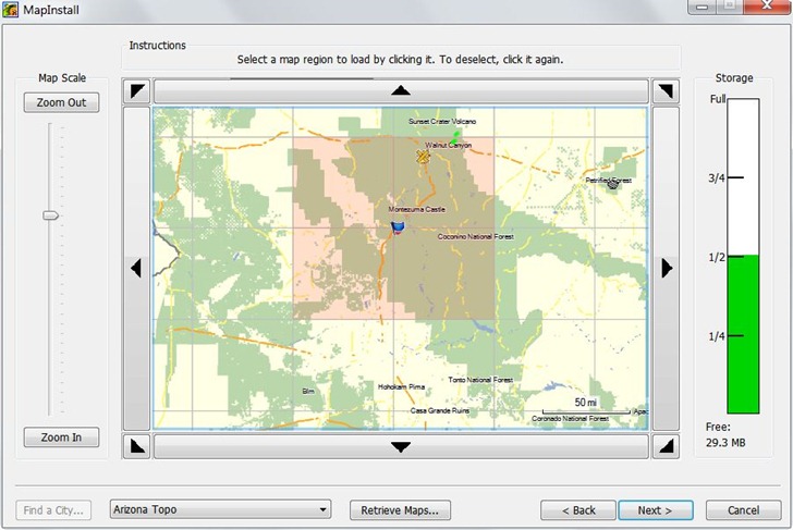
Probably the most important addition is an associated tool called MapInstall, that lets you upload Garmin-compatible maps to your GPS unit. Prior to this, the only complete tool for doing this was Garmin’s MapSource program, only available if you purchased a Garmin mapset, or Garmin’s Trip and Waypoint Planner software, sold for $30. If you wanted to use free mapsets like those available at the GPS File Depot, you were out of luck; now, you’re not. MapInstall isn’t as good for uploading and managing maps as MapSource, but it should be good enough for most people:

mapinstall

But there are lots of other useful new features:

  • Faster and less buggy than earlier versions
  • Tiled (poster) printing of installed mapsets
  • Support for Garmin Custom Maps and Birdseye Imagery
  • Better route management
  • Conversion of tracks to simplified routes
  • Better waypoint, track and route management
  • Better export to Google Earth
  • Ability to import mapsets pre-installed on some GPS models

Still some issues left, some kind of weird:

  • Import of KML files is iffy
  • Help file is still incomplete
  • Only supports USB-interface models; older serial models are out of luck (though you can still export data and use EasyGPS to upload it
  • There are features listed on the update/download page that don’t seem to exists, e.g. “Added printing of USGS Quads and other public land survey areas.”
  • Be nice to be able to simplify tracks and still keep them as tracks; now, you can only save a simplified route.
  • Basecamp insists on exporting waypoints to GPX, Google Earth format with a timestamp even if you’ve created them in the program (and don’t want a timestamp).

I did some Basecamp demo videos as a reference to what I presented at my talk, and have put them up on YouTube; not terribly exciting, but maybe you’ll find them useful.


GPSBabel Hits Version 1.40

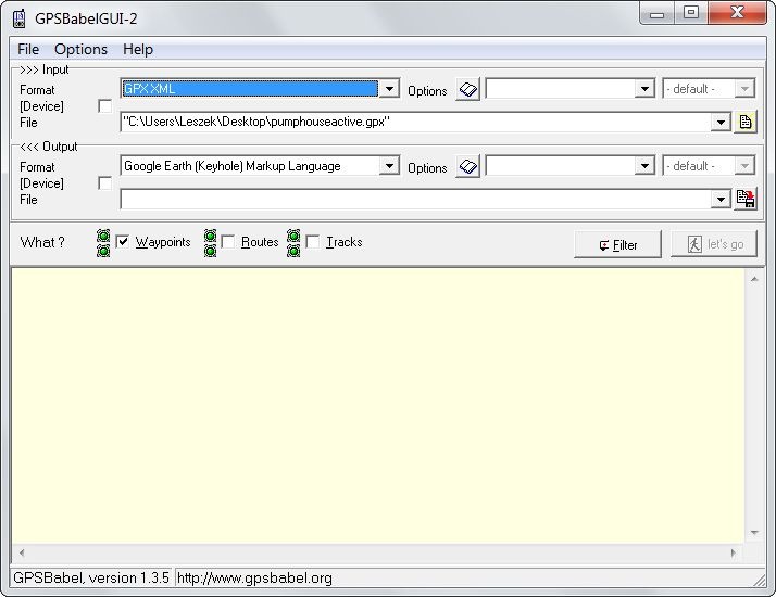
Via SlashGeo comes word that the multi-platform GPS format converter and GPS unit data uploader/downloader GPSBabel has hit version 1.40; unless I’m mistaken, this is the first official release in close to two years. (with lots of beta releases in between). Most obvious change is in the interface, which moves to a common Qt base for the Windows, Mac, and Linux versions. It’s not hugely different from the old interface in functionality:

Old Interface

gpsbabelold

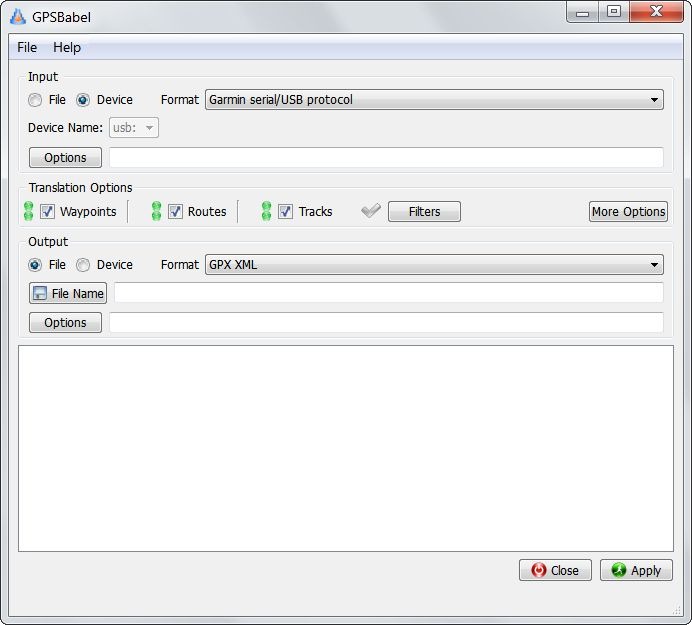
But the new layout is far cleaner and easier to figure out:

New Interface

gpsbabelnew

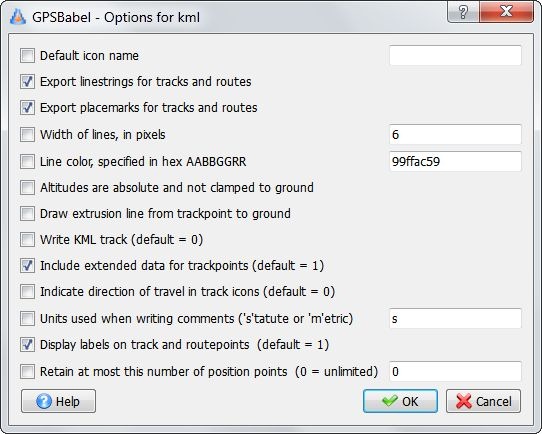
The previous version of GPSBabel probably supported the largest number of GPS-related formats of any program, and version 1.40 adds even more; it’s so strong that some commercial programs use it as a base for their format importation. One commercial company even uses it despite not releasing the necessary information to let GPSBabel interface with some of their GPS units (rhymes with Flagellan). Clicking the “Options” button brings up data output options for the selected output format:

gpsbabeloptions

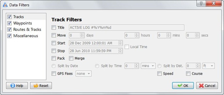
And you can filter/modify data before writing/uploading it:

gpsbabelfilters

Lots of additional features and power, but requires an effort to learn it all. No documentation up yet for Version 1.40, but there’s online documentation for version 1.36 still available, and you can download a PDF manual for version 1.35 from scribd.com. Information about the new formats and features can be found at this link.


Archive Of Old GPS Firmware And Software Updates

If you ever feel the need to roll your GPS back to an older version of the system firmware, you likely won’t find it on the manufacturer’s website; they typically only have the latest version. The Garmin Software Archives has a pretty extensive collection of  older firmware updates that covers most Garmin units released over the past dozen years, as well as some for other makers as well (Bushnell, deLorme and Magellan). The collection is most comprehensive for handheld units (need an update for your 12XL?), but includes some marine, aviation and automotive units as well. The archive also had older software updates for Garmin programs like MapSource, Basecamp, WebUpdater, POILoader , nRoute, even the old USB programmer for Garmin’s proprietary memory card format. Some programs (e.g. MapSource) don’t let you downgrade to an older version, so you’ll need to uninstall your current version, then install a valid older version from one of your map discs before using one of the updaters from the archive.

Almost forgot: there’s a link at the archive to a great Garmin PDF from 2005 on using your GPS with paper maps; also includes a page of map tools that you can print on a transparent sheet and use with USGS 1:24K topo maps (map grid for UTM and compass rose, and two scale rulers).


Google Maps Adds Measuring Tool

The main Google Maps page now has a distance measuring tool. It’s not turned on by default, so you’ll have to click on the green beaker at upper right (the Google Labs symbol for experimental features):

beaker

Then enable the Distance Measurement Tool in the window that pops up:

dmt

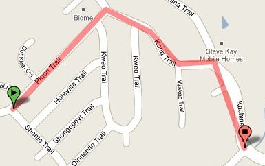
A ruler icon will now appear in the lower-left of the maps; clicking on that will put you into measurement mode. Clicking on the map will now draw a line:

mapline

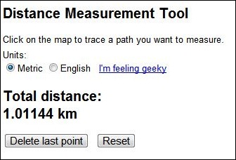
And the pane at left gives you the total distance (metric or English):

pane

The entire Labs section is worth a look, as it offers several other useful options (as well as some useless ones, like adding the “Beta” title back to Google Maps).

  • A “Drag N Zoom” button that lets you select an area to zoom to (finally!).
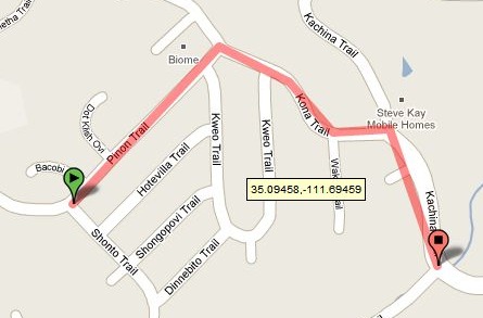
  • LatLng Tooltip brings a little pop-up window near your cursor that always displays the latitude/longitude.

fullscreenlatlong

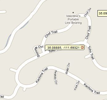
LatLng Marker lets you right-click on a point, and place a marker there with latitude/longitude. You can select the coordinate text with your cursor, copy the coordinates directly off the marker, then paste them elsewhere to save them.

droppedmarker