

MapAction is a non-profit volunteer organization that provides GIS and mapping services to disaster areas. They’ve just published a free 118-page Field Guide To Humanitarian Mapping that’s a terrific introduction to both data acquisition using a GPS, and how to use Google Earth and the free open-source Windows GIS program MapWindow for mapping. I’d even say that it’s a far better choice for beginners than the recently-published GIS For Dummies (more on that soon, when I get the review of that volume done).
Author Archive for Leszek Pawlowicz Page 13 of 79
8/13/2009: No longer free; there’s a subscription fee from which a small charge is deducted for every use. A free grid link is still available here for MGRS and UTM.
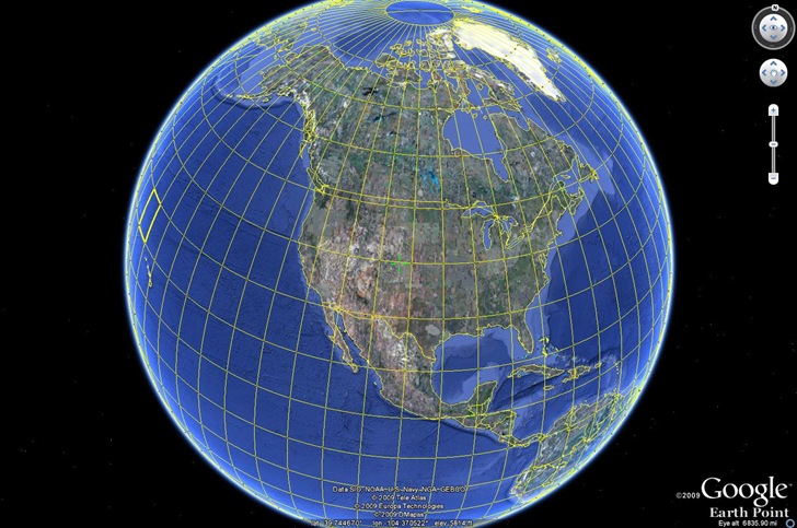
Earthpoint has a new beta Google Earth function – grid overlays for multiple coordinate systems:
- Deg – Decimal degrees
- DegSec – Degrees, Decimal seconds
- DegSecMin – Degrees, Seconds, Decimal minutes
- Georef – World Geographic Reference System
- UTM/UPS – Universal Transverse Mercator / Universal Polar Stereographic
- MGRS – Military Grid Reference System
Click the button for the desired grid KML file, and open it in Google Earth (UTM here):
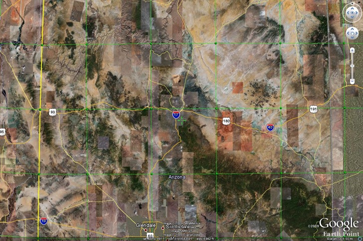
As you zoom in, the grids become finer; you may have to wait a bit for the network link to catch up:
Roll your mouse over one of the “balls” defining the grid, and get a pop-up with the coordinates (and UTM zone here):
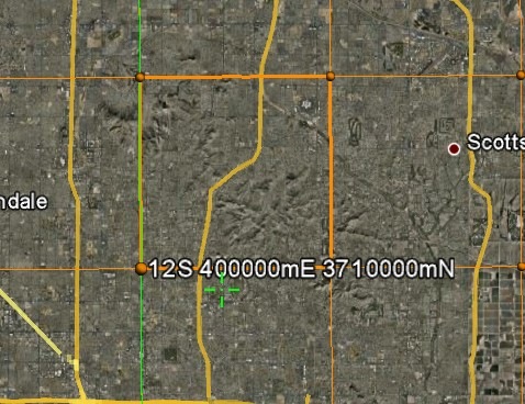
The crosshair marks the center of the display, the location for which Google Earth shows the coordinates and elevation in the bottom toolbar.
Updates to report on several photo geotagging applications covered previously on this blog:
Grazer: Grazer is a very simple and easy to use geotagging program. However, the first time I looked at it, it had difficulty matching up the times in my GPX track with the times in my photos, even though other applications had no such issues. Supposedly those problems have been fixed, and the program modified to run in Vista, and a quick test confirmed that. The feature set is a bit thin, but that also means there are fewer options to confuse you with. Still not my top choice, but now that it actually does work, it might be worth a look for someone looking for a very simple geotagging app. Windows only.
Prune: Version 7 of Prune is out, with a slew of new features:
- Loading of KMZ files and zipped GPX
- Improved compression functions with four configurable algorithms
- New function to call gpsbabel to send data directly to GPS receiver
- Charting functions (eg altitude or speed against distance) using gnuplot
- Map view can now use other OpenStreetMap images such as OpenCycleMap, OpenPisteMap or any other tile server
- New function to create an average position from a track section
- Display of straight line distances between waypoints
Since it’s a Java application, it should run on any platform that supports Java, including Mac OS X and Linux. Note: You will need to download EXIFTool to geotag photos. You will also need to both “Correlate” photos, then explicitly tell the program to “Save to EXIF” to embed the geotagging data; just correlating alone doesn’t save the geotagging data.
GeoSetter: My favorite free geotagging application (Windows only); bit of a learning curve, but it’s worth it. Since my first post on it over a year ago, lots of improvements and bug fixes; most recently, the latest version of EXIFTool was added.
Over at the Google Earth Library site, Matt has started a project to convert USGS topographic maps (1:250K, 1:100K and 1:24K scales) into Google Earth overlays.. These are “super” overlays, where views from higher elevations are at lower resolutions, while closer views load in high-resolution imagery; this speeds up display times significantly. Arizona and Nevada are available now, with Colorado and California coming soon.
The network link to access the overlays online is at the bottom of the web page; click on the “G-Earth” graphic. Once loaded in Google Earth, activate it, then expand it to select the state and map type you want, 1:24K maps for Arizona here:
Continue reading ‘USGS Topographic Map Overlays For Google Earth’
Last week, as part of a post on sample Google Earth plugins apps, I linked to an application called Stereo that generates a stereo image pair of Google Earth views. By crossing your eyes sufficiently to get the two images to blend together, you get a 3D view, possibly accompanied by a headache. Horst Blaesig pointed me to a stand-alone app called Stereo GE Browser that goes one step further – it also can create a 3D anaglyph, a blending of the two views that can be seen in 3D using standard red-blue 3D glasses. Open up the app, and you’ll see three globe views:
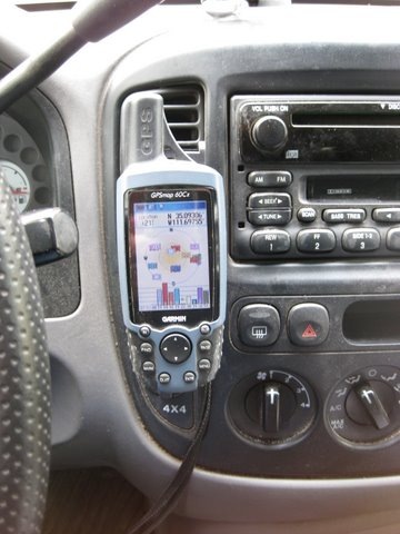
For my regular car, I use a standard Garmin adjustable bracket mount to hold my Garmin 60Cx handheld GPS receiver:
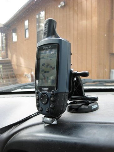
Works fine, position is adjustable – great. But I can’t really use it easily in another car, since it slides into a bracket mounted with adhesive on the dashboard, and I’d need to glue a similar bracket into the other vehicle. Sticking the GPS into a cup holder, or holding it in my hands, isn’t always an option. On a recent field survey trip, I needed to be able to read the location while driving over a very rocky surface while dodging creosote bushes. Holding the GPS in my hands while keeping control of the steering wheel was …. interesting.
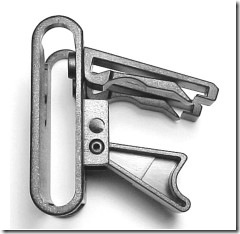
So when I stumbled across the Vent Mount from TheClip.com, it looked like a possible solution: a cheap GPS mount that you stick into a car’s vent, and can be easily moved from car to car. The mount is pretty straightforward, four pieces of molded plastic that snap together; here’s a side view (picture from the website):
The two pieces at upper right slide into one of the louvers in your car’s ventilation system, with the lower brace holding the mount base in place:
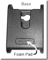
The GPS is mounted on the base by sliding a round swivel tab (like those found on many cellphones that slides into a belt clip) into the notch at the top. My GPS comes with a swivel tab as standard equipment:
If you have a GPS that doesn’t have a tab, they include three tabs and high-strength adhesive pads to stick them on the back of your GPS unit. You could also use the extra tabs for cellphones, PDAs, MP3 players, or any other portable electronic device you might want to have handy in your car.
Overall, the product seems to work quite well; the GPS stays in place even on rough roads, and there’s enough room between the GPS and the vent for air to flow. But a few caveats:
- It will work on vents with horizontal or vertical louvers, and ones that swivel left and right; but not on vents that swivel downwards. Mount your GPS on a downward-swiveling vent, and it will droop into an unviewable position
- You may have to play around a bit with the installation configuration; in my car, the vent snaps worked better when they were rotated 180 degrees from the normal position. YMMV.
- Once you figure out the trick of installing and removing it from a car’s vent, it literally takes only a second to do. However, learning how to do that trick may take a couple of minutes, possibly interrupted by a curse or two.
- For some units (like mine), there’s not enough clearance for the external power connector/USB connector in the back; for those, you’ll have to use it on battery power alone.
- List price is reasonable ($8.99), but then they tack on $5 for shipping, which seems a bit steep. Still, it’s a lot cheaper than a standard Garmin auto bracket mount ($25-30), and if I had known about it, I might not have bought that Garmin mount.
Overall, I’ve found the Vent Mount useful, and would recommend it if you need to use a handheld GPS in more than one car.
Full disclosure: I paid full price for this item, and this is an unpaid and unsolicited endorsement.
The Earthpoint Coordinate Converter takes a geographic position in latitude/longitude, or in a number of grid coordinate systems, including:
- UTM
- MGRS/USNG and MGRS Polar
- GeoRef
and converts it to all the other coordinate systems (including lat/long in decimal, DDMM and DDMMSS formats):
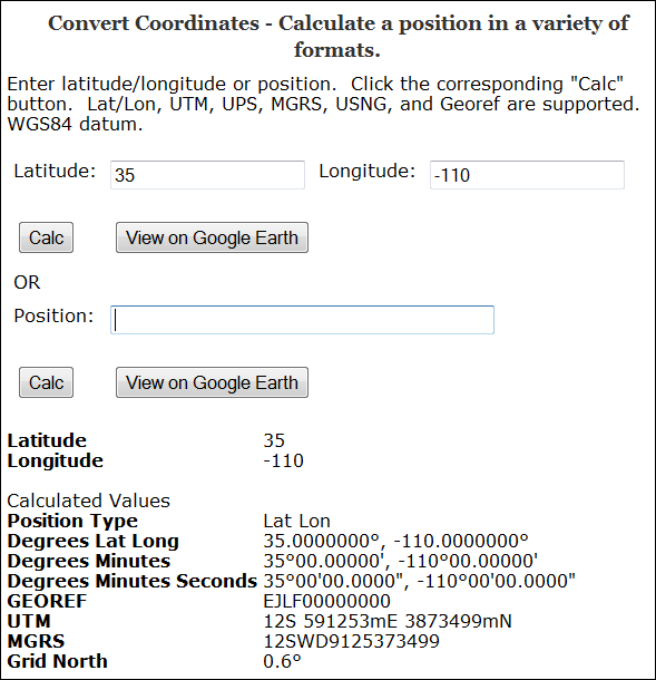
(Grid North is the deviation between true north and north along the map projection grid lines)
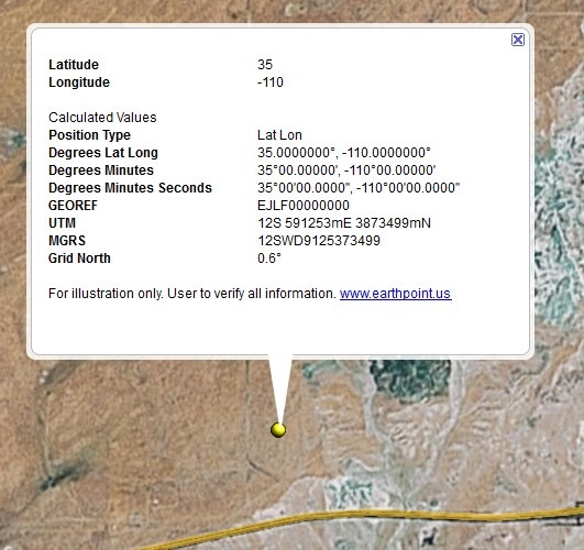
You also have the option of viewing the point in Google Earth, with a pop-up balloon that includes all the coordinate data:
I’ve posted before about Digipoint (version 1 and version 2), a web app that lets you select points in a Google Maps interface, then export their coordinates in a variety of formats. Version 3 of Digipoint is now out, with some modest improvements:
- A new interface, a bit easier to use, and which works better in browsers where the default font size has been modified
- Fly-to: Specify an address, country, or location, and the map will automatically go there. There are also a limited number of pre-specified country/region links, where clicking on the link takes you to the area automatically
- In previous versions, you had to copy/paste text for a particular export format like CSV or KML; you can now download the file automatically
- For exported shapefiles, a corresponding prj file is also created to specify the coordinate system (your choice of geographic or UTM; WGS84)
- Help section added
Still supports the same export formats as before: CSV, TXT, TAB, BLN (Surfer), GPX, KML, DXF and shapefile. Versions one and two are still available if you want them, but there’s no good reason to use them anymore.