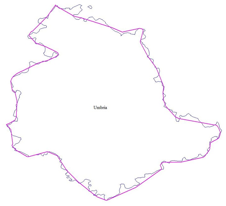
Wish I’d known about this site when I was hunting for a high-res border outline for the province of Umbria in Italy. The Global Administrative Boundaries website offers free vector GIS data for country borders and administrative areas within those borders. Data is available in geographic coordinates (lat/long), WGS84 datum, in multiple formats:
- Shapefile
- KML (Google Earth)
- MDB (ESRI geodatabase)
- R format (for use with the free R statistical software package)
Coverage is worldwide for level 1 data (country borders), but diminishes as you go down as far as level 4 (sub-administrative units), though for the latter there are some countries for which such a data level isn’t relevant. You can see maps of current level coverage here, and missing data will likely be added in the future. Data is licensed under Creative Commons for the US; other unspecified terms may apply for the rest of the world. Here’s the Italian province of Umbria, with the best free data I could initially find plotted in purple, and the high-res GADM data in blue:

Just around the corner, scheduled for unveiling at the October 2009 NACIS conference, is Natural Earth Vector. While there’s some overlap with GADM at the upper boundary levels, Natural Earth Vector may not include some of the finer administrative boundaries available in the GADM . But it will have a wide variety of other geographic features not available in GADM in vector format at multiple zoom levels (list from the web post):
- Continents (North America, Europe, Asia, etc)
- Cultural regions (South Asia, West Africa, etc)
- Countries (US, Canada, Mexico, etc)
- Country sub-divisions (for the US, states, semi-independent territories, dependencies, associations)
- Disputed territories (like Kashmir, Northern Cyprus)
- 1st order admins (states, provs)
- Bathymetry
- Lakes
- Lake Center Lines
- Rivers (including attributes that allow easy “tapering” of drains)
- Islands
- Glaciers
- Populated places (urban boundaries, not city points)
- Cities (point locations)
- Physical features like peaks, ranges, valleys, plains
I’ll try to post again when it’s officially released.
The precise wording is:
These files were extracted from GADM version 1.0, in March 2009
GADM is a geographic database of global administrative areas (boundaries).
This work is licensed under a Creative Commons Attribution-Noncommercial-Share Alike 3.0 United States License. This only covers our contribution, not that of others (data provided to us).
Visit http://www.gadm.org for details
Its not clear, for the UK for example, what the source is and therefore whether it is OK to use.
OOH YEAH!
I was just looking for something like this !!!
Simply great!!
You’re right about the Creative Commons license – I’ve modified the post accordingly. Data methods and sources for all countries aren’t fully documented yet, e.g. this web page for the data methods:
http://www.gadm.org/methods
A reasonable assumption would be that the data has been vetted to be non-proprietary and distributable, but without additional info, this is just an assumption.
The maps are also available at http://www.maplibrary.org, having in addition a focus on Africa and Central America, with additional formats (e.g. MIF, TIFF).