The “blank map, world map” site (sic) has lots of map graphics in GIF, EPS and PDF formats, under the Creative Commons license so they’re free to use. World and continent maps are available (multiple projections for world maps) blank/uncolored, with and without borders; country maps are available with and without borders and subdivision names.
Perhaps the most unique application is an online paintable world map that lets you color in countries with your choice of colors, and then export the graphic file in PNG format in sizes from small (200 x 132 pixels) to large (6000 x 3973):
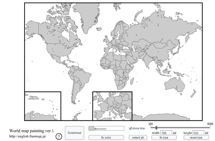
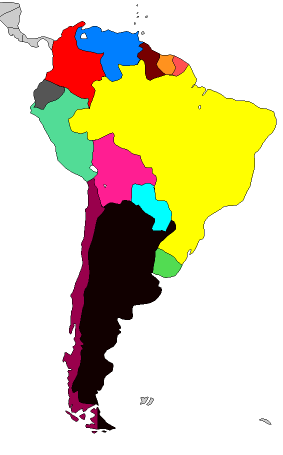
Click on a country or countries to select, then select the color you want to use for them (note: you need to de-select the country or countries you’ve just colored by clicking on them before coloring the next set). Useful for creating wildly-inappropriate coloring schemes:
Hi Leszek
This is a real neat tool to produce quickly thematic maps, without a legend but nevertheless I helps to impress colleagues. And it is another gem you discovered. Donating to you is a real good investment :-)
Cheers
Askan.