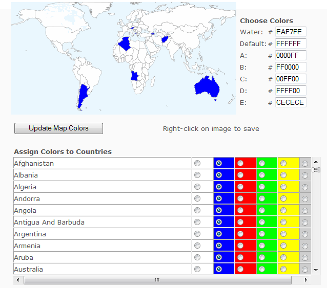
A while back, I covered a web app that lets you color in countries on a world map, then download the resulting graphic. Since then, it’s added more features, including the ability to add text, lines and labels. Mike Piaget writes to tell me of a similar app he’s created, the Customizable Map Of The World. Not as many options as the other app, but easier to use:

Click on a color next to the country name, then click “Update Map Colors” to color the country on the map; here, I’ve colored all world countries that start with the letter “A”. There’s only six colors available for country colors (including the default), plus one for water, but you can modify those colors with the appropriate hex code at upper right. To save a copy of the map to your computer, right-click on the image and choose the “Save Picture As ..” option (or the equivalent in your browser):

Unfortunately, you’re limited to the single on-screen size; however, there are closeup maps available for the subregions Africa, Europe, Asia, the Middle East and South America (links at the bottom of the web app page).
1 Response to “Self-Colored Map Graphics”