In a previous post’s comments section, someone asks if there’s “a way to filter for US cities (or world cities for that matter) that are between 3000 feet and 4000 feet elevation”. In order to do that, you need the data, and oddly enough there’s a specialized little application that can retrieve that data for world cities. GeoMaker (scroll down for the download link) lets you select from a list of world countries, then queries the NIMA (National Imaging and Mapping Agency) online database for the following:
- City/town name
- Geographical coordinates (latitude/longitude)
- Region/State (if available)
- Elevation above sea level (in meters)
You can also download a text file with NIMA gazetteer data as well for a particular country, but it includes all geographic features, not just cities, and can be enormous in size.
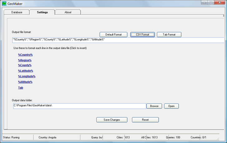
Output is in text format, in either “|”, comma or tab delimited formats, as specified in the Settings tab:

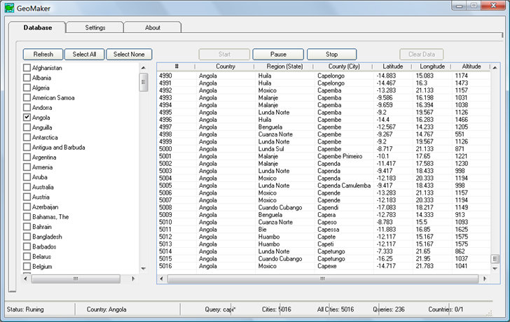
To retrieve the data, select the country you want the data for from the list on the main screen:

Click on the country name to select it, not the checkbox – clicking on the checkbox seems to select Afghanistan for every case in addition to the country you want. Once you’re selected the desired country, click “Start”, and the program will start querying the NIMA database. It uses a brute force approach, where it queries for every possible set of 2-4 starting letters plus a wild card character. Consequently, the search may take quite a bit of time even for small countries, and will usually come up with duplicate entries. Once complete, the output text file is saved in the “data” subfolder of the main program folder with a two-letter name descriptive of the country (e.g. “AF” for Afghanistan, “AO” for Angola).
You can open the text file in a spreadsheet and do a query or sort to find the information you need. If you saved it in CSV format, you could use a GIS program like MapWindow to convert it into shapefile format., and then query the attribute table. Source code for the app (Visual Basic 6) is also available at the download site.
For the United States, the program is supposed to use a different online database, but that doesn’t seem to be working right now. But a full install of MapWindow includes several sample projects; in the “United States” folder you’ll find the “cities” shapefile, which lists over 3000 US cities, their elevation above sea level in feet, and other information. You can query this shapefile in a GIS program, or export it into spreadsheet format with Shape2Text.