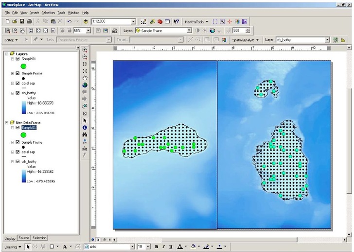
The Sampling Design Tool is another free ArcGIS extension from NOAA’s Center for Coastal Monitoring and Assessment, the source of the Habitat Digitizer Extension I posted about last week. Key features (from the PDF manual):
- Spatial sampling –sampling and incorporation of inherently spatial layers (e.g.
benthic habitat maps, administrative boundaries), and evaluation of spatial
issues (e.g. protected area effectiveness) - Scalable data requirements – data requirements for sample selection can be
as simple as a polygon defining the area to be surveyed to using existing
sample data and a stratified sample frame for optimally allocating samples - Random selection -eliminates sampling biases and corresponding criticisms
encountered when samples are selected non-randomly - Multiple sampling designs – simple, stratified, and two-stage sampling
designs - Sample unit-based sampling – points or polygons are selected from a sample
frame - Area-based sampling – random points are generated within a polygon
- Analysis – previously collected data can be used to compute sample size
requirements or efficiently allocate samples among strata - Computations –mean, standard error, confidence intervals for sample data
and inferences of population parameters with known certainty - Output – geographic positions in output simplifies migration to global
positioning systems, and sample size estimates and sample statistics can be
exported to text files for record keeping
Example of random sampling (from the manual):
