YP asks:
…would you know an easy (and free) way to query a DEM (Digital Elevation Model) to get elevations for a list of points (potentially as many as a few thousand)
Well, I know one way to do it with free software:
Exploring the world of free tools for GIS, GPS, Google Earth, neogeography, and more.
YP asks:
…would you know an easy (and free) way to query a DEM (Digital Elevation Model) to get elevations for a list of points (potentially as many as a few thousand)
Well, I know one way to do it with free software:
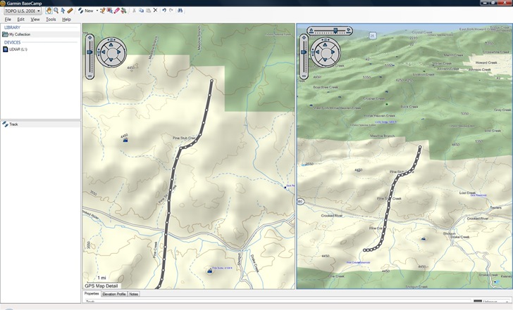
If you own a Garmin mapset that includes DEM data, like their 1:24K topographic mapsets or Topo US 2008, you might want to download and take a look at Garmin’s new free 3D map viewer and GPS data editor, BaseCamp. Here’s a screenshot using Topo US 2008 data:

On the plus side:
On the down side:
It’s probably worth downloading if you have a compatible mapset, but I don’t find the new features compelling enough to make me switch over from Garmin’s older Mapsource program to BaseCamp, especially given how sluggish the latter is. Hopefully future versions will be snappier, and add more features.
NASA’s Next Generation Blue Marble imagery (available here) is a set of 12 monthly composite images of the entire earth, using 500-meter-resolution imagery from the MODIS satellite. The Blue Marble Navigator offers a convenient interface to view this imagery, along with several other useful options.
After selecting your initial location from a world map, the main interface comes up:
MapAction is a non-profit volunteer organization that provides GIS and mapping services to disaster areas. They’ve just published a free 118-page Field Guide To Humanitarian Mapping that’s a terrific introduction to both data acquisition using a GPS, and how to use Google Earth and the free open-source Windows GIS program MapWindow for mapping. I’d even say that it’s a far better choice for beginners than the recently-published GIS For Dummies (more on that soon, when I get the review of that volume done).
8/13/2009: No longer free; there’s a subscription fee from which a small charge is deducted for every use. A free grid link is still available here for MGRS and UTM.
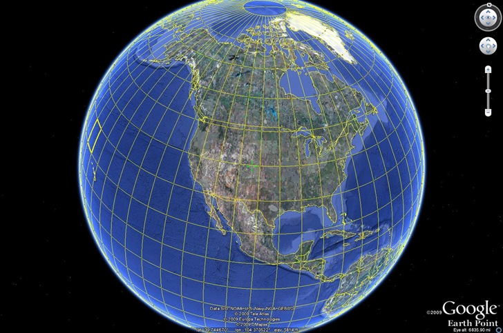
Earthpoint has a new beta Google Earth function – grid overlays for multiple coordinate systems:
Click the button for the desired grid KML file, and open it in Google Earth (UTM here):

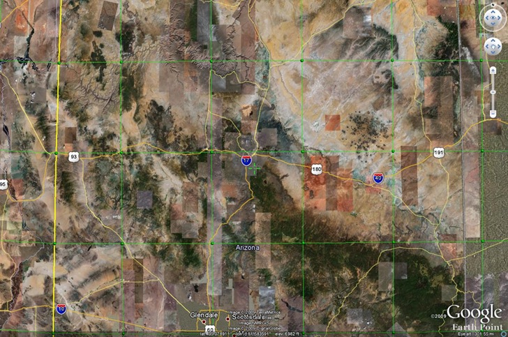
As you zoom in, the grids become finer; you may have to wait a bit for the network link to catch up:

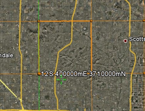
Roll your mouse over one of the “balls” defining the grid, and get a pop-up with the coordinates (and UTM zone here):

The crosshair marks the center of the display, the location for which Google Earth shows the coordinates and elevation in the bottom toolbar.
Updates to report on several photo geotagging applications covered previously on this blog:
Grazer: Grazer is a very simple and easy to use geotagging program. However, the first time I looked at it, it had difficulty matching up the times in my GPX track with the times in my photos, even though other applications had no such issues. Supposedly those problems have been fixed, and the program modified to run in Vista, and a quick test confirmed that. The feature set is a bit thin, but that also means there are fewer options to confuse you with. Still not my top choice, but now that it actually does work, it might be worth a look for someone looking for a very simple geotagging app. Windows only.
Prune: Version 7 of Prune is out, with a slew of new features:
Since it’s a Java application, it should run on any platform that supports Java, including Mac OS X and Linux. Note: You will need to download EXIFTool to geotag photos. You will also need to both “Correlate” photos, then explicitly tell the program to “Save to EXIF” to embed the geotagging data; just correlating alone doesn’t save the geotagging data.
GeoSetter: My favorite free geotagging application (Windows only); bit of a learning curve, but it’s worth it. Since my first post on it over a year ago, lots of improvements and bug fixes; most recently, the latest version of EXIFTool was added.
Over at the Google Earth Library site, Matt has started a project to convert USGS topographic maps (1:250K, 1:100K and 1:24K scales) into Google Earth overlays.. These are “super” overlays, where views from higher elevations are at lower resolutions, while closer views load in high-resolution imagery; this speeds up display times significantly. Arizona and Nevada are available now, with Colorado and California coming soon.
The network link to access the overlays online is at the bottom of the web page; click on the “G-Earth” graphic. Once loaded in Google Earth, activate it, then expand it to select the state and map type you want, 1:24K maps for Arizona here:
Continue reading ‘USGS Topographic Map Overlays For Google Earth’
Last week, as part of a post on sample Google Earth plugins apps, I linked to an application called Stereo that generates a stereo image pair of Google Earth views. By crossing your eyes sufficiently to get the two images to blend together, you get a 3D view, possibly accompanied by a headache. Horst Blaesig pointed me to a stand-alone app called Stereo GE Browser that goes one step further – it also can create a 3D anaglyph, a blending of the two views that can be seen in 3D using standard red-blue 3D glasses. Open up the app, and you’ll see three globe views: