blankblank blank


Archive for March, 2009 Page 2 of 2


A (Reasonably) Cheap Portable Auto Mount For Handheld GPS Units

For my regular car, I use a standard Garmin adjustable bracket mount to hold my Garmin 60Cx handheld GPS receiver:
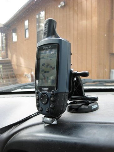
bracket

Works fine, position is adjustable – great. But I can’t really use it easily in another car, since it slides into a bracket mounted with adhesive on the dashboard, and I’d need to glue a similar bracket into the other vehicle. Sticking the GPS into a cup holder, or holding it in my hands, isn’t always an option. On a recent field survey trip, I needed to be able to read the location while driving over a very rocky surface while dodging creosote bushes. Holding the GPS in my hands while keeping control of the steering wheel was …. interesting.

So when I stumbled across the Vent Mount from TheClip.com, it looked like a possible solution: a cheap GPS mount that you stick into a car’s vent, and can be easily moved from car to car. The mount is pretty straightforward, four pieces of molded plastic that snap together; here’s a side view (picture from the website):

3-8-2009-7.48.35 PM

The two pieces at upper right slide into one of the louvers in your car’s ventilation system, with the lower brace holding the mount base in place:
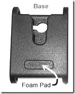
3-8-2009-7.57.10 PM

The GPS is mounted on the base by sliding a round swivel tab (like those found on many cellphones that slides into a belt clip) into the notch at the top. My GPS comes with a swivel tab as standard equipment:
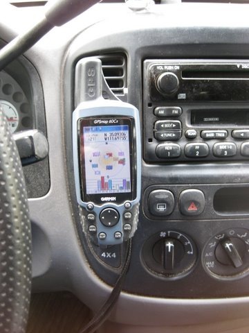
vent

If you have a GPS that doesn’t have a tab, they include three tabs and high-strength adhesive pads to stick them on the back of your GPS unit. You could also use the extra tabs for cellphones, PDAs, MP3 players, or any other portable electronic device you might want to have handy in your car.

Overall, the product seems to work quite well; the GPS stays in place even on rough roads, and there’s enough room between the GPS and the vent for air to flow. But a few caveats:

  • It will work on vents with horizontal or vertical louvers, and ones that swivel left and right; but not on vents that swivel downwards. Mount your GPS on a downward-swiveling vent, and it will droop into an unviewable position
  • You may have to play around a bit with the installation configuration; in my car, the vent snaps worked better when they were rotated 180 degrees from the normal position. YMMV.
  • Once you figure out the trick of installing and removing it from a car’s vent, it literally takes only a second to do. However, learning how to do that trick may take a couple of minutes, possibly interrupted by a curse or two.
  • For some units (like mine), there’s not enough clearance for the external power connector/USB connector in the back; for those, you’ll have to use it on battery power alone.
  • List price is reasonable ($8.99), but then they tack on $5 for shipping, which seems a bit steep. Still, it’s a lot cheaper than a standard Garmin auto bracket mount ($25-30), and if I had known about it, I might not have bought that Garmin mount.

Overall, I’ve found the Vent Mount useful, and would recommend it if you need to use a handheld GPS in more than one car.

Full disclosure: I paid full price for this item, and this is an unpaid and unsolicited endorsement.
Online Lat/Long – UTM – Grid Coordinate Converter

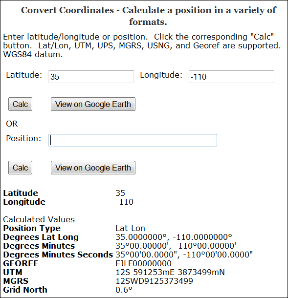
The Earthpoint Coordinate Converter takes a geographic position in latitude/longitude, or in a number of grid coordinate systems, including:

  • UTM
  • MGRS/USNG and MGRS Polar
  • GeoRef

and converts it to all the other coordinate systems (including lat/long in decimal, DDMM and DDMMSS formats):

3-5-2009-8.55.12 PM

(Grid North is the deviation between true north and north along the map projection grid lines)

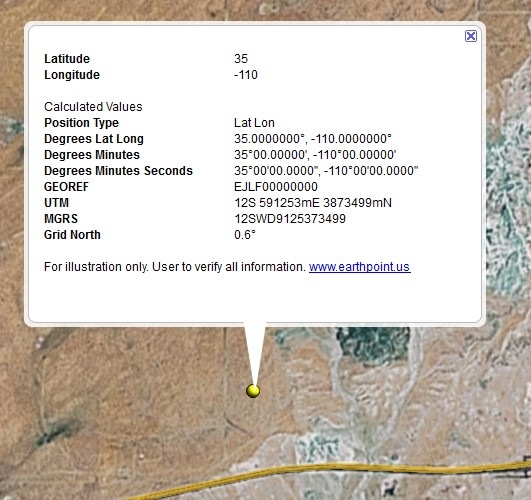
You also have the option of viewing the point in Google Earth, with a pop-up balloon that includes all the coordinate data:

3-5-2009-9.04.06 PM


Digipoint, Export Of Google Maps Point Coordinates, Upgraded To Version 3

I’ve posted before about Digipoint (version 1 and version 2), a web app that lets you select points in a Google Maps interface, then export their coordinates in a variety of formats. Version 3 of Digipoint is now out, with some modest improvements:

  • A new interface, a bit easier to use, and which works better in browsers where the default font size has been modified
  • Fly-to: Specify an address, country, or location, and the map will automatically go there. There are also a limited number of pre-specified country/region links, where  clicking on the link takes you to the area automatically
  • In previous versions, you had to copy/paste text for a particular export format like CSV or KML; you can now download the file automatically
  • For exported shapefiles, a corresponding prj file is also created to specify the coordinate system (your choice of geographic or UTM; WGS84)
  • Help section added

Still supports the same export formats as before: CSV, TXT, TAB, BLN (Surfer), GPX, KML, DXF and shapefile. Versions one and two are still available if you want them, but there’s no good reason to use them anymore.


Sample Applications With Code For The Google Earth Plugin

Stumbled across this page with a number of interesting applications using the Google Earth Plug-In, that might prove useful for someone trying to learn what it can do. Click on a directory name, then click on the .html to start up the application; right-click on a file to save the code to your computer for examination/modification. Among the apps are:

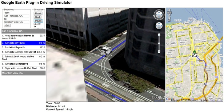
The Google Earth Driving Simulator: Enter a start and finish destination, and a miniature car will drive that route in the Google Earth Plug-in, and also in an adjacent Google Maps interface (Firefox only, apparently):

3-7-2009-9.51.57 PM

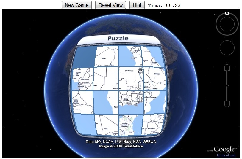
Sliding Tiles Puzzle: Click on tiles of Africa to move them to the empty square, ultimately putting them in the right order to re-assemble the continent (a version of the old Sam Loyd 15 tile puzzle):

3-7-2009-9.53.40 PM

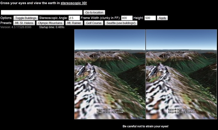
Stereo: Open two views of the same area, but at slightly different angles; if you can cross your eyes right, you’ll get a stereo effect. My eyes are a bit too old to get it to work :(.

3-7-2009-9.59.04 PM


Free And Open Source Windows GIS Software Installation With OSGeo4W

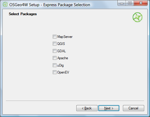
The OSGeo4W project is an automated installer for a variety of Free and Open Source Software GIS applications for Windows, including command-line, desktop and web apps. While some of the programs in this installer are also available in stand-alone installers (e.g. uDig and OpenEV), others can currently only be installed using the OSGeo4W installer (e.g. Quantum GIS (qGIS) v. 1, and the native Windows version of GRASS (6.4.0RC3-2)). You have two install options, Express and Advanced. Express just gives you a short checklist of installable applications:

OSGeo4W Express install

Choose the ones you want, and OSGeo4W takes care of downloading, unzipping and installing the programs, including all required dependencies. Desktop apps will be found in the Start Menu under Start => Programs => OSGeo4W; there will also be a “OSGeo4W Shell” icon that starts up a command window for running command line programs. You’ll also be given the option to put icons on the desktop.

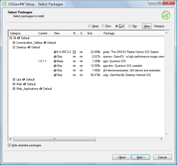
Selecting Advanced installation takes you through a set of configuration screens, then the one you need to use to select the programs to install:

OSGeo4W advanced install

Clicking on the circular arrow icon will take you through available options for that program:

  • Skip – No install
  • Keep – Keeps the currently installed version of that program. In the screen above, I already have Quantum GIS 1.0.1-1 installed, and would probably want to keep it.
  • Uninstall – Uninstalls a currently installed program
  • Reinstall – Reinstalls the same version of the program, useful if it’s gotten corrupted
  • Version numbers – Installs that version of the program. In the example above, the 6.4.0RC3-2 version of GRASS would be installed. I could also select a different version of Quantum GIS to install over the current version.

“Hide obsolete packages” presumably does what it says, but I was unable to find an example of an obsolete package being hidden or unhidden by checking/unchecking the box.

Once you’ve selected your desired packages, clicking Next starts up the same install process as in Express.

I can certainly see how this installer has its advantages, but for now think I still prefer stand-alone installers for individual programs; they give you more control over which program options to install, and which directory to put them in.  Also, if you use a stand-alone installer, you’ll typically be downloading it from the app’s home page, and will have already found out what it is and what it does from there.  The OSGeo4W has no such info in it, and I think the installer would benefit from having some kind of descriptions of the available software built into it (the current Package Listing page has no such information, so you’ll have to go to every program’s home page to find out more about it). But advanced users may well prefer OSGeo4W’s approach.

It would also be helpful if the OSGeo4W installer could also make a copy of itself in a program directory and create a desktop icon for itself; as is, you have to manually keep track of where the program is if you want to run it again in the future for additional installs or program updates..


Animated Cartograms Of World & USA Demographic And Economic Data

Mapping Worlds has created two sites for the USA and the world with animated cartograms, maps where the value of a parameter is used to adjust the drawn size of a geographic area. Here’s an animated cartogram showing military spending for world countries; click on the clockwise circular arrow on the map to have the countries resized based on their military expenditures:


Click on the Resize button (the counter-clockwise circular arrow at the upper left) to reset the countries to their original size. Repeat at will.

Data can be very timely; here’s a USA cartogram showing stimulus bill jobs by state:

Over 140 datasets are currently available with demographic, economic, trade, environmental, etc. data; you can also submit your own datasets for inclusion. Direct links are immediately available for every cartogram page, but you can also get images and embeddable code (like the examples above) emailed to you if you agree to Mapping Worlds’ Terms Of Use.