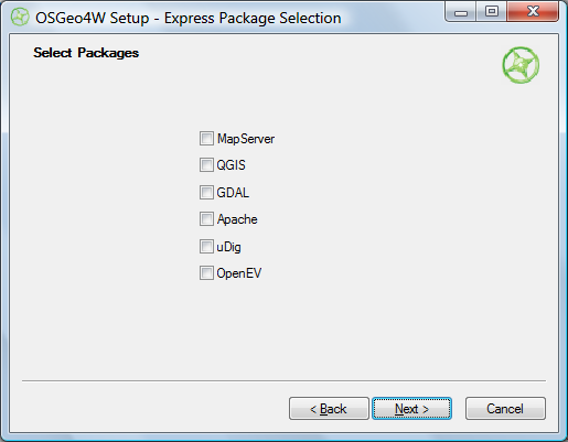
The OSGeo4W project is an automated installer for a variety of Free and Open Source Software GIS applications for Windows, including command-line, desktop and web apps. While some of the programs in this installer are also available in stand-alone installers (e.g. uDig and OpenEV), others can currently only be installed using the OSGeo4W installer (e.g. Quantum GIS (qGIS) v. 1, and the native Windows version of GRASS (6.4.0RC3-2)). You have two install options, Express and Advanced. Express just gives you a short checklist of installable applications:

Choose the ones you want, and OSGeo4W takes care of downloading, unzipping and installing the programs, including all required dependencies. Desktop apps will be found in the Start Menu under Start => Programs => OSGeo4W; there will also be a “OSGeo4W Shell” icon that starts up a command window for running command line programs. You’ll also be given the option to put icons on the desktop.
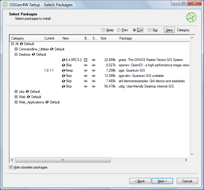
Selecting Advanced installation takes you through a set of configuration screens, then the one you need to use to select the programs to install:

Clicking on the circular arrow icon will take you through available options for that program:
- Skip – No install
- Keep – Keeps the currently installed version of that program. In the screen above, I already have Quantum GIS 1.0.1-1 installed, and would probably want to keep it.
- Uninstall – Uninstalls a currently installed program
- Reinstall – Reinstalls the same version of the program, useful if it’s gotten corrupted
- Version numbers – Installs that version of the program. In the example above, the 6.4.0RC3-2 version of GRASS would be installed. I could also select a different version of Quantum GIS to install over the current version.
“Hide obsolete packages” presumably does what it says, but I was unable to find an example of an obsolete package being hidden or unhidden by checking/unchecking the box.
Once you’ve selected your desired packages, clicking Next starts up the same install process as in Express.
I can certainly see how this installer has its advantages, but for now think I still prefer stand-alone installers for individual programs; they give you more control over which program options to install, and which directory to put them in. Also, if you use a stand-alone installer, you’ll typically be downloading it from the app’s home page, and will have already found out what it is and what it does from there. The OSGeo4W has no such info in it, and I think the installer would benefit from having some kind of descriptions of the available software built into it (the current Package Listing page has no such information, so you’ll have to go to every program’s home page to find out more about it). But advanced users may well prefer OSGeo4W’s approach.
It would also be helpful if the OSGeo4W installer could also make a copy of itself in a program directory and create a desktop icon for itself; as is, you have to manually keep track of where the program is if you want to run it again in the future for additional installs or program updates..
I found this article a little later than it was written, but I have a comment to the last paragraph anyway. If you want the installer itself also installed, it is possible in the Advanced mode – in the current version, at least. Just check the Setup package (I think it was Setup under Commandline_Utilities category, but not sure, I’m currently in Linux) for installation, it will show up in the OSGeo4W menu then.