The last photo geotagging application I’ll cover for now is GPicSync, freeware from Francois Schnell. This application doesn’t have as fancy an interface as PhotoMapper, locr or Location Stamper, but it has some useful, and unique, features:
- It just works, cleanly and neatly. Set the locations for picture folder and the GPS file (GPX or NMEA), set the correct time offset between local time and UTC (aka GMT), and click the Synchronize button to geotag the photos.
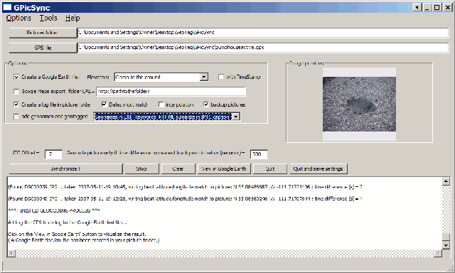
- Pictures geotagged by GPicSync are recognized by Picasa right away; no need to re-process them with EXIFTool.
- You can create a Google Earth/Google Maps KML thumbnails file at the same time you’re geotagging the photos. You can also associate audio and video files with the pictures, so that GPicSync will create links in the Google Earth / Google Maps files that link to the audio/video.
- Handy tools include an EXIF reader, a utility that lets you manually embed geographic location into the EXIF header, a GPX file reader, and KMZ file generator to create a Google Earth file with the photo thumbnails embedded in it (unlike the KML file).
- And there’s a newsgroup where you can interact directly with the program author, report bugs, and suggest new features.
Thanks, Francois!


GpicSync ? There is a better solution !
I tried Geosetter 3.0.14 (http://www.geosetter.de/en/).
It is far better respect other like GpicSync. Its GUI interface is well done and has a lot of features.
Siply to use, almost nothing to do to configurate it. In a snap all the photo are geotagged using the data from logger unit.
In a word: wonderful freeware !
Ciao
Danilo
Yes, I posted on GeoSetter in December of 2007; it’s currently my favorite geotagging app.