Rich of GPS TrackLog points out that the demo version of OziExplorer has the ability to open shapefiles, and export the data to a GPS. I’d avoided looking at OziExplorer because I thought it was shareware, and you’re obligated to pay $85 for registration to use it. But Rich is right – the demo version does let you import shapefiles, and send them to a GPS. And it does a bunch more as well:
- Imports other GIS vector formats, like MIF and MapGen, and even has limited support for the dreaded E00 format; also does GPX and Google Earth KML files
- Exports data from any of the above formats to a GPS unit, and supports a wide variety of units from Garmin, Magellan, Lowrance, Eagle, Brunton/Silva, and MLR.
- Imports GPS data (waypoints, tracks and routes), and can save in GPX, KML, shapefile, text, and IGC format.
- Lots of additional features for importing and calibrating background images, creating vector shapes, real-time navigation, etc..
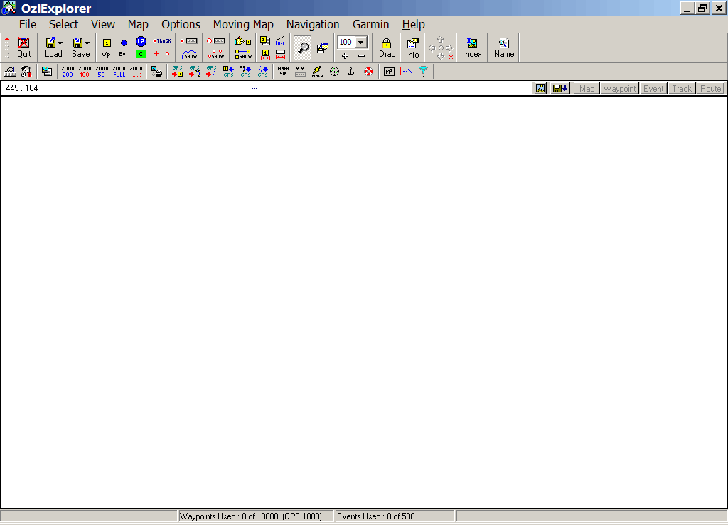
Almost too many features, in fact – the interface is a bit intimidating:

If you try it for the GPS/GIS/Google Earth features, here are a few tips:
- Select Map => Blank Map (Auto Scale) before importing or downloading data.
- For GPS connections, set the GPS type and the communications port in File => Configurations. OziExplorer will create a GPS menu with the brand name of your GPS unit based on this choice.
- All the downloaded data may not appear on screen; use the +/- buttons to zoom out, or click on a blank area and drag to move the map screen.
As with GPS Utility, though, OziExplorer *is* shareware, and if you plan to use it on a regular basis, you should pay the $85 registration fee. It has lots of additional mapping features, but if you don’t need all the bells and whistles, you might be better off with GPS TrackMaker or EasyGPS, completely free options described in earlier posts.


Dear Leszek
thanks for the post. I have been using GPS in Africa, specifically Uganda for some years. Unfortunatly my Garmin etrex Vista (the old :-( version)unit did not come with a decent set of African maps. I know that there are some tools out there which help you to upload maps into the GPS unit with some tricks. I have never tried it, because it is not very clear how it might effect the unit itself.
Do you know about any software package which makes it really easy to upload selfmade maps (not tracks, routes or waypoints) into the Garmin unit?
Cheers
Askan.
http://askan.biz
Hi Askan,
I wouldn’t say that there’s any software that makes it “really easy; but there is software that allows you to create your own maps with topographic contours, upload them to your Garmin, even add them to MapSource as one of the sets of maps you can use. Try these links to start:
http://www.geopainting.com/en/
http://www.cgpsmapper.com
http://www.mapwel.biz/
And then look at the links on those pages, and Google for more information.
I may post about some of these at some point in the future …
Leszek
Dear Leszek
Thanks for the tip. Mapwel seems to be the choice, but I have to test it. An advantage for me: the site is also in German.
Cheers
Askan.
I would suggest another program for creating Google maps for OziExplorer (http://sasgis.com/SASPlanet).
More powerfull and usefull!