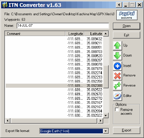
Ogle Earth posts about ITNConv, a program that converts from one GPS format to another. It opens:
– Autoroute Express (.axe, .axg)
– Streets & Trips (.est)
– MapPoint (.ptm)
– MapSource (.gdb, .mps)
– TomTom 3, 5 & 6, Go, Rider, One (.itn, .ov2)
– Navigon MN|4, MN|5 & MN|6 (.rte)
– Destinator PN (.dat)
– Marco Polo, Falk Navigator, Motorrad Tourenplaner & OnRoute (.bcr)
– GPS eXchange (.gpx)
– GPX MapSource (.gpx)
– Garmin PCX5 (CartoExploreur) (.rte)
– Magellan SD (Meridian et eXplorist) (.rte, .upt)
– ViaMichelin (.xvm)
– IGN Rando (.rdn)
– OziExplorer (.rte)
– OziExplorer CE (.rt2)
– Google Earth (.kml)
– CSV (Longitude,Latitude,Comments)
And writes in:
– Autoroute Express (.axe) (Version 2004 and higher)
– TomTom 3, 5 & 6, Go, Rider, One (.itn)
– Navigon MN|4, MN|5 & MN|6 (.rte)
– Destinator PN (.dat)
– Marco Polo, Falk Navigator, Motorrad Tourenplaner & OnRoute (.bcr)
– GPS eXchange (.gpx)
– GPX MapSource (.gpx)
– Garmin PCX5 (CartoExploreur) (.rte)
– Magellan SD (Meridian et eXplorist) (.rte)
– ViaMichelin (.xvm)
– IGN Rando (.rdn)
– OziExplorer (.rte)
– OziExplorer CE (.rt2)
– XML Location (.loc)
– Google Earth (.kml)
– CSV (Longitude,Latitude,Comments)
Not as many as GPSBabel, but it does a few that GPSBabel doesn’t, and the interface is a bit easier to handle:
It’s very much point-oriented, though. If you convert a GPX file with several tracks into a KML file, it will connect the endpoints of successive tracks to create one single, long track. Similarly, if you convert a set of waypoints into KML, it will connect all the points sequentially into a single long track (but you can always turn the track off in Google Earth, or delete it entirely). GPSBabel handles tracks better.
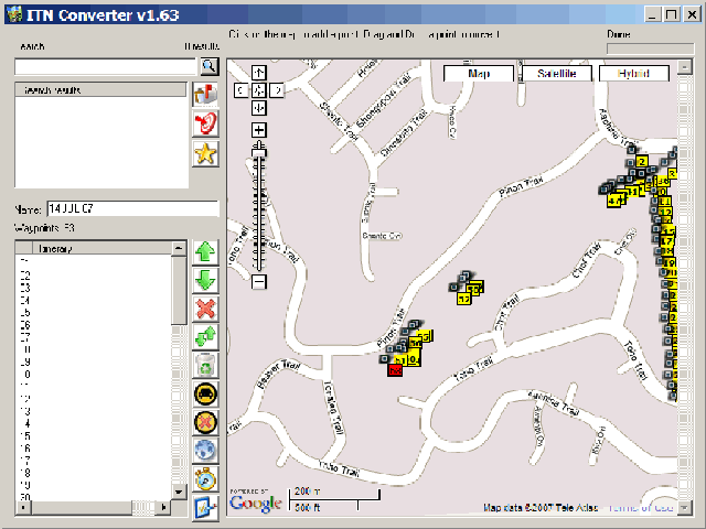
One nice touch is the built-in editor that loads the points into a Google Maps interface, where you can re-label them, move them around, add or delete points, search, find get directions, etc.. You can even create a set of points, and then save them in one of the supported formats:
Note: The website is in French, but the program itself is in English. Look for the download at the left under “Telechargement”, or at the bottom labeled “Télécharger la version Windows“.


No World Wind support :(
Hi.. I’m actually new to all of this stuff of GIS. So I would really appreaciate if you could delp me.
I would like to do a GIS system using either MApserver/OpenLayer or MApGuideOS/OpenLayer and I am searching for a mapfile of my country. I already asked for it on Navteq and DS Solutions but the cost is really expensive (USD$22,000 a year) so searching through the internet I found that I can download Destinator maps which comes with streets and covers all of my country cities and roads.
I would like to know if there is some way to convert from that format (PN I think it is) to shapefile so I can use it at my MapServer.
Thanks in advanced
Do a search on this blog for Open Street Map; there are free maps available for much of the world, in shapefile format at some locations (e.g. Cloudmade).
Thanks a lot for your answer
Hi again.. I already search in that project but there is very little information of cities on my country.
I would like you to clarify me please. If I use google Earth and export some region to kml file and then, with some software I convert it to shp format. Does that shp format have all the information and can be used from an independent MapServer service?
Thanks in advanced