blankblank blank


Archive for the 'Google Earth' Category Page 5 of 25


USGS Topographic Map Overlays For Google Earth

Over at the Google Earth Library site, Matt has started a project to convert USGS topographic maps (1:250K, 1:100K and 1:24K scales) into Google Earth overlays.. These are “super” overlays, where views from higher elevations are at lower resolutions, while closer views load in high-resolution imagery; this speeds up display times significantly. Arizona and Nevada are available now, with Colorado and California coming soon.

The network link to access the overlays online is at the bottom of the web page; click on the “G-Earth” graphic. Once loaded in Google Earth, activate it, then expand it to select the state and map type you want, 1:24K maps for Arizona here:

Continue reading ‘USGS Topographic Map Overlays For Google Earth’


3D Anaglyph Views In Google Earth

Last week, as part of a post on sample Google Earth plugins apps, I linked to an application called Stereo that generates a stereo image pair of Google Earth views. By crossing your eyes sufficiently to get the two images to blend together, you get a 3D view, possibly accompanied by a headache. Horst Blaesig pointed me to a stand-alone app called Stereo GE Browser that goes one step further – it also can create a 3D anaglyph, a blending of the two views that can be seen in 3D using standard red-blue 3D glasses. Open up the app, and you’ll see three globe views:

Continue reading ‘3D Anaglyph Views In Google Earth’


Online Lat/Long – UTM – Grid Coordinate Converter

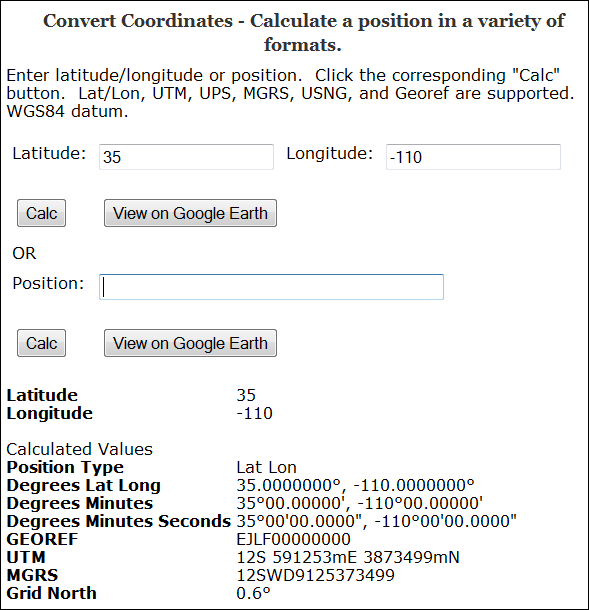
The Earthpoint Coordinate Converter takes a geographic position in latitude/longitude, or in a number of grid coordinate systems, including:

  • UTM
  • MGRS/USNG and MGRS Polar
  • GeoRef

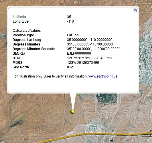
and converts it to all the other coordinate systems (including lat/long in decimal, DDMM and DDMMSS formats):

3-5-2009-8.55.12 PM

(Grid North is the deviation between true north and north along the map projection grid lines)

You also have the option of viewing the point in Google Earth, with a pop-up balloon that includes all the coordinate data:

3-5-2009-9.04.06 PM


Sample Applications With Code For The Google Earth Plugin

Stumbled across this page with a number of interesting applications using the Google Earth Plug-In, that might prove useful for someone trying to learn what it can do. Click on a directory name, then click on the .html to start up the application; right-click on a file to save the code to your computer for examination/modification. Among the apps are:

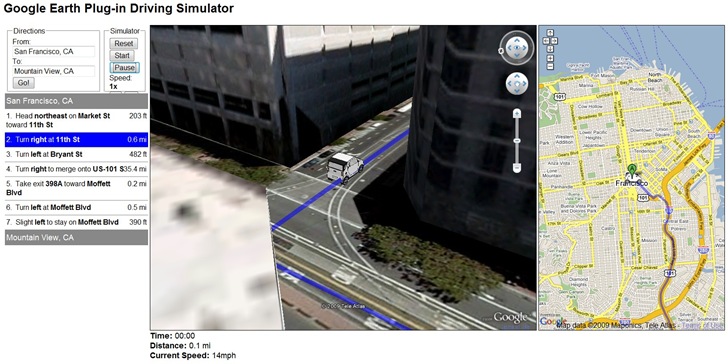
The Google Earth Driving Simulator: Enter a start and finish destination, and a miniature car will drive that route in the Google Earth Plug-in, and also in an adjacent Google Maps interface (Firefox only, apparently):

3-7-2009-9.51.57 PM

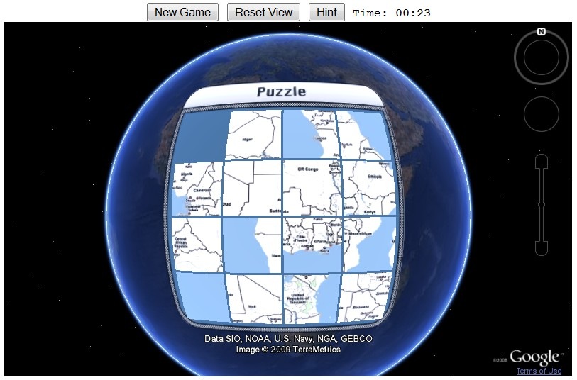
Sliding Tiles Puzzle: Click on tiles of Africa to move them to the empty square, ultimately putting them in the right order to re-assemble the continent (a version of the old Sam Loyd 15 tile puzzle):

3-7-2009-9.53.40 PM

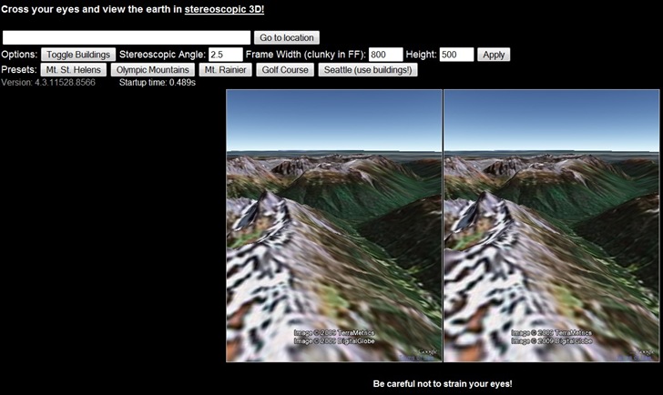
Stereo: Open two views of the same area, but at slightly different angles; if you can cross your eyes right, you’ll get a stereo effect. My eyes are a bit too old to get it to work :(.

3-7-2009-9.59.04 PM


Online KML To Shapefile Converter

Just got an email from Zonums Software that, after a prolonged hiatus, they’ve resumed development of free stand-alone and web-based geographic tools. I’ve posted previously on their stand-alone KML to shapefile converter, but a glance through that post’s comments will reveal that it has some serious bugs in it. While those are still being fixed, Zonums has released an online KML to shapefile converter:

Continue reading ‘Online KML To Shapefile Converter’


Web Application For Querying NGS Survey Marker Locations And Displaying Them In Google Earth

Not too long ago, I posted about DS World, a Windows app that lets you query a database of National Geodetic Survey markers, and returns a KML file to display them in Google Earth (note: earlier versions of DS World may have problems with Google Earth 5, but the newest one works fine). In comments, the survey firm of Metzger and Willard noted that they’ve created a web app called NGS Control Stations (NGSCS) Radial Search that performs a similar function. Despite the name, it allows search by three different areal selection methods:

Continue reading ‘Web Application For Querying NGS Survey Marker Locations And Displaying Them In Google Earth’


GPS Support Added To Free Version Of Google Earth

A few months ago, Google discontinued Google Earth Plus, their $20/year augmented version of Google Earth. At the time, they said they would add one of Plus’s key features, support for direct connection of a GPS receiver, to the free version in the near future. With this week’s release of Google Earth 5.0, lots of attention has been paid to its big new features (ocean coverage, historic imagery, tour recording); see Ogle Earth and the Google Earth blog for more info on those. But I’ve only seen one or two mentions that this latest version adds GPS support.

Access the GPS control with Tools => GPS:
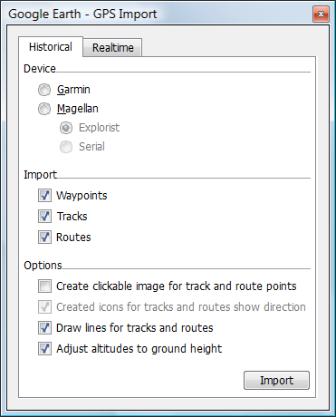
Google Earth GPS import

The Historical tab lets you import waypoints, tracks and routes from either a Garmin or Magellan GPS (the only brands currently supported). Garmin support should include the serial as well as USB interfaces, but I don’t have a serial connection to test that. Checking the “Create clickable image …” link assigns icons to the track/route points with pop-up data for them; checking the box below that creates icons to show the direction of movement.

The Realtime tab shows the options for live tracking of your position in Google Earth:
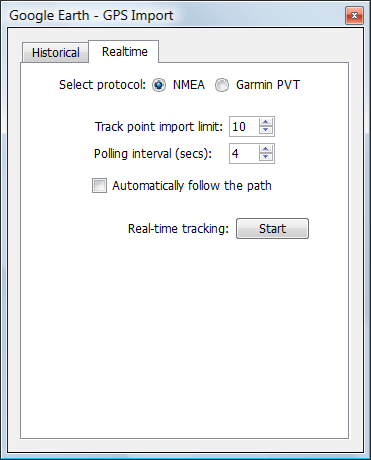
Google Earth GPS tracking

Currently, it supports only the Garmin protocol and NMEA (serial connection, either through a serial port or Bluetooth); I’ve tried both, and it does a good job of finding the correct port. Polling interval determines how often GE gets position data from your GPS, while “Track point import limit” determines how many position points are imported and averaged for every polling. More points means a slower position update, but a more accurate one; less points updates your position more quickly, but potentially at the cost of accuracy. If you have a high-quality GPS receiver, with strong satellite reception, accuracy is unlikely to be a serious issue, and you can probably set the track point import limit to a low number.

Checking the “Automatically follow the path” box will make Google Earth automatically zoom to the current GPS location, and follow it as it changes. The only view you have with this option is from overhead; if you change to an oblique view, it will automatically move the view back to overhead. The option is ghosted out as soon as you start tracking, so if you don’t check the box, the only way to immediately zoom to the current GPS position is to go into “Temporary Places”, find the Position marker in the RealTime GPS folder, and double-click on it:
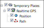
2-3-2009-10.45.14 AM2-3-2009-9.49.06 PM

If you move, it also saves your path and displays it onscreen; to save it permanently when you’re done, you’ll have to right-click on the “Path” listing and save it as a KML file. I believe the Position icon is supposed to show up in the Google Earth display to show your current position, but for static positions it disappears almost immediately.

For simplicity and convenience, Google Earth’s built-in GPS interface is hard to beat. But for real-time tracking, the feature set is pretty weak; the limited GPS receiver support, the inability to view from an oblique angle with live tracking, and problems with icon display (and lack of choice for the icon) are serious drawbacks. The data import feature also isn’t that great; you’d be better off using a program like EasyGPS or GPSTrackmaker to import data from your GPS, and then save it either in GPX format (which Google Earth can open), or directly in KML format. The free version of GPS Trackmaker comes with a real-time GPS position interface which supports more units than Google Earth, and which can plot your rea-time position in Google Earth. There are other options for GPS real-time tracking and data import into Google Earth as well; do a search on this blog for “Google Earth” and “GPS”.
National Geodetic Survey Marker Positions And Info In Google Earth

The US National Geodetic Survey has produced DS World, a free program that can query their database for the positions of geodetic survey marker stations based on either state/county, distance from a fixed coordinate, or Project ID. It then produces a KML file with their locations and loads it into Google Earth. For example, to get county data, choose Stations => By State and County, then select the state and county from the successive dropdown menus that appear:

Continue reading ‘National Geodetic Survey Marker Positions And Info In Google Earth’