One oddity of Google Earth is that while you can measure distances, and also draw paths, there’s no direct way to determine the length of a path you’ve drawn. I’ve previously covered several applications that will take a KML path file and determine its total length; all of the require that the path file be a KML, not KMZ file. Via the comments in that post, Nicholas Hoza announces that he has a new online application that will also compute Google Eath path lengths, and do it for either KML or KMZ files. Click the “Attach file” link to select the file on your computer:
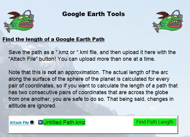
Then click “Find Path Length” to, ummm, you know:

And you’ll also get back the input screen so that you can select another file. As a bonus, the website cycles through scenic backgrounds, and you have the lovely angler fish logos to look at; you can even order a T-shirt with the logo.
Bruce Ralston of the University of Tennessee has previously released several US Census TIGER data tools that I’ve posted about in the past. TGR2SHP converts TIGER files into shapefile format, while TGR2KML converts TIGER polygon files (like legislative districts and county subdivisions) into basic KML files for viewing in Google Earth. Both of these tools only work with the older pre-2007 TIGER format, which is no longer in use; the Census Bureau now issues all this TIGER data in standard shapefile format. But Bruce Ralston has just released a new tool called AFF Mapper that goes a step beyond his previous ones: it can convert TIGER shapefile data into KML format, link it to tabular American Fact Finder data (AFF) from the US Census, and plot this census data thematically. But unlike the previous TIGER tools, this one is a general-purpose one; it can convert any shapefile – point, line or polygon – into a thematic or unique value KML file, with the option of using thematic data from a linked external table. The only limitation is that the shapefile must be in geographic coordinates (lat/long), WGS84 datum, Google Earth’s native coordinate system.
I won’t go through the process with Census data; there’s an excellent PDF manual that describes the process of creating maps like this one (from the manual):
Continue reading ‘Convert TIGER Census Shapefiles (And General Shapefiles As Well) Into Thematic Google Earth KML Files’
SpaceEye (direct download link) runs simultaneously with Google Earth, and lets you perform simple image processing functions on the imagery visible in the Google Earth window. After installing and running the program, it first starts up Google Earth in a partial screen window, then starts itself up either side by side with Google Earth, or overlapping it as in this case:
Continue reading ‘Simple Google Earth Image Enhancement With SpaceEye’
Almost a year ago, I posted on Bjorn Sandvik’s Thematic Mapping Engine, which can plot data thematically in Google Earth as:
- Choropleth
- Prism
- Proportional symbol
- Pie chart
At the time, you could only use a limited number of pre-packaged datasets. Bjorn has just announced the Thematic Mapping Engine API, a Javascript library that lets you do thematic mapping in the Google Earth plugin with your own data (including online sources like Google Docs Spreadsheet). Still in beta, and Bjorn is looking for people to try it out (non-commercial use only). Documentation is a bit sparse right now, but if you look at the page source for example maps created with the API, it’s not too hard to figure out.
After yesterday’s post on thematic mapping in Google Maps, John Stewart of the University of North Carolina’s MEASURE program wrote to tell me about their own thematic mapping tool, the E2G Thematic Mapper. This Microsoft Excel macro spreadsheet data and links it with polygon data for countries and their administrative units to create thematic maps for Google Earth:
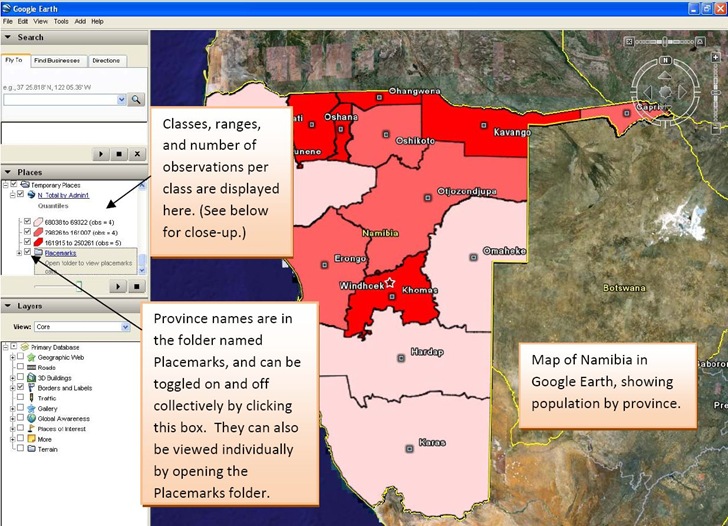
Image is from the excellent PDF manual included with the distribution. I can’t try it out because I don’t currently have a computer with Excel (2003 or 2007), and it doesn’t seem to run on Open Office Calc.
It also currently only has polygon data for sixteen countries:
- Botswana
- Côte d’Ivoire
- Democratic Republic of the Congo
- Ethiopia
- Guyana
- Haiti
- Kenya
- Mozambique
- Namibia
- Nigeria
- Rwanda
- Tanzania
- Uganda
- Vietnam
- South Africa
- Zambia
But John says that an update coming this summer will add polygon data for more countries, along with more macro features.
If you’re interested in field data acquisition, the entire Monitoring and Evaluation Systems section of the MEASURE site is worth a look.
By default, Google Earth uses latitude/longitude as its coordinate system, with WGS84 as the datum. In the Tools section, you can choose to display lat/long in decimal degrees, degrees/decimal minutes, or degrees/minutes/seconds. You can also set the displayed coordinate system to UTM (Universal Transverse Mercator)/WGS84, a coordinate system often used on maps. But for other coordinate systems and datums in Google Earth, you’re out of luck.
Plex.Mark is a small helper app for Google Earth that, to a limited degree, can show you the position in the center of the Google Earth in many other coordinate systems. After installing and running the program, Google Earth will open up, and the Plex.Mark dashboard will overlay the display, always on top:
Continue reading ‘Google Earth Coordinates In Multiple Projections With Plex.Mark’
MapAction is a non-profit volunteer organization that provides GIS and mapping services to disaster areas. They’ve just published a free 118-page Field Guide To Humanitarian Mapping that’s a terrific introduction to both data acquisition using a GPS, and how to use Google Earth and the free open-source Windows GIS program MapWindow for mapping. I’d even say that it’s a far better choice for beginners than the recently-published GIS For Dummies (more on that soon, when I get the review of that volume done).
Via GIS @ Vassar.
8/13/2009: No longer free; there’s a subscription fee from which a small charge is deducted for every use. A free grid link is still available here for MGRS and UTM.
Earthpoint has a new beta Google Earth function – grid overlays for multiple coordinate systems:
- Deg – Decimal degrees
- DegSec – Degrees, Decimal seconds
- DegSecMin – Degrees, Seconds, Decimal minutes
- Georef – World Geographic Reference System
- UTM/UPS – Universal Transverse Mercator / Universal Polar Stereographic
- MGRS – Military Grid Reference System
Click the button for the desired grid KML file, and open it in Google Earth (UTM here):
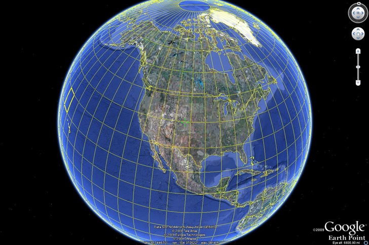
As you zoom in, the grids become finer; you may have to wait a bit for the network link to catch up:
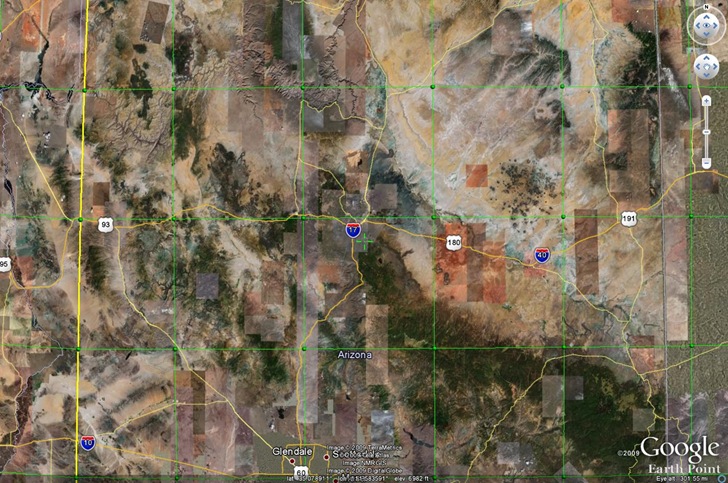
Roll your mouse over one of the “balls” defining the grid, and get a pop-up with the coordinates (and UTM zone here):
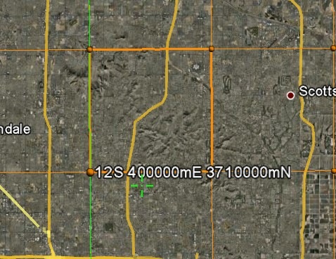
The crosshair marks the center of the display, the location for which Google Earth shows the coordinates and elevation in the bottom toolbar.

![]()


