The U.S. Census Bureau produces TIGER/Line vector data files (Topologically Integrated Geographic Encoding and Referencing). From the Census Bureau’s TIGER overview:
“The TIGER/Line files are a digital database of geographic features, such as roads, railroads, rivers, lakes, legal boundaries, census statistical boundaries, etc. covering the entire United States. The data base contains information about these features such as their location in latitude and longitude, the name, the type of feature, address ranges for most streets, the geographic relationship to other features, and other related information.”
These TIGER files are updated yearly, and contain some of the most current digital data for US streets and addresses. Most GIS programs can’t open TIGER vector files, and ESRI only has free TIGER data in shapefile format for the year 2000. Now a TIGER-to-shapefile converter that used to be a paid commercial program has been released as open source software, free for any use, along with a number of other useful TIGER and Census demographic data utilities.
TGR2SHP takes a standard zipped US Census TIGER file, downloaded for free from the TIGER website, and allows you to select which of the many different kinds of data it contains you want to convert to shapefile format. When you start the program, it comes up with the window that specifies the input data:
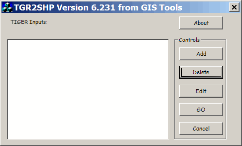
Click on Add, and you’ll get the standard File Open dialog:
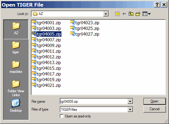
TIGER maps come in zipped format; each file represents a unique single county in a single state, with the numbers rising in alphabetical order. For the example above, 04 means that the state is Arizona, while the 005 refers to Coconino County. Opening this file gives you the window below:
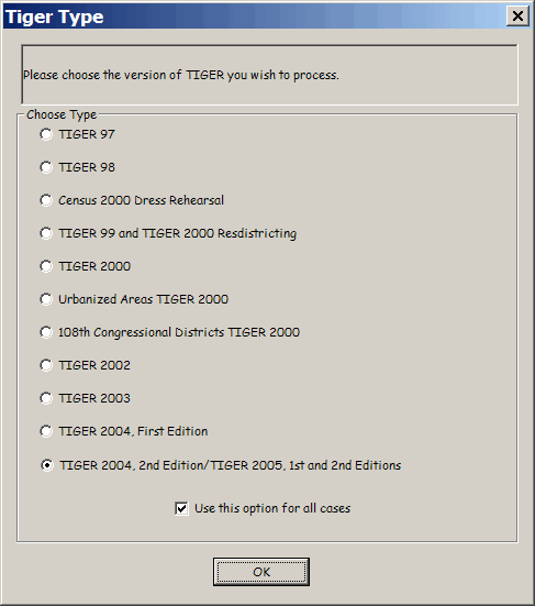
TIGER data is updated on a yearly basis, and you should choose which version of the TIGER data you want TGR2SHP to process. If you don’t have TIGER data yet, then the only data currently available from the website is TIGER 2006 data in 1st and 2nd Editions. The TGR2SHP website states that the current version supports 2006 1st Edition in its current version, and will be updated to support 2006 2nd Edition shortly. If all of your data is in the same TIGER edition, you should leave the box marked “Use this option for all cases checked”. Click on OK:
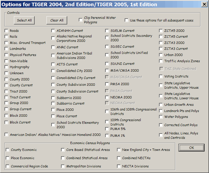
Here are all the datasets contained within the TIGER datafile, and you can select which ones you want to extract and convert to shapefile format. Choose the ones you want, and click OK:
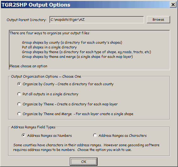
TGR2SHP gives you multiple options for organizing the output data. You can output all the data for a county into an individual folder, or put all files from all counties into single folder. You can also sort them into directories by the theme (e.g. roads, railroads, hydrography, etc.) in individual shapefiles for each county, or combine all the common theme data from all the counties into a single shapefile.
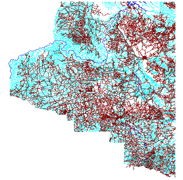
Here’s a map image made using shapefiles extracted from a TIGER file. Dark blue are water polygons, light blue are drainages, and red are roadways:
TIGER data was originally intended for use by the Census for general geographic position data, and isn’t 100% accurate for the entire country. If you lay street data from the county above on top of maps or photos, in many cases the TIGER data won’t lay exactly on top of the actual streets themselves. The Census is working on improving TIGER accuracy, and has increased accuracy dramatically for much of the US. See the TIGER website for information on the progress of this program.
The TGR2SHP website also has links to the TGR2MIF program, which converts TIGER to MapInfo data files, and a complete manual for both programs. And if that’s not enough, there are also programs to warm the heart of any demographer: programs that allow you to extract tabular demographic data from US Census Summary Files 1-4 (SF1-SF4). There’s an even a free program to convert DLG vector files, both DLG-O and SDTS format, into shapefiles. Many thanks to Bruce A. Ralston for making TGR2SHP and these other program files available as open source freeware.
The TIGER files converted painlessly, but I cannot figure out how to get them projected. I think this is probably very easy, but I can’t seem to figure it out.
Hopefully at some point I can use this feature. Thanks,
Sam
The coordinate system for TIGER is (I believe) unprojected, latitude/longitude, NAD83. To convert them to a projected coordinate system, you can use a program like MapWindow that has a built-in shapefile re-projection utility; search for MapWindow on this blog for a post on this.