Not too long ago, I posted about DS World, a Windows app that lets you query a database of National Geodetic Survey markers, and returns a KML file to display them in Google Earth (note: earlier versions of DS World may have problems with Google Earth 5, but the newest one works fine). In comments, the survey firm of Metzger and Willard noted that they’ve created a web app called NGS Control Stations (NGSCS) Radial Search that performs a similar function. Despite the name, it allows search by three different areal selection methods:
- County
- Radial search from a latitude/longitude center point
- Rectangular search from a latitude/longitude center point
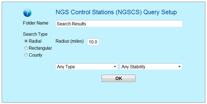
Web form is straightforward:

For radial/rectangular area searches, the maximum search dimension is 10 miles, and it won’t retrieve more than 3000 stations. You may wonder where you enter the latitude/longitude for the center point, and the answer is you don’t. Clicking on OK will open up a unselected network link in Google Earth:

Now move the view in Google Earth so that the desired location is in the center, and check the box marked “Search Results”. The NGS database will be queried, and the locations of NGS markers will be plotted on-screen:

The circles mark one-mile-increment radii from the center point.
You can save this network link in your “My Places folder, and use it as a generic query for any point. Just change the center viewing point, right-click the Network Link, and choose “Refresh”’; a new set of NGS markers will be plotted for the new center viewing point.
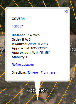
Click on a marker, and get a pop-up with more info:

Click on the link near the top (“FQ0557” in this case), and it will take you to the NGS info page with the full info for this marker.
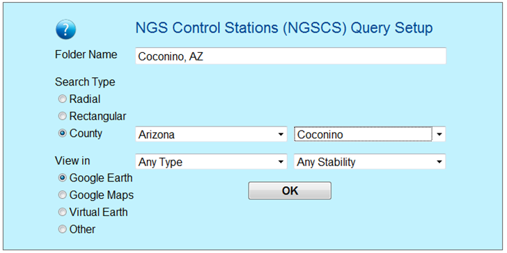
If you choose the County option, you’ll get several more display options, the ability to display the markers in Google Maps and Microsoft Virtual Earth in addition to Google Earth:

DS World does have one significant advantage over this web app in that it creates a static KML file that you can save on your computer; using appropriate software, you can then export this data directly into a GPS receiver. Addendum: From the comments, a way you can do that with this web app. Select the Stations subfolder in the NGSCS Search Results folder, then right-click and choose Save Place As… . Aside from that, this web app has most of DS World’s functionality, and is the only option I know of for non-Windows systems.
Terrific tip! thanks…we linked you up on our blog…surveyors will love this…
> DSWorld does have one significant advantage over this web app in that
> it creates a static KML file that you can save on your computer
Select the Stations subfolder in the NGSCS Search Results folder.
Right-click and choose Save Place As…
Thanks – I’ve added that info to the post as an addendum.