blankblank blank


Archive for the 'Google Earth' Category Page 15 of 25


GPS Photo GeoTagging I – Two Simple Solutions

There are a fair number of programs that not only embed geographic data from a GPS file into a photo’s EXIF header, but also have a host of other features as well. While I’ll be posting about some of those shortly, I thought I’d start out with two more modest programs that don’t do much more than geotag the photos.

More after the fold …

Continue reading ‘GPS Photo GeoTagging I – Two Simple Solutions’


Geotagging Photos With iTag

Ogle Earth has done posts on using Picasa to geotag (aka geocode) photos in both the stand-alone version of Picasa, and online in PicasaWeb albums. There are a fair number of other stand-alone programs for geotagging photos in a wide variety of ways, many of which include other useful features (like inserting the photos into Google Earth or Google Maps). Over the next few weeks, I plan to review a fair number of these programs on this blog.

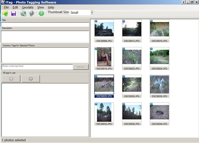
First up is iTag, an IPTC tag installer. Its principal function is to add title, description and keyword tags to photos, but it does have some geotagging capabilities. iTag opens entire folders with pictures, and displays their contents in thumbnail format:
itag.jpg

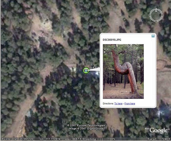
If your photos are already geocoded, iTag can create placemarks with a photo thumbnail bubble in Google Earth, though this can take a while depending on how large the photo size is:
itagge1.jpg

You can save the placemark from Google Earth, but iTag also lets you create a KMZ file with the photo (or photos) embedded directly in the file, or linked to an internal or external location.

Geotagging a photo or group of photos is a multi-step process. You need to first create a placemark at the desired location in Google Earth. iTag’s default geotagging process is to take KML placemark data copied into the Window’s clipboard (right-click on the placemark and choose Copy), and use the geographic data embedded in that to geotag the photos. You also have the option of using a saved KML placemark file to geotag the photos. I prefer Picasa’s method of geocoding the position directly in Google Earth by selecting the photo in Picasa and then choosing the position with a cursor in Google Earth, but there may be occasions when iTag’s placemark process might be more convenient.

iTag lets you copy EXIF GPS data to the IPTC tags and vice versa, and also erase the geographic data completely from the photo. It also can convert GPX waypoint files to KML, so that you can use individual GPS points to geotag your pictures (but there are better ways to do this that will be covered in future posts).

iTag is a convenient way to apply descriptive tags and keywords to a photo or group of photos, better than the Picasa IMO because that’s all it does. The geotagging capabilities are a convenient bonus, but here I think Picasa is easier to use in most (if not all) cases.


MapMyRide.com

Lifehacker posts about MapMyRide.com, a new workout-oriented Google Maps site:

  • Display a USGS topo map in addition to the standard Google Maps views
  • Measure distances
  • Import a GPS track
  • Create a route, export it to GPS or Google Earth format, annotate it with markers for parking, bathrooms, etc.
  • Calculate the number of calories you’ll burn
  • Save and track your data (requires registration)

Free, but lots of ads (the price you pay …). Some of the features (e.g. Map Settings, Workout Calculator) don’t seem to work in the Firefox browser, but work in Internet Explorer (Windows).


Update For Online Google Earth Utilities

Juan Garcia writes to say that his Geo Utilities website has been updated. I’ve posted about this site before; it has a number of tools for Google Earth KML files, including:

  • Simplification (reduction of the number of vertices
  • Buffering
  • Area calculation
  • Topology (find the intersection points between a path and the perimeter of a polygon)

Updates include modification of the algorithms to speed them up, and a download link to the source code, released under the GPL.


EarthPlot Software Tools For Google Earth

Back in 2005, EarthPlot software released several shareware tools for plotting data and creating graphic overlays in Google Earth. The most recent versions of their software are now available as freeware. If you’re interested in plotting spreadsheet data or creating annotated overlays in Google Earth, you should definitely check these out.

More after the fold …

Continue reading ‘EarthPlot Software Tools For Google Earth’


LIDAR Tools

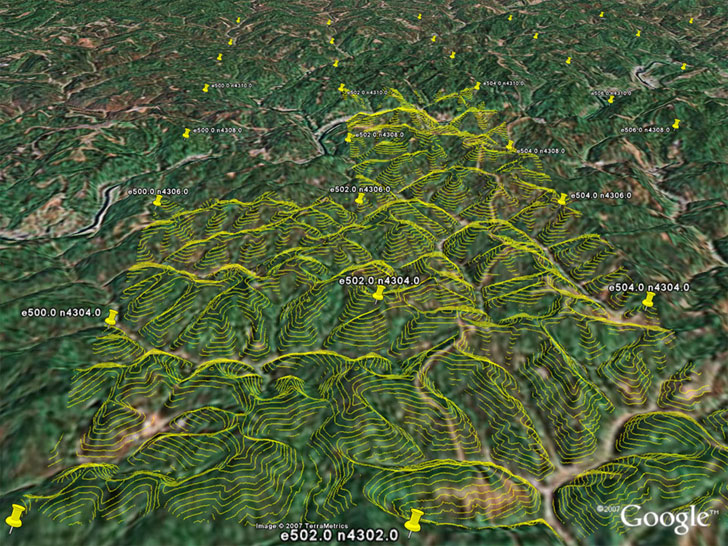
I’ve been meaning to write about these LIDAR Tools for a while, but since Google Earth Blog has just posted on their Google Earth visualization capabilities, I’ll jump in with my two cents. Posted by Martin Isenburg of the University of North Carolina – Chapel Hill, these tools allow quick conversion of LIDAR data into contour and DEM Google Earth KMZ files for “quick” basic visualization of the data. The process involves taking the original LIDAR data, simplifying it down a bit for contours, then converting it directly to either transparent contour overlays, or high-resolution DEM reflectance overlays. Here’s a screenshot of a set of contours from their showcase overlay gilmer.kmz (click on the image for a larger view):

LIDAR-derived contours in Google Earth

Note: To see the contours for a grid square, you’ll have to click on the placemark icon for a square, then click on the “load contours” link in the info balloon that pops up.

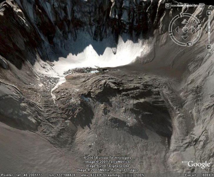
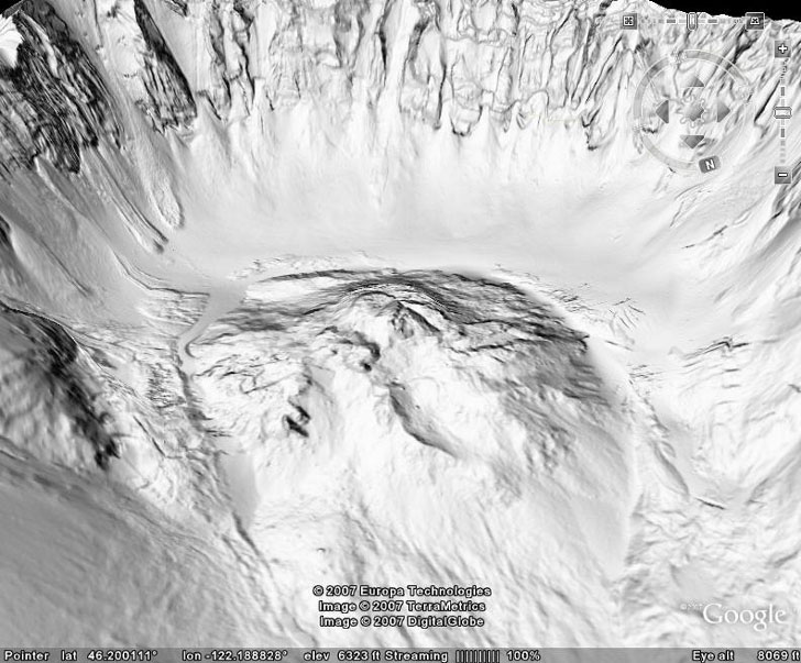
Here’s a screenshot of the interior of Mt. St. Helens from Google Earth:
gehelens

And here’s the same view with the high-resolution LIDAR DEM reflectance view loaded in from the saint_helens.kmz file:

LIDAR DEM view of Mt. St. Helens

All the tools used to create these overlays are downloadable from the website; they’re all command-line tools (ouch), but there’s an example of usage given to make figuring them out a bit easier.

Also available are a basic set of LIDAR tools to:

  • Convert text ASCII LIDAR data to the more efficient LAS format
  • Print the LIDAR data
  • View the LIDAR data
  • Compress it losslessly


News About "Hey What's That" Panorama And Viewshed Site

Michael Kosowsky, one of the creators of the “Hey What’s That” site (for panoramas, viewsheds and peak identification in Google Maps and Google Earth) has sent out an email with some news:

  • He gave a talk at Google about his website in early May, which you can view at Google Video
  • Contour mapping at Hey What’s That, which was spotty before, is now improved; contours should be visible at every zoom level.


Creating A Network KML Link To A Google Spreadsheet

So I saw the article on the Google Earth Blog about the new Google Earth Outreach program, and was reading the tutorial page when I noticed that there’s now the capability to create a network KML link from a Google Spreadsheet to Google Earth. When did they do that?!

There’s been the ability to create a network link from the EditGrid online spreadsheet site for a while now, developed in part by Valery Hronusov. The new Google capability seems like it has more options and flexibility in terms of displaying information, but it’s still not exactly pushbutton simple, either – you’ll have to follow the directions quite carefully. And of course you’ll also need a Google account to do this as well. Visit the tutorial page, click on the link for the starter spreadsheet, and follow the instructions step-by-step either on the tutorial page itself or on the instruction page that shows up at the starter spreadsheet.

It’s probably best to first make a working copy of the starter spreadsheet using the File=> Copy command before doing anything else. Click on the links at the bottom to access the Template, where you can specify the file information, icon and colors to be used for the placemarks and info balloon. Click on the Placemarks link at the bottom of the spreadsheet page to enter the actual data you want to plot in Google Earth. For location, you can enter latitude/longitude directly, or enter an address and have Google geocode it for you automatically (you can cut and paste this data from another spreadsheet). Then follow the convoluted tutorial directions for creating first a network link to this spreadsheet data, then adding the network link to Google Earth. I have to believe they’ll come up with an easier way, eventually, but this will do for now for a network-linked spreadsheet.

For a static spreadsheet file, there are other options for creating a plain KML file that might make more sense; take a look in this website’s “spreadsheet category” for any number of ways to do that, like this link:

Importing Spreadsheet Data Into Google Earth

or this link:

Another Excel To KML Converter