

Now that we’re moving into the more active part of hurricane season, Stormpulse is a great site to monitor for information about current and past storms, satellite imagery, and current conditions and forecasts for US areas that are likely to be affected by hurricane activity.
Archive for the 'data' Category Page 14 of 19
The USGS GNIS is a gazetteer database of close to two million geographic landmarks in the United States (and, oddly enough, Antarctica as well). Types of landmarks include manmade (airports, hospitals, populated places, etc.) as well as natural (summits, arches, cliffs, etc.). There’s a direct interface to the GNIS at the USGS’s Board Of Geographic Names website that lets you search by feature name and get:
- Federally recognized feature name,
- Feature type,
- Elevation (where available),
- Estimated 1994 population of incorporated cities and towns,
- State(s) and county(s) in which the feature is located,
- Latitude and longitude of the feature location,
- List of USGS 7.5-minute x 7.5-minute topographic maps on which the feature is shown, and
- Names other than the federally recognized name by which the feature may be or have been known.
- Links to sites offering map viewers for graphical display of the feature
- Link to site offering information about the watershed area in which the feature is located
You can also download tab-delimited text files for individual states, or all states in one large file.
There’s another site with GNIS data, plus some extras. Wayhoo.com lets you search a copy of the GNIS database for US features, but has some additional options as well:
- Browse for features by county, filtering by feature type
- Add features to a waypoint list, then export the list directly from the browser to any GPS waypoint format supported by GPSBabel (GPX, EasyGPS, Garmin MapSource, Fugawi, OziExplorer, etc.)
- Plot the feature’s location in Google Maps, Yahoo Maps, Virtual Earth, Terraserver, and a bunch more
- Find the National Weather Service 7-day forecast for that location
- Find the nearest recorded Degree Confluence point
- Find the nearest geocaches
- And a bunch more …
And Wayhoo requires no registration; you just need to have cookies enabled on your browser if you want to create a waypoint list.
ILWIS is a sophisticated GIS package that was released as free and open source software on Monday. While the open source version is available from 52North, there’s an add-on software package for ILWIS currently only available from the original ITC website. AHAS (AVHRR Hydrological Analysis System) works with ILWIS for analysis of data from the Advanced Very High Resolution Radiometer currently flying aboard many US and European satellites. Analysis products are biophysical (e.g. NDVI, Fractional Vegetation Cover, Crop Reflectance, etc.), climatic (Daily Radiation, Sunshine Fraction, Soil Heat Flux, etc.), and hydrological (Potential Evapotranspiration, Volumetric Soil Water Content, etc.). AHAS requires ILWIS to function properly, and will ask for the location of the ILWIS executable the first time it starts up (it first looks in C:\Program Files\ILWIS3.1\ for the Ilwis3.0.exe executable file).
Unfortunately, while AHAS is free, free multi-band AVHRR data is hard to find, especially recent data; if anyone knows of good free sources for this data, please post them in the comments section. You can buy AVHRR data directly from the USGS.
The classic functionality for Google Maps is the computerized equivalent of “sticking a pin in a map”, albeit a very fancy pin with the ability to hold and display additional information. ZeeMaps takes that simple Google Maps functionality and moves it towards something a lot closer to a Geographic Information System. With ZeeMaps you can:
- Create standard maps, housing maps (specialized real estate data attributes), or IP maps (data markers based on location of IP address)
- Import and export data in CSV format.
- Import a list of addresses and have them automatically geocoded and plotted. Or, import data with latitude/longitude coordinates.
- Define attribute fields for your data, then filter your data based on those attributes.
- Annotate the map with text (separate from the data markers).
- Display data in map form, list form, or both.
- Select data points based on distance from a specific point (spatial selection).
- Publish maps on the Web, either in read-only format, or allowing others to add and modify points. You can also select subsets of data that is displayed, while hiding other datasets.
- Associate and upload pictures and audio files with data markers.
- “Print” the map in PDF format.
The service is free, and can be used without registration (though registration makes tracking and managing multiple maps easier). The interface is intuitive, and there’s a decent help section. Although some operations take a few more steps to accomplish than I would like, overall there’s nothing major to complain about; it’s a great Google Maps service, especially at the price.
Mike Mahaffie writes to say that the National States Geographic Information Council (NSGIC) has just started up a new blog, posting on geographic issues of interest to state governments. The main NSGIC website is worth a look as well, to see what projects and initiatives are currently under way. From the NSGIC website About page:
“The National States Geographic Information Council (NSGIC) is an organization committed to efficient and effective government through the prudent adoption of geospatial information technologies (GIT). Members of NSGIC include senior state geographic information system (GIS) managers and coordinators. Other members include representatives from federal agencies, local government, the private sector, academia and other professional organizations. A rich and diverse group, the NSGIC membership includes nationally and internationally recognized experts in geospatial information technologies, data creation and management as well as information technology policy.”
From the Yahoo Research Labs comes Zurfer, a mobile phone application that gets your location from the nearest cellphone tower, and pulls in geotagged photos for that general area from Flickr. Also retrieves photos from your friends, and lets you upload pictures from your cellphone to Flickr. Currently only runs for sure on a limited number of cellphone models; Yahoo says it runs on:
“Nokia Series 60 v2 and v3 phones: N73, N95, N80, 6682 and N70. It should work on most Nokia Series 60 v2 and v3 phones, but your mileage may vary. It also runs on the Motorola RAZR V3x. It may work on other phone models.”
They also recommend that you have an unlimited data plan, since this application will suck down data like crazy. Requires you to sign up for a free ZoneTag account so that it can figure out where you are.
Via Download Squad.
The Geonames website offers a number of useful geocoding services:
- Enter a name, and get back:
- A list of the first fifty geographic features in their database that include that name
- The feature coordinates
- A link to let you plot the location of that feature in Google Maps, along with fifty other nearby features
- Links to download those features in “csv” spreadsheet format (looks more like tab-delimited to me), or a png image that shows the selected feature plotted as a red point on country line graphic:
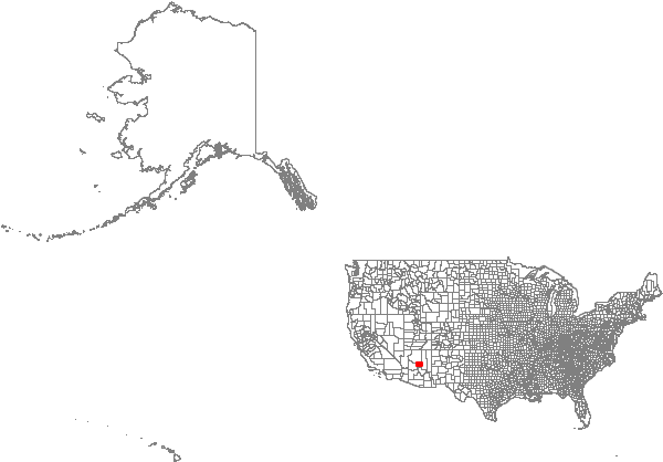
- A web-based geocoding service
- A postal-code lookup service
- A downloadable copy of the geocoding database, by individual country, or combined into a single 150 MB file for all countries
LIDAR (Light Detection and Ranging) can be used to create high-resolution terrain data (sub-meter), detail good enough to show individual man-made features like buildings and bridges. It’s especially useful for analyzing terrain in areas that are in constant change, like coastlines. High-resolution coastal LIDAR data is available at this NOAA website for the entire US ocean coastline, and parts of the Great Lakes coastlines, for times ranging from 1996 to the present.
Continue reading ‘LIDAR Data Coastal Erosion And Flooding Analysis Using MicroDEM’