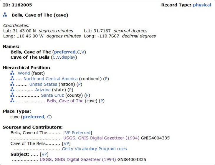
With 895,000 records and 1,115,000 names, the Getty Thesaurus Of Geographic Names Online lets you look up position and hierarchical data for geographic features around the world:
The position data is described as “approximate and … intended for reference (“finding purposes”) only”; a few test cases showed that the positions ranged from spot-on to over a mile off for locations in the US. Lookup can be by name only, or limited by type of geographic location and nation; Boolean and wild-card operators are supported.
Quite a while back, I did a post on Metacarta Labs’ Map Rectifier, an online application that let you upload a raster image, use online mapping services to georeference it, then export it in GeoTiff or WMS format. Map Warper is an extension of this online rectifier, with some similarities in the basic interface. But Map Warper adds some useful extra features:
Your own personal account, where you can add and manage map images, including map descriptions and tags.
The option to make your map private (Map Rectifier requires all maps to be public).
You can crop the map to a user-specified polygon shape.
You can preview the rectified image as an overlay on top of the reference image.
In addition to GeoTiff and standard WMS export, you can also export it in KML format as an image overlay, or as a WMS link that can be used in the JOSM OpenStreetMap editor. You can also open a KML file directly in a Google Maps interface.
On the downside, there’s no Google Maps layers to use for calibration/rectification, only OpenMaps data and Landsat data; the author indicates that he may add Google Satellite imagery at some point in the future, depending on the licensing limitations.
Maps are exported in geographic projection (lat/long), WGS84 datum, making them perfect for use with programs that generate raster maps for GPS units (e.g. TritonRMP Helper for Magellan Triton units, G-Raster for supported Garmin units).
The same map rectification engine is used by the New York Public Library’s Map Rectifier tool, a crowd-sourcing georeferencing tool. You can select from already georeferenced historic maps and export them in GeoTiff format, or select an uncalibrated map and georeference it yourself. Same export functions, although the KML image overlay in Google Earth is a network link, and the Google Maps view doesn’t work very well. Since the MapWarper application is open-source, you could use it to create your own crowd-sourcing website, like the NYPL site, to aid in georeferencing a large number of raster map images.
Google Maps MyMaps feature lets you create and save simple maps (lines and points), and share them with the world. But the sharing is done through a network link, not through a stand-alone KML file, and you can’t save the data directly to your computer. The GMaps tips website offers a simple way to save a stand-alone KML file of your MyMaps map:
1. Create the map.
2. Right-click on the “View In Google Earth” link, and copy the link address; paste it into a text editor:
4. Paste the modified link address into your browser’s address bar, and go to it; depending on how your browser preferences are set, you’ll either save the KML file for your map to your standard download directory, or it will open in Google Earth. In the latter case, right-click on the KML entry in the View pane at left, select “Save As”, and choose a name and location to save it in.
Useful if you’re stuck using Google MyMaps, maybe because of its collaboration options. If you don’t need to collaborate, Scribblemaps and Scribblemaps Pro offer direct KML export and have a much greater selection of drawing tools than Google MyMaps.
12/28/2010: Original method doesn’t work anymore, as the “View In Google Earth” link shows up very briefly, then disappears in favor of viewing the data in the Google Earth plugin in your browser. But you can still get it to work with a slight revision. Instead of right-clicking on the “View In Google Earth” link, do that on the “Link” in the upper-right-hand corner, then copy and paste that into a text editor. Then insert “&output=kml” (no quotes) before “&msid” in the link text. Copy and paste that modified link into your browser, and it will work as advertised.
Claude Henri-Meledo writes to tell me about BeGraphic Lite, a free data visualization tool for Microsoft Excel. I don’t currently have easy access to Microsoft Excel (I’m working in OpenOffice exclusively), so I can’t try it out, but it looks interesting. It apparently does a wide variation of data graphics, not just maps; these include:
cascade chart / waterfall chart, marimekko / mekko chart, sankey diagram, dynamic diagram, pivot diagram, powerpivot charts, pivot chart, ishikawa cause-effect diagram, BCG matrix, ADL matrix, McKinsey 7S, RB profiler, DuPont chart, choropleth map, swot analysis model, vector glyph, business chart, business graph, business graphics, professional excel chart, mini-graphs, micro-charts, sparkline for excel, excel gauges, strategic maps, strategy map, dashboard software, moving bubble, motion chart, trend analyzer, scada system, control room, make a custom map in Excel, thematic map in PowerPoint, dynamic sales territories, mapping tool, geographical information system in excel2010, choropleth map, and any innovative charts…
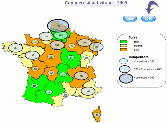
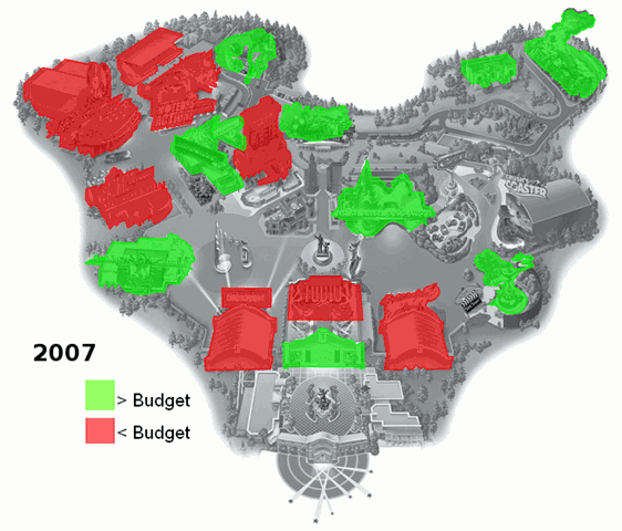
A few sample map screenshots from the website:
BeGraphic LIte works with the free vector graphic map data available atd-maps.com, which now has 7500 maps available (up from 4000 when I posted about the site in August 2009). Edit: You need to download the files in WMF format. There’s a Pro version of BeGraphic in the works for later this year, but the Lite version will still be free and available.
The GE Coords program simplifies the job of grabbing coordinates for a point in Google Earth, and putting them into your clipboard, from where you can paste them into the application of your choice. Not terribly complicated to use (and the website has more complete instructions if you need them):
1. Install the program (you’ll find it in the “Thots Utilities” folder)
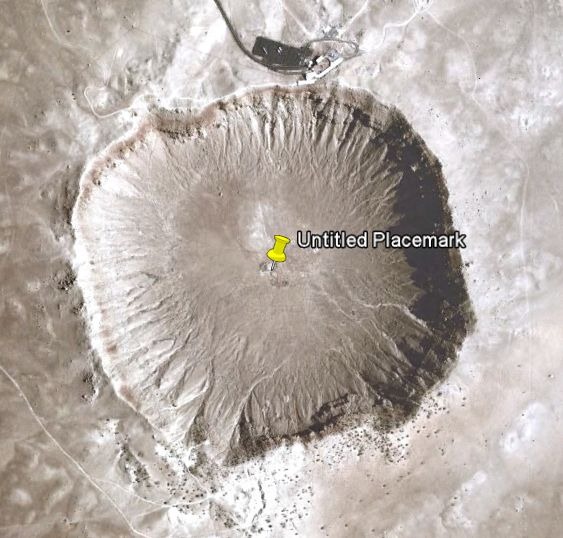
2. Fire up Google Earth, press the yellow pushpin icon on the toolbar, and drag it to your desired location:
3. After closing the placemark properties box, right-click on the pushpin and select “Copy” from the drop-down; this will copy the full KML code for the placemark into the clipboard
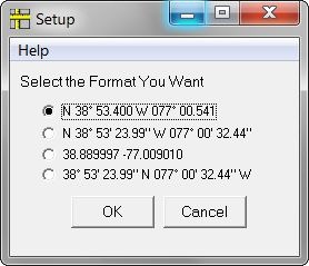
4. Run the GE Coords program; it parses the KML code, extracts the position, and copies the coordinates into the clipboard. You’ll hear a beep when it’s done. DM is the default format:
N 35° 01.640 W 111° 01.364
But running the program without any placemark code in the clipboard brings up the option to “Setup” the desired default coordinate format:
Mobile Atlas Creator (formerly TrekBuddy Atlas Creator) is an open-source program that downloads map tiles from a variety of sources, and converts them into a large number of formats compatible with mobile phone mapping apps, some Garmin and Magellan GPS units, and OziExplorer. Written in Java, it comes with a Windows executable and Linux shell script to start up the program; I don’t have a Mac, but I’d guess there’s some way to get it to work with Macintosh computers as well. Map sources currently built into the program include:
So I’ve had an Intel Classmate Convertible touch-screen tablet netbook for about six months now, using it out in the field as well as the office. How well does it meet the requirements listed in this post for a GeoPad, a field-capable GIS workstation?
Going through my requirements list one at a time, let’s get the bad news out of the way first:
Good screen visibility in outdoor conditions.
Nope, not really, at least under normal use conditions. It’s pretty much as bad as any standard laptop in direct sunlight, or on a bright cloudy . Under those conditions, it’s marginally useful at best, and more often unusable, particularly in tablet mode. When used in standard clamshell mode, it’s somewhat better, and if you buy a sunshade (or make one out of cardboard like I did), it’s bright and clear enough even on a sunny day to be usable. But a sunshade doesn’t really help when it’s in tablet mode; for that, you need to do one of the following:
Get into shade or heavy forest cover; there, the screen is more than bright enough.
Just turning your body so that the computer is in shade helps a bit, but you’ll still get enough scatter from the light areas behind you to make screen visibility less than ideal. If you’re willing to look like a bit of a dork, holding an open black umbrella behind your head can shade enough of the backlight to improve visibility significantly.
Finally, throwing a light-proof cloth over your head to shade it and the laptop will make the screen fully visible. Unless capes come back into fashion, this will also make you look like a bit of a dork.
In any case, the current display is less than ideal for outdoor use, and you should keep that in mind. For the most part, I’ve been able to work around that problem, and still be productive with it. And that’s the worst news; for all the other requirements, it’s proven to be pretty good. Given that this laptop is pretty inexpensive (< $450), if you could add a sun-friendly LCD screen to it for a less-than-exorbitant price bump, say $100-$200, you could probably sell quite a few of these. So if you’re looking for a business opportunity …
Relatively inexpensive.
I was looking for less than $1000; $450 is a lot better than I had hoped for.
Durable.
Strictly speaking, this isn’t a true “rugged” notebook. But the basic specs (0.5-meter drop test on concrete non-operating, 0.4-meter on plywood operating) should be enough for basic field work, as long as you don’t abuse it too much. I’ve used mine on bumpy roads, tossed it into a backpack, and even dropped it on a rocky surface once, without any apparent ill effects. A good case should improve its shock resistance even further, and I’ll talk about mine in a future post.
Touch-screen convertible.
Works as advertised, and is quite accurate with a stylus. Palm rejection is excellent, so you can write on it with your hand resting on the screen without worrying about it mistaking the palm touch for intended input. In fact, even a finger touch won’t register unless you use the edge of your fingernail. Comes with some software for handwriting recognition; while it’s OK, there are better choices. It has a built-in sensor that detects the orientation at which you’re holding the tablet, and can automatically rotate the screen to match that; in practice, I’ve found it better to switch screen rotation in manual mode.
Windows OS
Mine came with Windows XP, but you can now get it with Windows 7 Starter Edition. However, if you want a true Microsoft Tablet PC OS, using Windows own handwriting recognition and other tablet-specific features, you’ll need to upgrade to either Windows XP Professional or Windows 7 Home Premium at a minimum; standard Windows XP and the 7 Starter Edition don’t support Microsoft Tablet PC functionality. Startup is a bit slow, but all the GIS programs I tried ran at perfectly acceptable speeds; it will even run Google Earth at an acceptable speed (after complaining to you during installation that the screen is too small). It comes with the Blue Dolphin touch-screen-friendly desktop, which I found to be a very handy way to organize and access programs so that they could be easily accessed via the touch screen.
Respectable battery life; at least 4 hours under normal use.
Intel specs battery life with the 6-cell battery at 6 hours, with WiFi and webcam off. While this is the standard “best-case scenario”, I found in normal use that it easily hit 4 hours, and sometimes even 5 hours. The input voltage is 12V, which means that with a fairly cheap auto adapter, you can charge it directly from your lighter socket (running it from the socket is possible, but you’d need a high-power adapter).
Decent memory; 1 GB RAM, plus at least 30 GB storage space for software and data.
Comes with 1 GB RAM, expandable to 2 GB, plus a 60 GB shock-mounted PATA hard drive. The hard drive isn’t the fastest in the world, and I wouldn’t mind replacing that with a faster, low-power solid state drive at some point.
Light weight and compact size.
With the 6-cell battery, it weighs in at about 3 pounds (1.45 kg), and it’s a standard netbook size, maybe even a bit smaller than most.
Plus as many typical notebook features as possible.
Adequate on this score with one exception: the keyboard is very small, really designed for child-size hands. With small hands, you should have no problems; I have medium-size hands, and it definitely takes some additional effort to touch-type on this at a reasonable speed. If you have large hands, you may find it impossible to touch-type at all; hunt and peck may be the only practical method.
Comes with two USB ports, Ethernet port, VGA output, headphone/microphone jacks. The latter is useful, as the built-in microphone doesn’t work very well. There’s a SD-Card slot protected by a rubber plug; getting cards in and out can sometimes be a bit of a challenge. You can actually boot from the SD card, but when I tried installing booting from Linux on a 4 GB Class 4 SDHC card, it was unusably slow. The 1.3 megapixel camera works well, and it rotates so that you can use it either pointing towards you or away from you, in either clamshell or convertible mode. So you can snap a photo of something in the field in tablet mode, then annotate the picture directly in the tablet.
My final conclusions? I really wish the screen were more visible in daylight conditions, and if that’s a dealbreaker for you, then you shouldn’t consider it. But even with that limitation, I’ve found this to be a useful field companion. Over the next few months, I’ll be posting my experiences and recommendations on configuring this system with the right hardware and software to make it a full GeoPad.
Contents of the Free Geography Tools Blog copyright 2007-2018; all rights reserved.
Determining the accuracy, reliability, validity, or appropriateness of any of the software or data written about in this blog for any uses is the sole responsibility of the reader, not the authors of the blog posts. The blog authors have no liability for any uses of the software or data described here.
Shopping at Amazon through the link below helps support the site. Thanks!