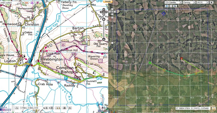
Where’s The Path lets you display UK Ordnance Survey 1:50K topographic maps side by side with other kinds of maps, including:
- Google roads/satellite/terrain/hybrid
- OpenStreetMap
- 1930s and 1940s OS maps
Cursor movement on one map is mirrored in another; you can import GPX/KML files, and also draw features on the map and export them to in GPX/KML format. Overlay multiple types of grids (lat/long and UKOS); toggle a Panoramio layer to see photos taken at locations within the map view:

Most annoying aspect is that it’s only for the UK; wish someone could put something similar together for the US.
HT to Trev Broomfield.
Hi Leszek,
If you like this I think you’ll probably like “Gavin’s Unofficial Overlay” for Google Earth too. This uses OS OpenSpace as well, the Survey know all about it and don’t appear to be concerned.
http://www.brock-family.org/gavin/google-earth/
Regards,
Nick.