I’ve posted recently about ScribbleMaps and ScribbleMaps Pro, web apps that let you draw features on a number of web maps (like Google Maps, OSM, and ESRI), and export the data in GPX format for upload to a GPS. Stopped by the GPS Visualizer website the other day, and just noticed that they have a similar application now, the GPS Visualizer Freehand Drawing Tool. On the down side, it doesn’t have nearly as many tools, editing options and output options as ScribbleMaps; on the plus side, because it doesn’t have a large number of tools and options, it’s easy and intuitive to use. And in addition to Google Maps and OSM Maps, it offers a number of background map options that ScribbleMaps doesn’t:
- USGS topographic maps (1:100K to 1:24K, depending on the zoom level); yes!
- USGS aerial black and white imagery (DOQQs; 1-meter resolution)
- USGS aerial maps with Google Maps vector data overlaid.
- National Atlas US County maps (this wasn’t working for me when I tried it)
- Canada Natural Resources maps (including topo maps)
- Landsat 30-meter data
- Blue Marble
- Daily MODIS imagery; low-res (250-meter), but up-to-date
Interface couldn’t be simpler; click on the waypoint, track or area button on the toolbar:

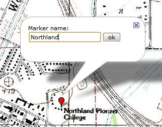
For waypoints, just click on the map at the desired point, then give it a name:

To re-position the mark, just click and drag. To rename or delete it, click on the markers name in the “map elements” below the toolbar:

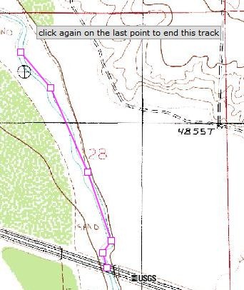
Create tracks and areas in a similar fashion, but click on multiple successive points to define a track or area:

Each box is a point; at any time, you can click and drag any of the boxes to re-position that point. For tracks, click on the last point to end it; for areas, click on the first point to close the polygon. As with waypoints, you can select tracks and areas from the “map elements” list to modify their names, or delete them. With tracks, you can also add additional points to the end of the track. You can’t delete individual track or area points in the Freehand Drawing Tool, but you can do that in a GPX editor after exporting them.
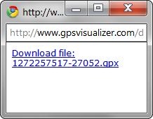
Once you’re done, you have the option of exporting either a GPX file with data for use with your GPS, or exporting a KML file for use with Google Earth or other compatible programs. This requires that you have pop-ups enabled for the website, which you may have to configure in your browser. Click on the GPX or KML buttons on the toolbar to get a popup with a download link:

KML files support points, tracks and areas; GPX files support only points and tracks, so area perimeters are converted into track lines.
BTW, if you have a GPS and haven’t checked out all the features available at GPS Visualizer, you definitely should. They include:
- Plot your GPS data in Google Maps
- Convert it to Google Earth format
- Geocode an address list
- Web interface to GPSBabel, for converting multiple GPS data formats to each other
- Create topographic map overlays for Google Earth
- Draw elevation profiles from GPS data
- And tons more …


