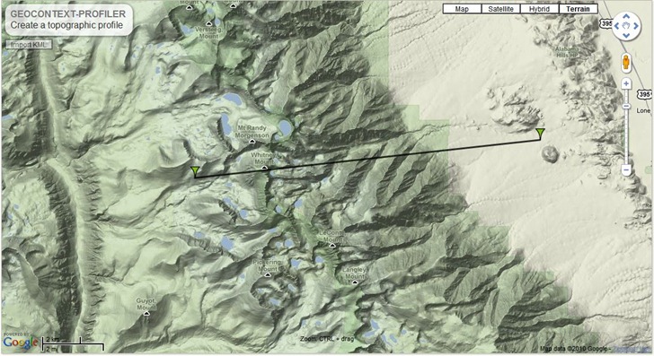
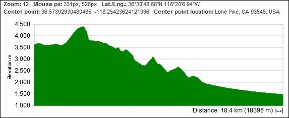
Krystian Pietruszka emails about his new Geocontext Profiler site, based on the new Google Maps API version 3. Place two markers on a Google Maps view by clicking, and get the elevation profile between them:


You can add as many additional markers as you want in any direction; to fine-tune a marker position, just click and hold on it, and drag it to the desired spot. You have multiple options for the lines between points:
- Direct – Straight line between points
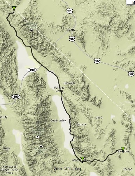
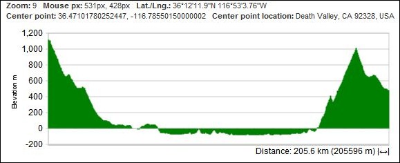
- Driving – Elevation along roads from point to point (like this preset example for Death Valley):


- Bicycling/walking
Click on the Geolocation IP link at right to jump to your local area; click on the double-arrow icon in the upper right corner to go to full-screen-width for the app (and back again). You can also link to a profile, or embed it on your site:
Note: The “Import KML” link in the upper left of the map will let you load and display KML data on the map, but doesn’t create an elevation profile between points or along a line.
I’ve been playing around with this quite a bit and love it. Question. Have you discovered a good way to export the profile chart? Also, where are the chart settings?
I exported the profile chart with a screen capture; if you’re asking about exporting the actual data, you can’t do it on this site. And there’s no way to modify the chart settings.
Gotcha. I was afraid of that. I’ll have to add the ability to export and change chart settings to my Google Earth wish list.
Cheers!
A few days ago I finished a new version GEOCONTEXT-Profiler.
New options:
– New chart shows the distance uphill and down
– Import KML files creates a graph
– Create a profile and add to the map (+ upload your photos)
– Create a profile and copy link
and many other options
—
I’m trying to do this for a walked route, and the instructions say “Click on the Geolocation IP link at right.” Is anyone else seeing this link? I’m not.
You might try a different browser; not all of them support this. You may also need to set the permissions on your browser to allow it to send geographic data.
Got program to work once with Firefox browser. Now hangs up for substantial part of half-hour “Waiting fo Googlegg.?? or “Transferring data from translate.googleapis.com.: Have tried it with and without Google maps running in another tab. Can’t seem to get program beyond that point.
Not sure why – works fine with Chrome. You might drop the author a note.
Downloaded Google Chrome as you recommended and tried Online-Elevation-Profiler. Hit shortcut, runs through some stuff, and stops without starting program.
Just tried it myself, and it worked perfectly. I’m guessing it’s some configuration issue with your computer that’s causing the problem. Try contacting the author to see if he has any insights.
I’m trying the Online Elevation Profiler on a different computer running a different version of Windows, and get the same nothing when I click on the link as I got on the other computer. I tried the Distances and Calories burned with the Gmaps Pedometer because it would also allow me to digitize a topographic profile. When I click on the Gmaps Pedometer link for the webpage Distances and Calories Burned with the Gmaps Pedometer, the program window opens, but even when I start by clicking Start Recording, the program does not record any points or distances.