The state of Utah’s Automated Geographic Reference Center (AGRC) has spectacular high-resolution color aerial photography and digital elevation model (DEM) data available for the entire state, with limited areas having even higher spatial resolution.
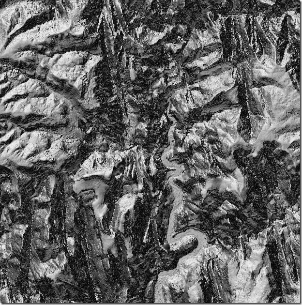
- 5-meter DEM data derived from aerial orthophotos is available for the entire state in ASCII ArcGrid (*.asc) format. You can use the FTP site along with statewide index shapefile to determine which files to download, or use the Interactive Map site. You may have to right-click on the file and choose “Save Link (Target) As”, otherwise the ASCII Grid files may open up as text in your browser. MicroDEM can open ASCII ArcGrid files directly (if you get an error message, zip the DEM file, then open the zipped file). Here’s a reflectance image of a 5-meter DEM of the Zion National Park area:
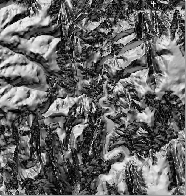
Compare that to a standard 10-meter NED DEM from the USGS Seamless Server for the same area, with far less detail:
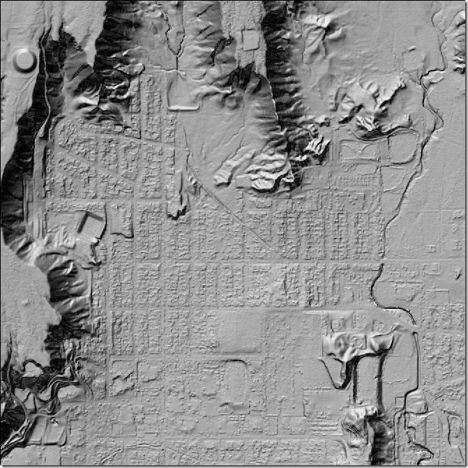
- 2-meter DEM data from aerial orthophotos is available for limited areas, also from FTP and interactive map sites with a shapefile index. Some building and street detail is visible, as in this example from the Price area:
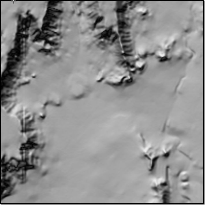
A lot better than the NED 10-meter data for the same area:
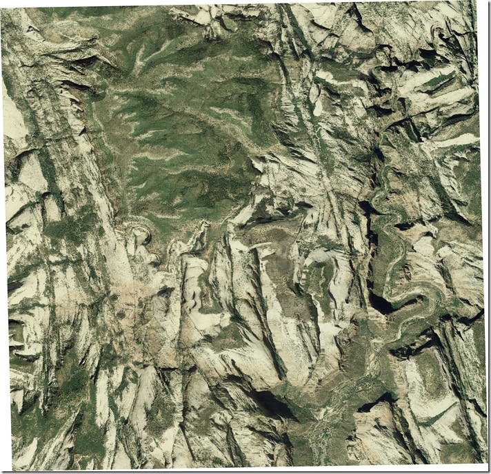
- One-meter color aerial photography from the National Agricultural Imagery Program (NAIP) dating from 2006 is available for the entire state in both natural color and CIR (Color Infrared); earlier 1-meter data for 2004 and 2-meter data for 2003 is available for limited areas .You can download the data in in county-wide MRSid format, and GeoTiff quads. Here’s a sample photo from Zion National Park:
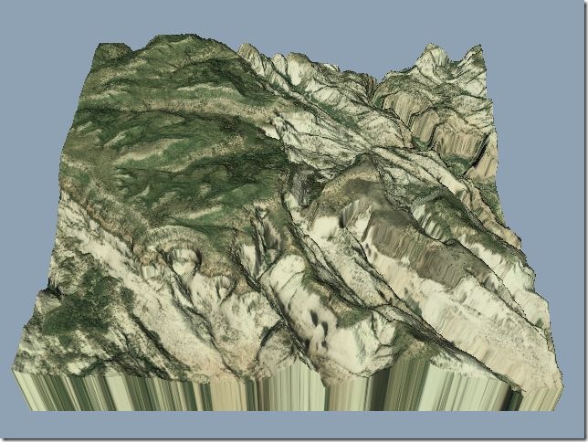
Combine the one-meter aerial with the 5-meter DEM with a program like 3DEM, and you can create great perspective views:
Or use an inexpensive program like SuperOverlay to create a tiled overlay to view the image in Google Earth. It looks like Google Earth uses some of this high-resolution imagery to cover parts of Utah, but not all of it. For the area above in Google Earth, it looks like the left two-thirds of the image are from this aerial imagery, while the right third is from an alternate source (Digital Globe?).
- 2006 one-foot resolution aerial imagery is available for limited areas of Utah in GeoTiff format (big files – 733 MB).
Lots more data is available from the Utah AGRC, including topo maps, floodplain vector files, and more. I wish every state had this kind of data available.
Thanks to Steve Richardson for the links.
12/13/2007: Steve writes to say that 1-foot resolution orthophotos (for 2006) are now available for roughly 20% of Utah.