Tom Patterson is a cartographer with the US National Park Service, and runs the Shaded Relief website, with many articles, tutorials and links related to terrain shading techniques in cartography. But he has also created fantastic terrain and landcover imagery and data, all of which is freely downloadable, license-free and reproducible in any format. These would make great background imagery for national and world maps created using GIS software. Some of the files are very large (well over 100 MB in size), so downloading them may take a while depending on your connection speed.
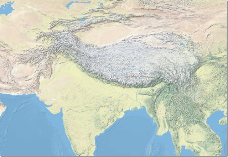
Natural Earth – Sets of georeferenced imagery (full-resolution TIFF images with worldfiles, Plate Carree projection) showing the world colored according to seven different types of landcover (desert, herbaceous, savannah, forest, highland, tundra and glacier). Imagery is available at both 1.24 kilometer and 5 km for the entire earth, and 500-meter for the continental US. It’s also available unshaded, shaded with terrain relief, and shaded terrain relief with water. Here’s a sample of the 1.24-km global imagery (shaded terrain relief with water):
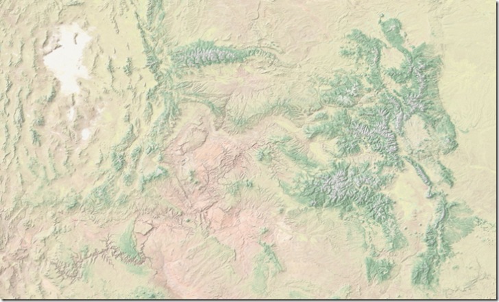
US 500-meter imagery:
Additional data for use as overlays includes water bodies, urban area, national boundaries, and more. There’s also a poster-size-resolution download for the world in the Robinson projection (including title and legend).
CleanTOPO2: A re-sampled and cleaned-up DEM for the entire world and the oceans, useful for terrain shading and elevation modeling. Not accurate for true elevations, since the zero level is based on the lowest ocean depth, not sea level. SRTM30 and GTOPO30 are used for the terrestrial data, and ETOPO2 for ocean bathymetry. Many of the measurement artifacts in the original ETOPO2 data were removed manually by the author, making it a lot cleaner for use in map shading. Datasets include full-resolution for lands and oceans, and terrestrial data re-sampled to a lower resolution to match the lower native resolution of the bathymetric data.
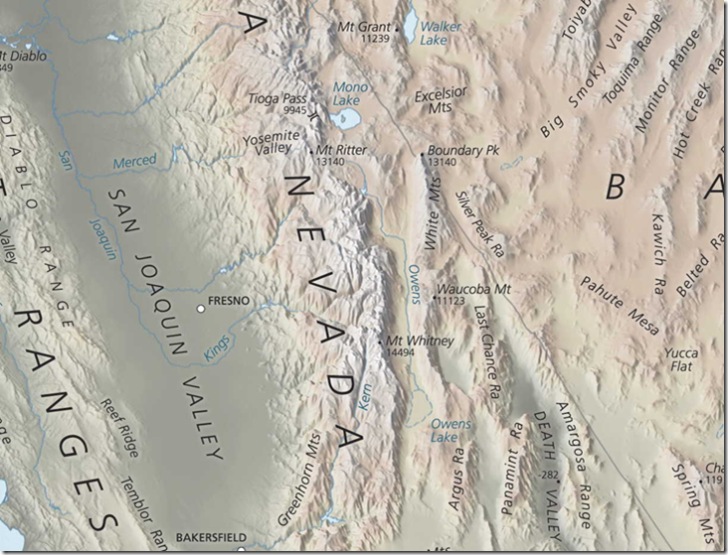
Physical Map Of the Coterminous United States: A high-resolution Albers Equal Area Conic projection map of the continental United States (no georeferencing data included, though). The map is available in a Flash-based zoomable/pannable interface, and a number of different resolution formats (poster-size, page size, web size) and layouts (with and without borders, water, neighboring countries, etc.) for download. Here’s a sample of the Sierra Nevada/Great Basin area with labels:
We have added Tom´s excellent imagery at http://www.shaded-relief.com (click on the Natural or Natural + map type.
or quicklink: http://www.shaded-relief.com/?lat=0&lng=0&z=2&t=6