One of the principal factors affecting GPS accuracy is the satellite geometry, or how far apart in the sky are the visible GPS satellites. If spaced widely across the sky, you can get a more accurate determination of your position by trilateration than if they are “clumped” together. A measure of this geometric accuracy factor is the Dilution of Precision, or DOP; the lower the DOP, the more accurate your GPS position is likely to be (though there are many other factors that affect GPS accuracy beyond satellite geometry). Some more expensive GPS receivers can calculate and display DOP in the field, but most consumer-grade units don’t explicitly give the DOP, but factor it into their error estimates.
I’ve posted before about free programs from Trimble and Magellan that will calculate the DOP for any location at any time, and plot it over the course of a single day. But if all you want is a general indication of what the worst DOP at a specific location over the course of a day will be, or what it was in the past, the US Air Force’s GPS Operations Center publishes maps of both the continental United States and the world showing what the highest DOP (corresponding to the lowest accuracy) will be over a specified 24-hour period (click on the Performance Reports link near the top).
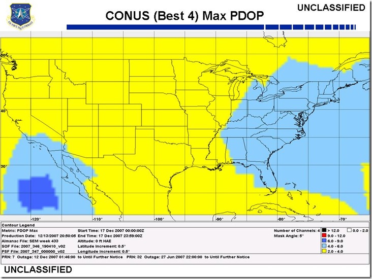
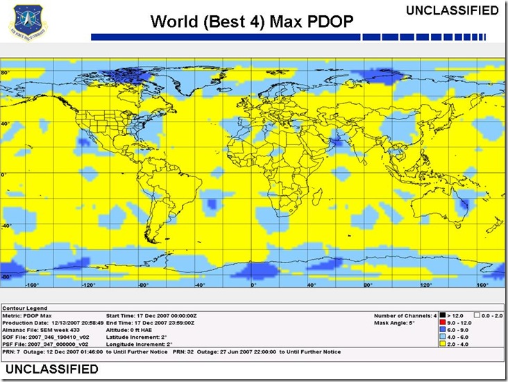
The default map is for three days in the future, which is also the latest date available. But you can get maps for previous days, and one/two days in the future, in the Archived Reports section. The site also offers advisories about the current status of the GPS system, a FAQ, and useful links.


sir,
i am experiencing problems in processing GPS data for 23 may 2008 , 24 may 2008 and 30 may 2008.can you provide me gdop plot at 10degree N 72degree E for 23 may 2008 , 24 may 2008 and 30 may 2008.
else please guide me as where can i get it.
thanks
rajesh
Try the Trimble Planning Software:
https://freegeographytools.com/2007/determining-local-gps-satellite-geometry-effects-on-position-accuracy