blankblank blank


Archive for the 'Google Maps' Category Page 12 of 15


Terrain-Shaded Relief In Google Maps

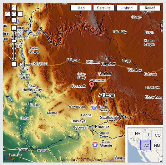
The Geolabels website offers another image option button for Google Maps, along with the standard Map, Satellite, and Hybrid buttons: Relief. This button gives you views of the terrain in an area, shaded by light at an angle and color.

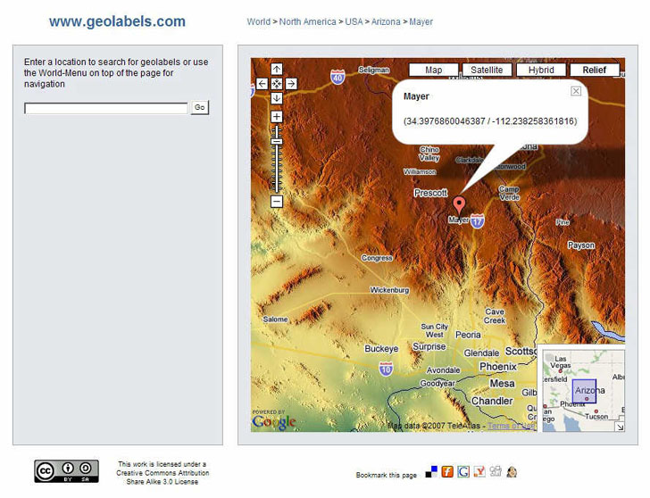
Go to the website, and either zoom in on an area of interest, or enter the name of a populated place in the box at the upper left and click “Go” (if you hit “Enter” after typing in the name, you’re likely to get an error screen). At left, you will get a list of world localities in the database that match that name; click on one, and the map will zoom in on that location:
mayer

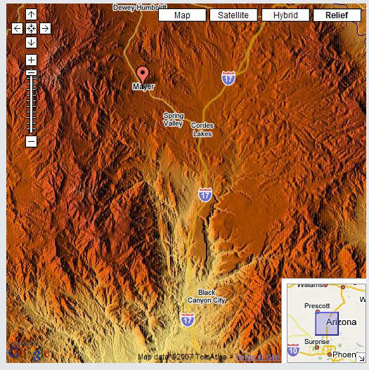
You will also get a marker at the location of the name you entered, along with a message box showing latitude and longitude to way too many decimal places. You can zoom in for a closer view:
zoomin

Or zoom out:

zoomout

Major rivers and bodies of water, major highways, and populated places are also shown on the map. Keep in mind, though, that the color shading represents altitude, not vegetation, e.g. in the image above, all that green around Phoenix definitely doesn’t represent lush vegetation. Other sites offer contours or topo maps in the Google Maps interface, but the Geolabels website is a nice complement to them.

Modified 8/26/07 to update URL.


Another Google Maps Geocoder/Reverse Geocoder

An earlier post covered a Google-Maps-based reverse geocoder, where you could click on the Google Map interface, and get a list of addresses close to that point. Reverse Geocoder for the United States is another Google-Maps-based application in the same vein. While it doesn’t have as many features as the Geonames reverse address geocoding site, it uses the Google Maps interface better, with a larger map display (one of the largest I’ve seen online) and the sliding zoom control (missing from the former site).

It’s easy to use: click on a point on the map, and you’ll get a marker placed there, and the latitude/longitude displayed in a box at the upper right. Click on “Submit point”, and the closest addresses to the selected point will be displayed as markers on Google Maps, and in a list on the right. Click on an address on the right, and a marker balloon will pop up on the map at the corresponding address. It also gives you the Zip+4 postal zip code for the address, which the Geonames site doesn’t. You can also enter a latitude and longitude in the upper right separated by commas, submit the point, and get similar results. A companion site does geocoding – submit an address, get back the latitude/longitude, and the address plotted in Google Maps (make sure you include either the city/state or zip code in the entered address).

Coverage is limited to the lower 48 US states and Alaska. Geocoding seems to use the Tiger database, whose accuracy varies depending on location.


Saving Money By Using Free Geography Tools Instead Of Geographic Data Services

SlashGeo links to a website that, like a number of others, offers services to convert graphic images and vector data into Google Maps, Google Earth, and Virtual Earth formats. There’s certainly a niche for services like this, especially if you don’t have a lot of background in working with geographic data. But if you have even a little bit of that background, you can save a lot of money by doing it yourself.

1. Converting PDF files to Microsoft Virtual Earth format requires first converting them to a graphic format like JPG or TIF, which you can do with for free with PDFCreator. Next you have to georeference them, assigning coordinates to the individual pixels in the image. I’ll be covering a number of free ways to do that in the future, but for now, it’s enough to say that you can georeference and image with the free GIS program MapWindow, or with MicroDEM. Finally, to convert the georeferenced image to Virtual Earth format, you can use Microsoft’s free MapCruncher utility. Saves about $499 versus outsourcing it, at the cost of a just a little time.

2. For plotting vector data like shapefiles on Google Maps, you can use the free utility Google Map Creator. Need to convert AutoCAD files to shapefile format? There’s a free plugin for MapWindow that lets you do that. Saves you $349 over outsourcing it.

3. Finally, for putting GIS Data into Google Earth format, there are a number of free or cheap options that let you do that. And to convert PDF files into a Google Earth format, use the process outlined above to convert a PDF to an image, and then georeference it. If you need to convert the image from UTM or some other coordinate system to Google Earth’s native coordinate system of latitude/longitude, you can use a free utility like GDALWarp (also to be covered in the future on this blog). You can then use a cheap ($20) utility like Valery Hronusov’s SuperOverlay to convert that image, or any georeferenced image, to a tiled Google Earth format. $20-50 in software costs, at most, versus an outsourced cost of $199-499.

BTW, if you have the need for any of these services, and don’t feel comfortable doing them yourself, email me with your requirements, and I’ll quote you a price that’ll be far less than those listed above ;-).


Simple Guide To Embedding Google Maps "My Maps" On Your Own Webpage

A while ago, I referred to a web-based tool that helps you embed Google Maps “My Maps” data on your website. Digital Geography has a short and simple step-by-step tutorial on how to do that.


Two Fun Cartographic Google Maps Tools

– Dig a hole through the center of the earth from any location, and find out where you’ll come out. Also useful if you’re making an earth sandwich.

– Set off in a constant compass direction from a location, and find out what path you’ll take around the world.

Via GoogleMapsMania.


New Version Of Globe Glider

This is too cool for me to even try to do it justice; go visit Google Earth Blog for the full details.


Customizing Google Maps Markers

PDMarker is “a Javascript library that extends the Google Maps API, making it easier to customize marker behaviour”. Examples and a demo are included.

Via Mapperz.


Embed Google Maps "My Maps" On Your Web Page

A nice tool that lets you create an embedded Google “My Maps” map, along with a KML file, on any web page.

Via Mapperz (which has an example) via Education/Technology (with another example).