blankblank blank


Archive for the 'data' Category Page 18 of 19


Mapping Carbon Dioxide

The National Oceanic And Atmospheric Administration (NOAA) has a new Carbon Tracker website up that plots carbon dioxide concentrations and emissions globally and locally, and by time. Here’s a map of weekly mean carbon dioxide flux (emissions) for the US from January 2005:

map of US carbon dioxide flux

A useful information resource for those interested in anthropogenic global warming (AGW).


Mexican National Atlas

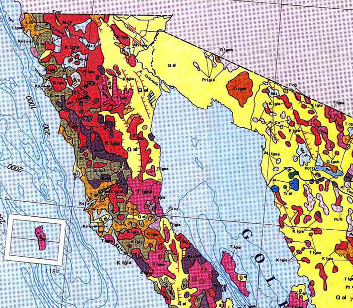
hablandodesigs links to the Mexican National Atlas, posted online by the National Autonomous University of Mexico’s Geographic Institute. Large-scale JPG scans of pages from the published volumes, slightly marred in some cases by not using de-screening during the scans. Map categories include General, Historical, Societal, Natural History, Environmental, Economics, and International Relations. En Espanol, of course, but even this gringo was able to make his way through the site and the maps. Here’s a subsection of one of the maps, showing the geology of the area around the northern Gulf of California.

Sample map from the Mexican National Atlas


Updated USGS 24K Topographic Maps From The US Forest Service

1:24,000 scale topographic maps from the United States Geological Survey (USGS) are a convenient cartographic resource, readily available from regional state GIS agency archives or the Internet Archive / Libre Map Project. However, many of the maps are seriously out of date, as much as twenty years or more.

Continue reading ‘Updated USGS 24K Topographic Maps From The US Forest Service’


Worldwide Digital Geographic Data From The FAO

The United Nations Food And Agriculture Organization (FAO) maintains the FAO GeoNetwork, a data portal for worldwide digital geographic information from the FAO, other UN agencies, NGOs and other organizations. Despite the “Food And Agriculture” in the name, there’s far more than just agricultural-related data here.

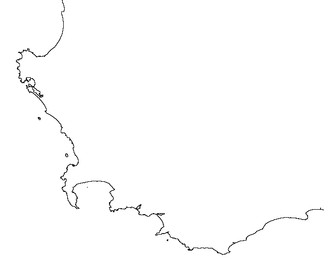
The FAO Portal Page has a web search interface for tracking down data. Not all the data is available in downloadable digital format – for much of it, only the metadata is available. If you’re only interested in digital data, just check “Digital” next to “Map type” box. Search results can be random in nature, and sometimes data listed as being available in downloadable format isn’t. But you never know what useful stuff might pop up. For example, here’s a map of the southern tip of Africa, plotted from 1:125,00 scale coastline vector data for Africa and Arabia derived from SRTM data:

FAO vector GIS data for Africa

Recent coastline data with that kind of resolution isn’t always easy to find.

You can subscribe to an RSS feed that lists new datasets as they’re added to the portal. There’s also an interactive online mapping system for creating your own maps, and an extensive list of WMS servers with a wide variety of information you can add to WMS-compatible programs like MapWindow and Google Earth. You may not always find exactly what you need, but it’s definitely worth a look.


Free Soviet Military Topographic Maps Of Europe And Asia

After the fall of the Soviet Union, a large number of topographic maps covering much of the world became available in the West; the story behind these maps is told on the informative Soviet Maps website. There are dealers who will sell you sets of maps on CD or DVD, but there are also some websites that allow you to download some individual maps for parts of Europe and Asia for free.

Some of the maps have a graphic style more colorful and visually appealing than many topographic maps from Western countries. Here’s an example of one of those maps, showing the Himalayas along the Nepal-Tibet border:
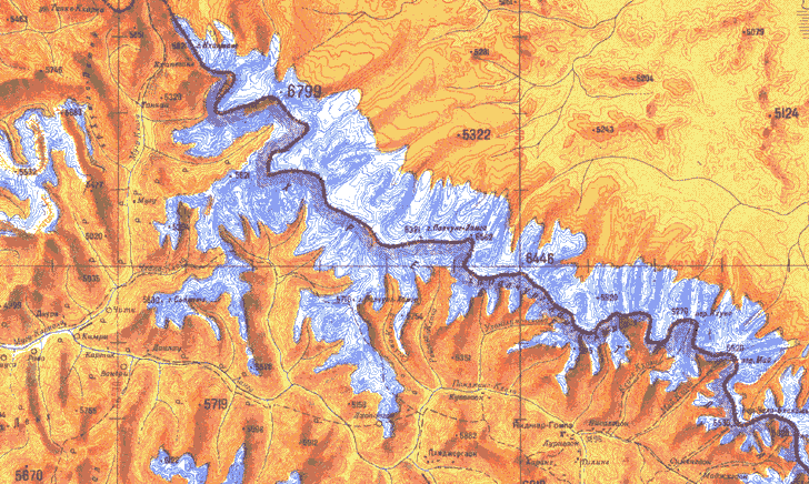
Soviet Army topographic map of the Himalayas

The Soviet Maps website has a few maps from England available for download, but there are far more available at two other sites linked to from there.

The Poehali website, connected with the MapStor dealers website, has a Google-Maps-based interface:
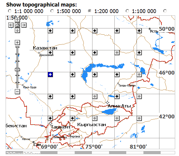
Poehali website interface for retrieving Soviet military topographic maps

Scroll and zoom to the area you’re interested in, and select a map scale you’re interested in at the top. Solid black plus signs in the map subsquares indicate that maps covering the entire subsquare at that scale are available; ghosted plus signs indicate part of the area is covered by available maps; minus signs indicate that no maps at that scale are available for the area. Click on the plus sign, and a list of links to those maps will appear below. Click on a link, wait a few seconds while you look at a MapStor ad, enter a numeric code, and you can then download the map in GIF format (not georeferenced).

You might also try ????? ??????? (Karta Ukraine?); it’s only in Cyrillic, so if you don’t read Russian (and I don’t), it’s kind of tough to figure out all of what’s available on it. From poking around the site, and from a very limited knowledge of Cyrillic, I can see that there are topographic maps and orthophotos (not georeferenced) for Ukraine, and apparently parts of Belarus and Moldova as well, in JPEG format. They also aren’t georeferenced, and you’ll have to do that to use them in a GIS program. Explore the site I’ll be posting about free georeferencing software and techniques in future posts.

Soviet maps don’t necessarily use the same symbology as Western maps. But you can download explanatory guides to Soviet topo map symbology from the Armchair General website or a Stanford Library website.


Digital Atlas Of North American Woody Plants

In 1999, the United States Geological Survey published a two-volume atlas of distribution and climatic data for the trees and woody shrubs of North America. The two-volume set costs $63, but the entire contents, including digital versions of the climate and distribution data, is available online for all you treehuggers out there.

Continue reading ‘Digital Atlas Of North American Woody Plants’


Rocks And Dirt – Geology And Soil Maps Of The US And World

I love rocks. I love dirt. And I love the maps that show them. A good geology map is visually like a weird hybrid between a Peter Max poster and Jackson Pollock drip painting, but also tells a story spanning several billion years of Earth’s history. I’ve found a few websites where you can find and download geology maps in a variety of formats.

Continue reading ‘Rocks And Dirt – Geology And Soil Maps Of The US And World’


Automatic Caching Of Google Earth Data For Offline Use

If you plan to do real-time GPS tracking with Google Earth, and you won’t have Internet access while doing so, you’ll need to have data for the area you’ll be doing your tracking in cached on your hard drive by Google Earth. You can do this manually by “visiting” the area in question in Google Earth while you’re connected to the Internet, but DestinSharks.com has a post on Google Earth Voyager, a free program that automates that process. Edit: Thanks to Yousuf in the comments for this download link at Download.com.