blankblank blank


Archive for the 'coordinate conversion' Category Page 2 of 5


UK Coordinate Converter

The UK’s Ordnance Survey has a free high-accuracy coordinate converter for transforming from GPS coordinates (latitude/longitude/WGS84) to OSGB National Grid (eastings and northings):
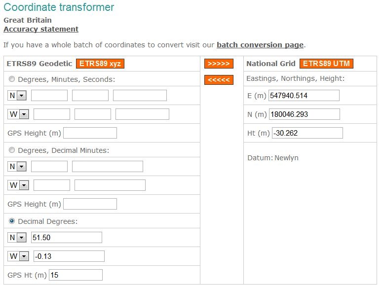
UKcoordconverter

In addition to this single-coordinate-set converter, there’s an online batch converter, and additional converter options for coordinates in the Irish Grid (good for Northern Ireland and the Republic of Ireland). There’s supposedly a free Windows stand-alone converter that you can download after filling out registration info, but the registration form doesn’t like my US phone number, so I couldn’t check it out. The OS provides both a set of equations/parameters, and a free DLL, if you want to incorporate the coordinate converter in your own software. And there’s a page with more information on coordinate systems used in Great Britain, including their free “Guide to coordinate systems in Great Britain“.

Other free services at the Ordnance Survey website include a RINEX data server for GPS post-processing, and several searchable databases of assorted geodetic control points:

  • 900 GPS reference marks
  • 750,000 benchmarks
  • 21,000 horizontal control stations

HT to Malc.


Two Online Map Scale Calculators

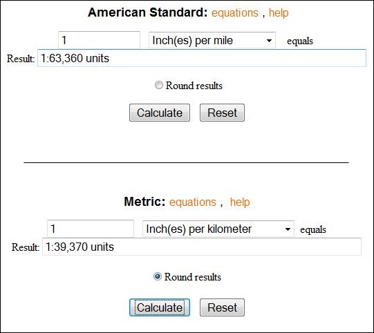
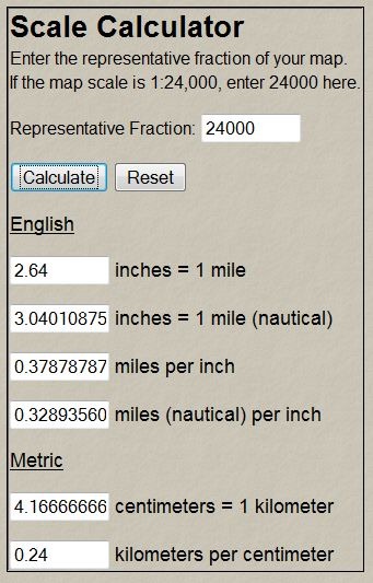
With the UT-Bureau Of Economic Geology’s Scale Calculator, enter a map scale and it calculates what a measurement on the map represents in reality, or what a unit distance translates to at that map scale:

utscale

There are also links at the top of the page to other calculators for area/distance conversion, and decimal degree / deg-min-sec degree conversions (both ways).

The OSU Scale Calculator is a bit different – enter a map measurement distance for a unit distance, and get back the map scale number:

osuscale

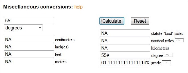
There’s also another calculator for basic distance unit conversions, plus also conversions from degrees of slope to  % grade and back:

slopegrade

Via Kelso’s Corner (which also has some useful tables and info related to map scale),


The Big List Of Image Registration / Georeferencing Software

If you want to use a raster map image in a GIS program, it needs to be calibrated so that the software will know the geographic position of every pixel in the image. This calibration data can be embedded in the file, as in GeoTiffs and MRSID files, or external as in worldfiles. If you have a raster map image which doesn’t include this calibration data, you’ll need to create it yourself; this process is called  “image registration” or georeferencing. There’s a number of free programs that can perform this function, and I’ve put together a list of some of them below; if you know of others, please let me know and I’ll add them. And if I’ve included a program that doesn’t do georeferencing (very possible, since I haven’t used all of them), let me know that as well and I’ll drop it from the list.

One thing to keep in mind: some of the programs only work correctly if the map image is already in a specific map projection like UTM or geographic, and you use the same coordinate system to georeference the image. As a general practice, it’s always best to use the same coordinate system the map was created in to georeference it. For example, if you have a map in the UTM projection, and use geographic coordinates to georeference it, the resulting calibration is unlikely to be accurate over the entire map (unless you’re at the equator). Some programs let you warp the map image to get it to match the coordinate system, a process known as “rubber-sheeting”; this is especially useful for those maps that aren’t drawn accurately, like old or hand-drawn maps, or maps created in no-longer-used coordinate systems.

BTW, I haven’t used most of these for georeferencing – GlobalMapper is my program of choice for this function. It’s not free, or even cheap, but it works great for georeferencing, including rubber sheeting. For beginners, I’d suggest looking at MapWindow, qGIS or MicroDEM first before going on to the more advanced software.

CHIPS For Windows

DIVA GIS

e-Foto

GRASS

gvSIG

HyperCube

ILWIS

Image Georeferencer

LandSerf

MapWindow

MicroDEM

MicroMSI (link may be dead)

Opticks

OSSIM

qGIS

QLandKarte

RasterStretch

Regeemy

SAGA

SavGIS

Spring GIS

TransGen

xBit

Online map rectification tools

MapWarper

Metacarta Map Rectifier

NYPL Map Rectifier

Old Maps Online Georeferencer (in development)


Convert/Reproject Shapefiles And KML Files To SVG Format With indiemapper

indiemapper is a promising-looking thematic mapping service that is supposed to come online shortly. But until then, they’ve released a free  online Flash application that lets you upload vector data (point, line or polygon) in KML or shapefile format, re-project it into one of 11 different projections …

  • Equirectangular
  • Mercator
  • Winkel Tripel
  • Robinson
  • Albers Equal Area Conic
  • Lambert Conformal Conic
  • Orthographic
  • Polyconic
  • Sinusoidal
  • Bonne
  • Cylindrical Equal Area

… and then export it as an Scalable Vector Graphic (SVG) file for use in programs like Adobe Illustrator or Inkscape. Shapefiles must be in geographic coordinates (latitude/longitude), WGS84; KML files are already in this format. Network KML files are acceptable. Add a file to the display, or choose one or more of their sample datasets:

open

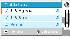
You can load multiple datasets into the display, move their draw order, and turn them on and off  by clicking on the “eye” icon:

datalayers

The graticule grid can be turned on and off, and spacing set to automatic or manual.

Select the projection using the “Project” button at upper-right:

projections

You’ll get info about the projection, including its pluses and minuses. Here’s Mercator (a screen capture, not SVG):

mercator

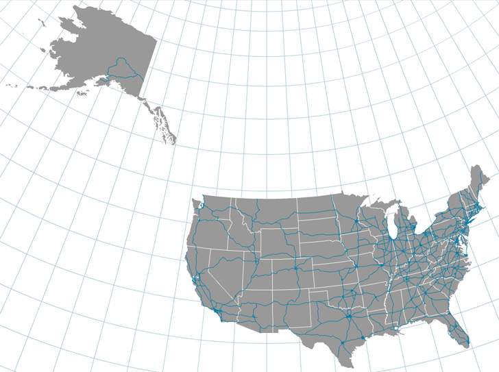
And Albers Equal Area Conic:

albers

With the center latitude/longitude of view adjustable. Once done, click on the “Export” button at upper right to convert the vector data to SVG format, and download it to your computer for use in vector editing software, or for viewing in a compatible browser like Firefox.

There are limitations for now. There’s no control over layer colors, and no thematic coloring based on the attributes of the vector files. It looks like the full indiemapper application will have those, and the screenshots make it look interesting, but it’s not clear yet whether that full online app will have a free version. Stay tuned.

Via the thematic mapping blog.


PLSS Converters For The Western United States With DLLs, Code

1.  The TRS-data site at Montana State University lets you enter PLSS data (Township, Range, Section, “TRS”) for one of 17 western US states (AR , AZ, CA, CO, ID, KS, MT, ND, NE, NM, NV, OK, OR, SD, UT, WA and WY), and get back the latitude/longitude for the center of that section. You’ll need to know the correct meridian for the TRS section you’re interested in; the same site has a map that you can click on that will bring up a datasheet with the meridian. It also will give you information about the point you clicked on like latitude/longitude, slope, aspect, roughness, nearby landmarks,etc., but the scale of the map is so small that most of this data isn’t terribly useful.

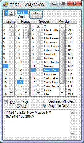
2. The site above uses Martin Wefald’s free TRS converter software, available for free download. This includes a DOS executable, DLLs for use in other Windows programs (including both TRS to lat/long and lat/long to TRS), source code, documentation and a sample Visual Studio app for TRS to lat/long conversion that functions similarly to the above website:

trs2ll

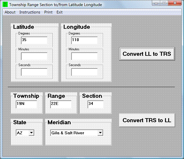
3. Paul Jorgensen has used these DLLs to create more stand-alone converters:

– A single-point app for converting TRS to lat/long, or vice-versa:

trs

– A bulk converter that takes a text file with TRS data, and outputs a text file with lat/long data. Documentation and download at this website. The format the input data needs to be in is very specific, so it might not be the easiest to work with.

4. While I’m on the topic: I’ve posted before about the Township And Range website, which takes TRS data and plots the location in Google Earth. Since the original post date, the author has added converters that will take TRS data and convert it to lat/long, and vice-versa, with the option to view the location immediately in Google Earth.

HT to Steve Richardson.


Google Earth Coordinates In Multiple Projections With Plex.Mark

By default, Google Earth uses latitude/longitude as its coordinate system, with WGS84 as the datum. In the Tools section, you can choose to display lat/long in decimal degrees, degrees/decimal minutes, or degrees/minutes/seconds. You can also set the displayed coordinate system to UTM (Universal Transverse Mercator)/WGS84, a coordinate system often used on maps. But for other coordinate systems and datums in Google Earth, you’re out of luck.

Plex.Mark is a small helper app for Google Earth that, to a limited degree, can show you the position in the center of the Google Earth in many other coordinate systems. After installing and running the program, Google Earth will open up, and the Plex.Mark dashboard will overlay the display, always on top:

Continue reading ‘Google Earth Coordinates In Multiple Projections With Plex.Mark’


Online Lat/Long – UTM – Grid Coordinate Converter

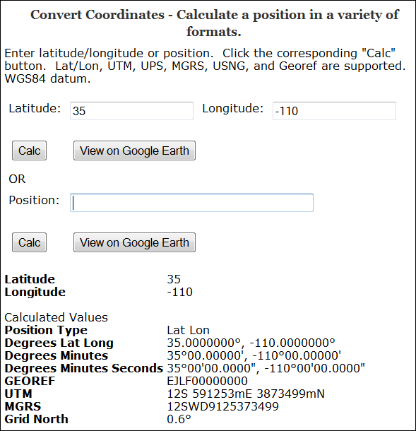
The Earthpoint Coordinate Converter takes a geographic position in latitude/longitude, or in a number of grid coordinate systems, including:

  • UTM
  • MGRS/USNG and MGRS Polar
  • GeoRef

and converts it to all the other coordinate systems (including lat/long in decimal, DDMM and DDMMSS formats):

3-5-2009-8.55.12 PM

(Grid North is the deviation between true north and north along the map projection grid lines)

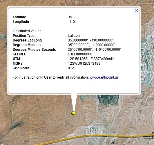
You also have the option of viewing the point in Google Earth, with a pop-up balloon that includes all the coordinate data:

3-5-2009-9.04.06 PM


Google Maps As A Decimal Degree To Degree-Minute-Second Converter

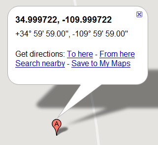
Got coordinates in degree-minute-second  degrees, and need them in decimal format fast? Or the reverse? Go to Google Maps, enter the coordinates into the search box. e.g. +34 59′ 59.00″, -109 59′ 59.00″, and get a map with a pop-up containing the converted coordinates:

10-19-2008-10.05.20 PM

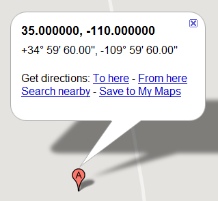
You can then copy and paste the pop-up text into another application. It does have one minor bug – type in an even latitude/longitude, like 3,-110, and you’ll get this:

10-19-2008-10.06.49 PM

Obviously, instead of 59 minutes and 60 seconds, the degree numbers should be one higher. Not a situation you’ll see often, though …

If you do this on a regular basis, you might take a look at some earlier posts on this blog that talk about stand-alone options:

Via Mapping Hacks.