blankblank blank


Archive for the 'cartography' Category Page 11 of 14


More Online Historic Maps

A short followup to my earlier posts on large-format downloadable historic maps and online historic map collections:

American Geographical Society Library Digital Map Collection: Based at the University of Wisconsin – Milwaukee, the collection currently holds 200 online maps, with more on the way. Strongest in maps of Wisconsin and the surrounding area, but has an assortment of maps for other locations as well. No download links for maps.

Hat tip to Nina Frantzen in the comments.

The Boston Public Library’s Norman Leventhal Map Center has strong holdings in maps of Boston, Colonial New England and the American Revolution, but also collections of some of the earliest printed maps, and European/Dutch maps from the Age of Discovery.
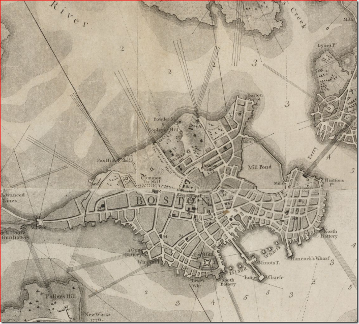
 

1777  Boston map Detail from map of Boston (1777) 

Via GeoCarta Blog.


Historic Cities: Historic maps of cities from the Hebrew University of Jerusalem and the Jewish National University Library; catalogued by city and country. Also links to city maps at other websites.


Broer Map Library: Historic and modern maps from around the world in a Zoomify interface. Also includes links to historic maps in Google Earth KMZ format.


Another useful gateway is theĀ Map History / History Of Cartography site.


Free Blank/Colored Map Graphics

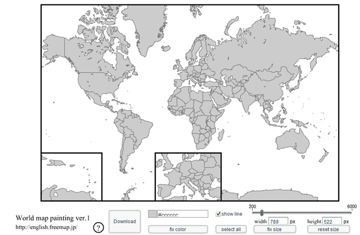
The “blank map, world map” site (sic) has lots of map graphics in GIF, EPS and PDF formats, under the Creative Commons license so they’re free to use. World and continent maps are available (multiple projections for world maps) blank/uncolored, with and without borders; country maps are available with and without borders and subdivision names.

Perhaps the most unique application is an online paintable world map that lets you color in countries with your choice of colors, and then export the graphic file in PNG format in sizes from small (200 x 132 pixels) to large (6000 x 3973):

printableworldmap

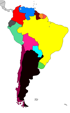
Click on a country or countries to select, then select the color you want to use for them (note: you need to de-select the country or countries you’ve just colored by clicking on them before coloring the next set). Useful for creating wildly-inappropriate coloring schemes:

world_mapa


One More Color Design Resource

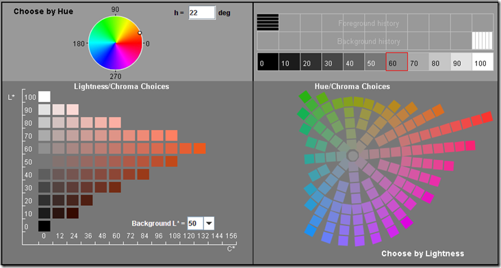
In comments on a previous post, Igor Asselbergs points to a page on Using Color In Information Graphics from the NASA/Ames Color Research Lab. In addition to a very large collection of articles/tutorials on effective (and ineffective) uses of color in representing information graphically, there’s also a Java-based Color Tool:

Color_Tool

“The Color Tool is designed to provide the designer with views of the perceptual relationships among the possible color choices. It improves on previous tools by more clearly representing the constraints imposed by the physical display and the structure of human color vision. This should help the designer manage the luminance contrasts of symbol and background colors by showing the tradeoffs in hue and saturation.” – from the website. One nice feature is the ability to change the background luminosity, and see how that affects the perception of the various colors.

Thanks, Igor!


Additional Color Applications For Maps And Design

Here’s a few additional color applications that might prove a useful complement to the application Kuler (from yesterday’s post) in designing map color schemes.

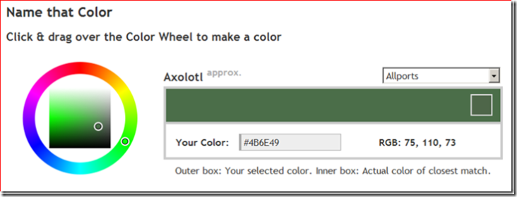
An online color application: Name That Color. Select a color from the color wheel, and Name That Color will … name that color. Also gives you the RGB and hex numbers for it.

snapper1188961707734_thumb1

Open source; Javascript and php code available at the website.

Via Download Squad.

Color Cop: A Window desktop application that lets you:

  • Determine the color code for a color anywhere on your desktop
  • Single-pixel sampling, or 3×3 and 5×5 averaging
  • Automatically generates a 42-color palette of complementary colors for your select color
  • And more …

Via Lifehacker.

Colorzilla: A Firefox extension that shows the color codes (RBG and hex) for the point under the cursor in the Firefox browser.

Via Lifehacker.

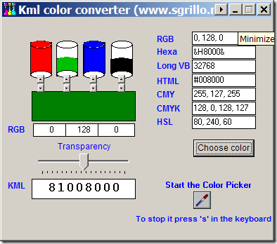
KML Color Converter: Mix and match R, G, B and black, set transparency, and get back the KML color code; gives other color codes as well (like RGB, CMY, CMYK, HSL). Also has a color picker to select colors from anywhere on-screen.

10-4-2007-9.38.32 PM


Color Palette Generator, Color Hunter: Online apps that create a color palette based on those found in a graphic or image file. You enter the URL of the image, and get back a palette with the colors in that image.


Creating Map Color Schemes With Kuler And ColorBrewer

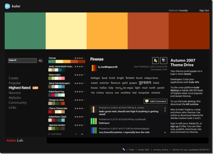
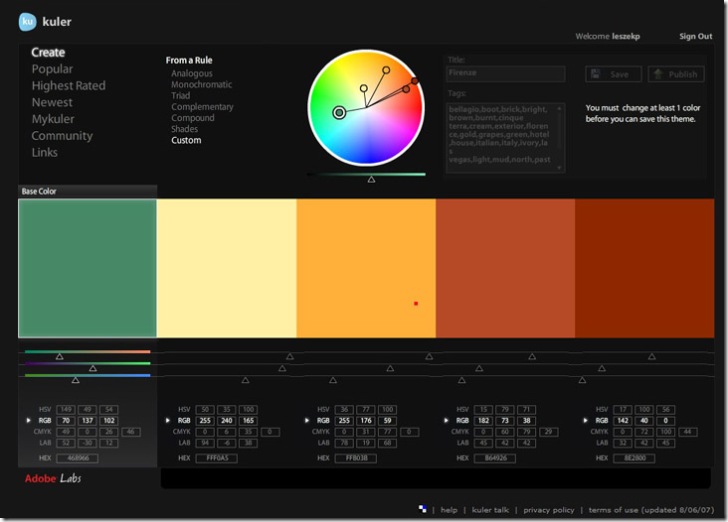
A while back, I posted about ColorBrewer, an online map-oriented tool for experimenting with different map coloring schemes. It’s a great tool, but with a limited number of color palettes to choose from, and no capability to modify them or create your own. Kuler is an online color palette creator from Adobe (Flash, multi-platform; free registration required) that lets you create and view your own color palette, or browse and modify palettes created by others. There’s a ranking system that lets you give a rating (1-5 stars) for palettes, and you can browse by popular (most downloads) or highest star ratings.

kuler

If your graphics application supports Adobe Swatch Exchange files (*.ase), you can download a swatch file from the application. If not, you’ll have to write down the color specs down (HSV, CMYK, RGB, LAB or HEX) from the settings in the Create window for your new palette. For an existing palette, click on the “Make changes …” button at middle right:

Kuler screenshot

If you want to enter ColorBrewer palettes into Kuler for experimentation and modification, you can download an Excel file with RGB values from the ColorBrewer updates page.


Maps Of War

The Maps Of War site has animated embeddable Flash maps illustrating historical trends, like this one showing the history of the Middle East over the past 5000 years:

And the Library page has a growing collection of links to other animated history maps from across the web.

Via BoingBoing.


Downloadable Cartograms From Worldmapper

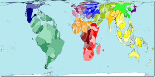
A cartogram is a map where the area depicted depends on the value of a variable instead of the actual geographic size within the boundaries of the area. Worldmapper has a large collection of cartograms (366, with more added all the time). Here’s a cartogram of number of plant species by country:

271c

In addition to the graphic image, which can be downloaded by right-clicking on it and choosing “Save Image”, you can also download the data used to create the maps in Excel format and OpenDoc format. Some maps include animations of the map morphing from a standard map to a cartogram, and/or can be downloaded in PDF poster format (missing for some of the newer maps).

More info about cartograms is available at Cartogram Central.

Via BlinkGeo.


Online Map Collections

A previous post talked about sites where you could find, view and download high-resolution historical and modern maps. But there are also a number of worthwhile sites that, while not allowing high-res downloads, let you view historical maps online.

David Rumsey Map Collection: Probably the best-known online map site, with 15,800 maps viewable, including “antique atlas, globe, school geography, maritime chart, state, county, city, pocket, wall, children’s, and manuscript maps”. There are a number of different map browsing and viewing options, none of which I’ve ever been all that crazy about. Before you even think about using this site, make sure you set your browser and firewall to allow pop-ups from this site, otherwise you’ll go nuts. But once you get past those issues, there’s hours of map-browsing pleasure here.

British Library: Not surprisingly, very strong in historic maps, especially those of the British Isles and Europe. Check out the collections of scanned maps. Higher-resolution digital images of many of the maps are available for purchase.

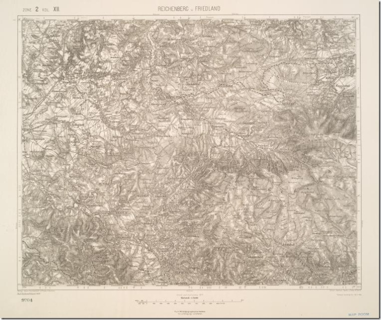
New York Public Library: Large collection of online maps for NY, the US and the world, and (oddly enough) shaded relief military maps of the Austro-Hungarian empire. Prints available for sale.


images.nypl.org

Shaded relief map of Reichenburg and Friedland, Austro-Hungarian Military Geography Institute

Know of any other large online map collections? Let me know in the Comments section.