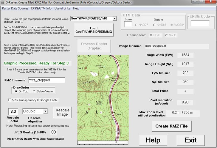
I”ve posted about my free app G-Raster before – it converts raster imagery like topo maps and aerial imagery into the format compatible with recent Garmin GPS models (the Colorado, Oregon, and Dakota series). I’ve just uploaded version 1.3, which adds some major improvements:
– The option to rescale images that are too large for Garmin units (> 100 million pixels) to a smaller size; the previous version only let you crop the image
– Automatic rescaling of images to make sure that less than 100 tiles (the maximum for Garmin units) are created
– Display of the image resolution in meters per pixel, plus the maximum Garmin zoom level at which an image can be viewed without pixelization (aliasing)
– A view of the central part of the raster imagery, updated when the image is rescaled to a smaller size, or when the JPG compression is modified
– Your choice of 6 different algorithms for use in rescaling imagery
– Adjustment of the JPG compression factor using a slider, with immediate updating of the image view so that you can see the effects.
– Major additions to the help file


