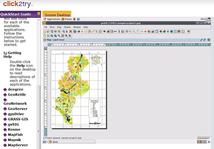
Over a year ago, I posted about GISVM, a Linux GIS workstation in a virtual package that could be run in free VM software like VMWare Player or Virtual Box. You can now try out a more recent release of this package (christened Arramagong, and distributed at the 2009 FOSS4G conference in Australia) in a Java-based virtual machine viewer at the click2try website. You need to register (for free) to save data and settings, but you can try it out without registration. You’ll definitely need a broadband connection to run it, and there’s a connection test to make sure your network link is up to it. Once running, display refresh speed is adequate enough to load up apps and try them out. Wouldn’t want to run the apps full-time on this service, but that’s certainly not the intention for this package – it’s just to show off what’s available in the distribution. If you like it, you can always download the 1 GB+ full distribution and a free virtual machine environment, and run it at acceptable speed on your own computer.

In addition to the apps you see listed above, it also has qGIS, uDig, RGeo, openJump, and MapTiler
Ricardo Pinho’s GISVM is a great packaging of the most common open-source geospatial tools.
For those interested in running an Amazon Web Services (Amazon EC2 web server cloud) based version, in our continuing work with the oceans observing community I’ve posted an Amazon Machine Image (.ami file) of our open-source based production server http://code.google.com/p/xenia/wiki/VMwareProducts with
AMI ID = ami-9028caf9
and further documentation at http://code.google.com/p/xenia/wiki/AmazonWebServices
The server image imports/aggregates in-situ data from a variety of instrumentation to a PostgreSQL+PostGIS simple database schema and exports data in a variety of formats(KML,GeoJSON,CSV,HTML) and web services(OGC SOS)
It’s built on top of Ricardo’s GISVM November 2008 package release.
Amazon doesn’t seem to have a very good search and discovery mechanism for the ami’s , it would be really helpful if they let folks apply search tags or maybe even suggested popular search tags to improve the ability to advertise and popularize commonly useful ami’s.
Cheers
Jeremy Cothran