If you need to plot a coordinate position quickly on a wide variety of maps from different websites, or if you want to find a list of nearby geocaches, benchmarks, or other info, here’s a neat little website for that:
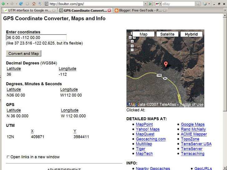
The GPS Coordinate Converter, Maps and Info website lets you enter a set of geographic coordinates (latitude/longitude, WGS84), converts them to decimal/degree-minute-second equivalents and UTM coordinates, and plots the position in a small Google Maps window on the right:

The “Enter coordinates” box at the top is fairly flexible, so you can enter coordinates in both decimal and degree-minute-second format.
Although you can select the standard Google Maps display options on the right, Map, Satellite or Hybrid, you can also open up a map for this position from a wide variety of mapping websites, listed below the small map image under the “Detailed Maps At:” heading. Open it on the official Google Maps site, Yahoo Maps, MapQuest, TerraServer, and a whole bunch more.
Below the Detailed Maps links are separate links to geocaching sites, benchmark sites and more; click on these links, and the matching website opens with the coordinate data you’ve entered above automatically passed to the website (in most cases).