blankblank blank


Archive for the 'data' Category

Panorama Generator For Parts Of Europe, Asia And Africa

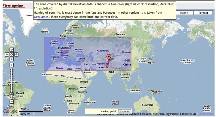
The Generate a Panorama site lets you generate high-quality panorama views, with labeled peaks, for some areas of Europe, Asia, and Africa; moving your mouse cursor over the “Covered areas in Europe, Asia and Africa” link near the top of the page shows the coverage area:

2011-04-26_192531

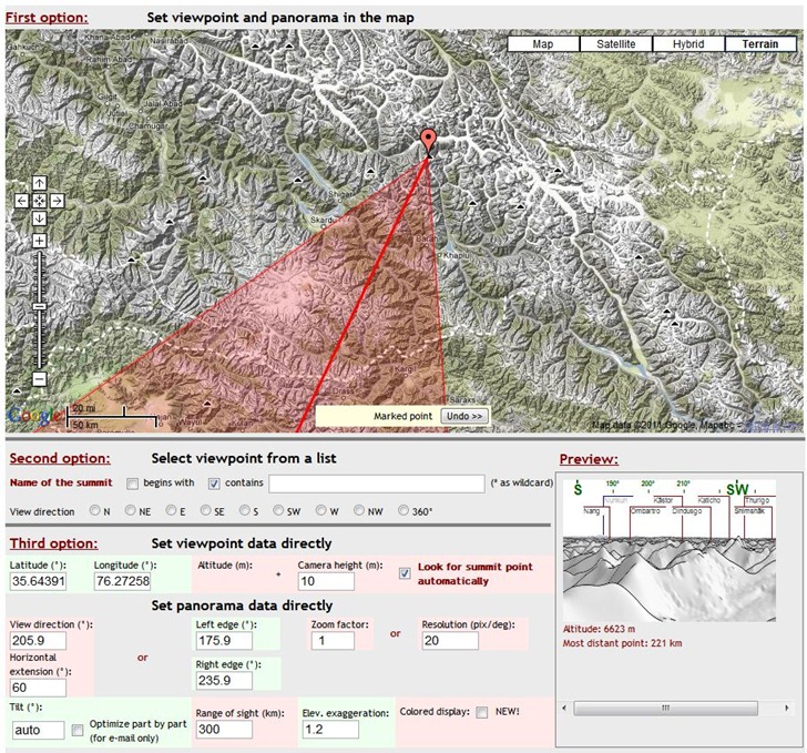
You have three options for setting the peak location:

  • Clicking directly on the map to set the location, then adjusting the direction of view.
  • Choosing peaks from a searchable list
  • Entering the exact latitude/longitude, and also setting camera height, distance, viewing angles and more.

As you adjust the position and parameters, you get a mini-preview of the view at lower-right:

pg_2

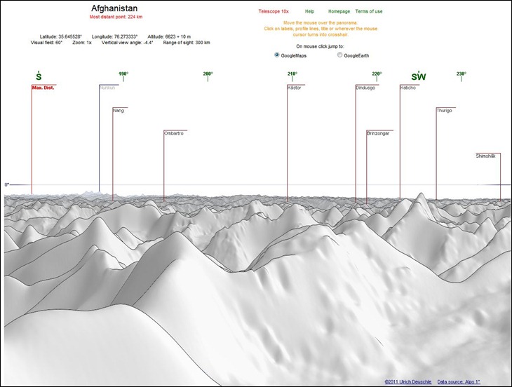
When everything is set, you have the option of either emailing a copy of the panorama to yourself or someone else, or viewing it in the browser:

pg_3

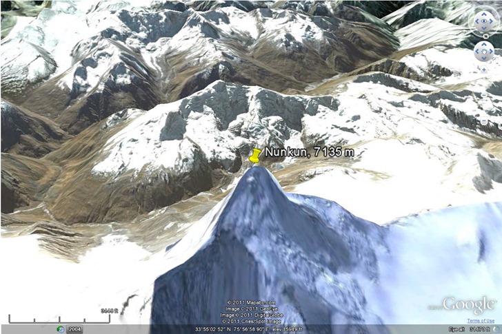
Peaks are clickable, and you can choose to have a peak location highlighted either in Google Maps, or the Google Earth browser plugin:

pg_4

There’s also a “Telescope 10x” option to blow up a section of the panorama, but I couldn’t get that to work.

Data resolution is 1 arc-second (30 meters) for the Alps, and 3 arc-second (90 meters for the rest of the world). Hopefully, the rest of the world will be covered at some point in the future. The panoramas look better than the ones generated by the HeyWhatsThat site, but that site offers worldwide coverage, and additional features like viewshed export to Google Earth.

Via Google Maps Mania.


Search And Catalog Your Local GeoData (ArcGIS Users Only)

When I saw this post at the WeoGeo blog on Voyager, I was psyched. The free version of Voyager searches your hard drives for up to 5000 geodata files, catalogs/indexes them, thumbnails them, and makes them easily searchable and retrievable; paid versions increase that data limit, and offer more features (concurrent users, network storage searches, etc.). You can even add links to online data sources like WeoGeo that support the Web Catalog Service (CSW) (live web demo here).

voyager

I’ve got data files scattered all over the place, so this would be a perfect organization tool for me. But I was bummed to find out that you need to have ESRI’s ArcGIS Desktop 9.3 or higher installed on your system, which I don’t. Nuts. But if you do have a supported version of ArcGIS, you’d be crazy not to at least try out the free version.


Free Open GeoData Server Package (With Geocoding)

Via geothought comes word of the latest project from the developer of OpenHeatMap, Pete Warden. The Data Science Toolkit wraps up a number of open-source data tools into a combined server/data package that you can install as a VMware image or Amazon EC2 package (downloads/instructions included). You can also set it up as a stand-alone Linux-based server, or install it on a hosting service, with instructions available at the project’s github depository. Geo-related services include:

  • Geocoding: US address to latitude/longitude)
  • Coordinates to political areas: Enter coordinates, and get country/state/region/neighborhood data. For example, for (37.769456,-122.429128), you get:

(United States, usa, country) (California, us06, state) (San Francisco, 06_075, county) (San Francisco, 06_67000, city) (Eighth district, CA, 06_08, constituency) (Castro-Upper Market, Castro-Upper Market|San Francisco|CA, neighborhood)

  • Geodict: “pulls country, city and region names from unstructured English text, and returns their coordinates.” This one’s not working fully yet; sometimes gives results, other times nothing, even on the same query.
  • IP Address to Coordinates: Translates IPv4 numeric address to coordinates. Not always the coordinates directly associated with the website. For example, this site is based out of Arizona, but the server address for the hosting company is in Chicago, and used to be in Utah.

Also includes a built-in REST/JSON-based API for web services, so you can invoke it from other websites. Big advantage of this approach is that you can set up your own server for these data queries, free of the daily limits other similar services apply. You can test out the current services on the website.

Here’s a talk on this topic by Pete Warden from this year’s GigaOm Structure Big Data 2011 conference:

Watch live streaming video from gigaombigdata at livestream.com


Government GeoData In ArcGIS-Compatible Form From GovMaps.Org

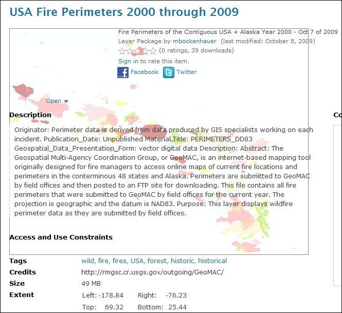
ESRI’s GovMaps.Org website (currently in beta), currently offers a searchable catalog of 88  data layers (and presumably growing) hosted at ArcGIS.com, mainly from the US Government, covering a wide variety of subjects areas. A random sampling:

Click on a link, and it takes you to that data page at ArcGIS.com with more info, metadata links, and download links:

govmaps_1

Clicking on the arrow next  to the “Open” link gives you a number of options, depending on the kind of data:

– “Open in ArcGIS.com Viewer”: Opens up the data directly in ArcGIS.com’s web-based map viewer. Oddly, this option isn’t available for all datasets; hopefully, it will be soon.

– “Open in ArcGIS Desktop”: Downloads an item.pkinfo or .lyr file that ArcGIS Desktop can use to load/download the info.

– “Download”: Downloads the full data in a layer package file (.lpk) that ArcGIS Desktop can open directly.

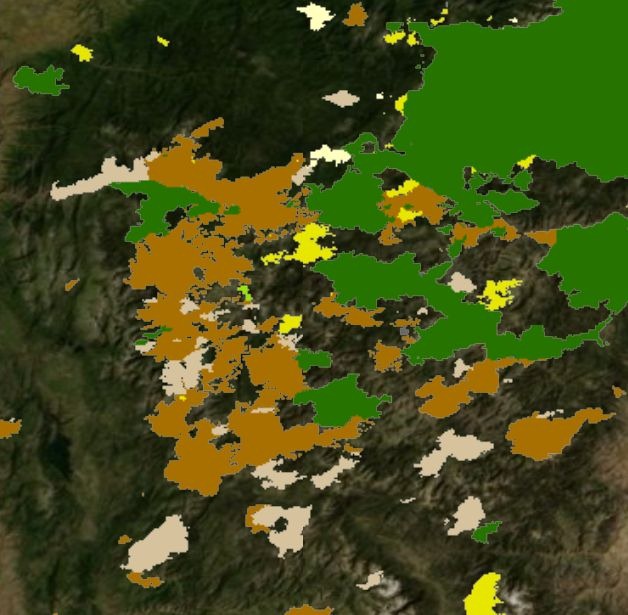
If you don’t own the expensive ArcGIS Desktop software, and want to view data that isn’t viewable at ArcGIS.com, any of the item.pkinfo, .lyr or .lpk files you download can also be opened up in ESRI’s free ArcGIS Desktop Explorer software, like the wildfire data shown below on top of the Bing Maps aerial basemap:

fire_data


Monitor Ship Positions And Tracks Real-Time With MarineTraffic.Com

If you’re at all interested in maritime traffic, the MarineTraffic.com site is a terrific resource. And even if you’re not, it’s worth checking out as an example of how you can display real-time data in many different ways on one site using the Web.

mtweb_1

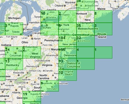
The main map view shows green gridded areas where the site has information on marine vessels; this includes not just the ocean, but also major inland waterways like the Great Lakes and the Mississippi River. Click on a grid square to zoom in.

mtweb_2

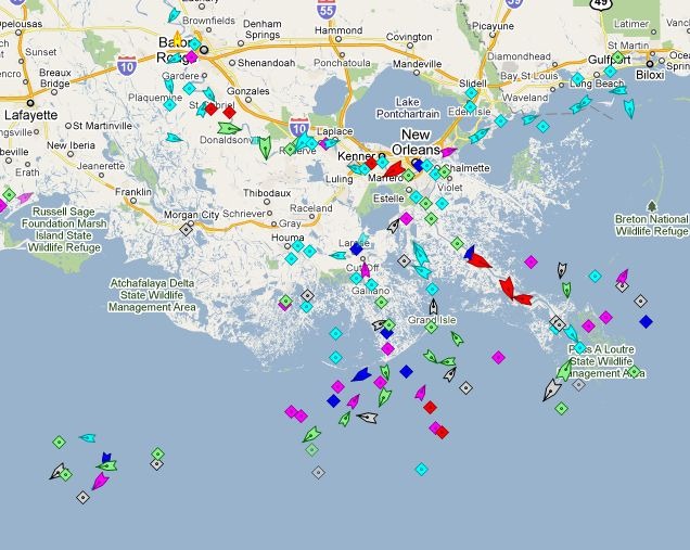
Triangles are ships in motion, with the point showing direction; diamonds are anchored/moored ships, or navigation aids.

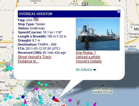
mt_popup

Click on a ship to pull up a popup balloon with more info, and links to even more information.

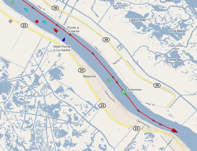
mt_track

Clicking on “Show Vessel’s Track” brings up its recent travel path; passing the cursor over the track brings up time/speed/bearing data for every marked point.

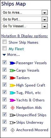
mt_options

The map’s options section shows you the ship color legend, and lets you turn on/off display of various types, as well as showing their names. You can “bookmark” ships into “My Fleet”, and also go to specific ports/areas/ships with the dropdowns.

The Services section offers many other data options, including:

– The ability to embed a map with real-time ship data on your website.

– Apps for iPhone and Android (Android app reviewed today at AndroGeoid).

– A mobile-enhanced website for use on other mobile platforms.

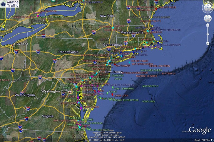
– A KML network link for use in Google Earth.

mt_GE

HT to Goya Bauwens.


WeoGeo Addendum

A short addendum to my post last Thursday on free geographic datasets from WeoGeo:


ShareGeo: Open Geo Data Repository

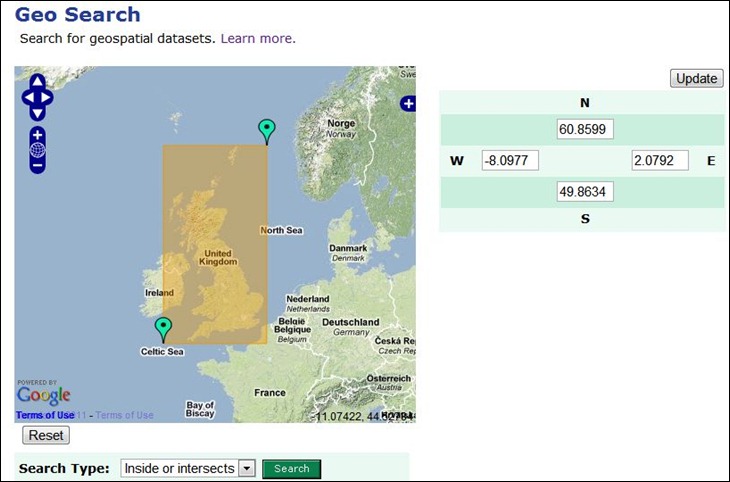
Addy Pope of the University of Edinburgh writes to announce ShareGeo, a data repository for open geo data that is freely shareable and distributable. While it’s open for use by anyone, the datasets currently available show a not-surprising bias towardsUK-related data. You can search for data by date, subject, source, title, or more generally by defining geographic extents:

sharegeo_1

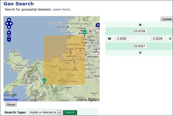
The initial view shows the defined area of interest as the yellow rectangle; you can adjust the extents by modifying the lat/long coordinates directly, or drag/drop the green markers to redefine the extents directly:

sharegeo_2

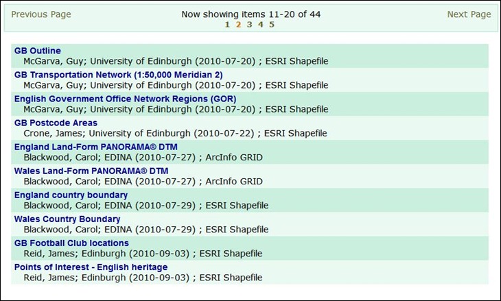
Once done, click on Search, and get both a list of available datasets for that area:

sharegeo_4

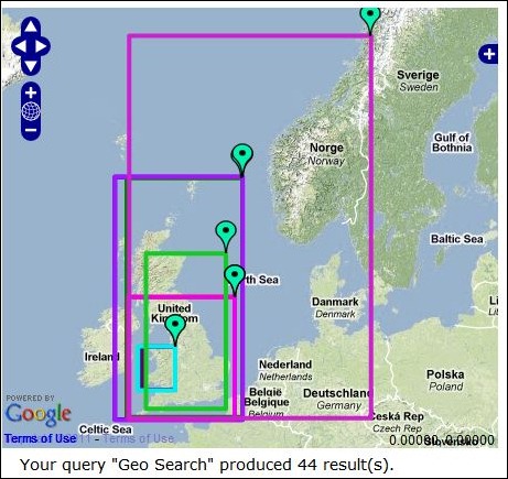
And a map that shows the extents of all datasets listed below it:

sharegeo_3

Click on a maker to identify which dataset’s extents it corresponds to. If you move to another page of results, this map will update automatically to show the extents of the new results listing.

Registered users (free) can upload data directly to the repository, or use a free extension to upload directly from ArcGIS.


Free Geographic Datasets From WeoGeo

Weogeo is a paid geographic data service that lets you create an online library of geographic data files, and share them with one or more users (free 30-day trial subscription available for the library, if you want to try it out). It also has a market side, that lets you put datasets up for sale online, and handles the financial transaction part. But they’ve also been putting a number of free datasets up on the market site, available for anyone to download (with free registration).

WeoGeo’s Fiducial Marks blog has been posting updates on free datasets on a regular basis. For example, the most recent being the NGIA’s Geonet Name Server,  a free database that “has accumulated over 5 million features with 7 million feature names.  It contains a name for every geopolitical area (country) in the world, including various land features”. The original dataset is in text format, and weogeo has converted it to shapefile format for more convenient use in a GIS. If you’re already registered on the site, the direct link at the blog post will take you to that dataset. But you can also browse/search the other datasets available at the site. After registering, go to the Market page and click on “Start Now”.
wg1

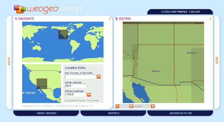
Select the general area you’re interested in with the pane at left; enter coordinates, city/country/zip code, or drag the selection box to the desired area. The selected area will be actively updated in the Refine box at right; you can also zoom in/out in Refine, or drag the map to move it to a different area, and have the changes reflected on the left. Next always moves you on to the next step.
wg2

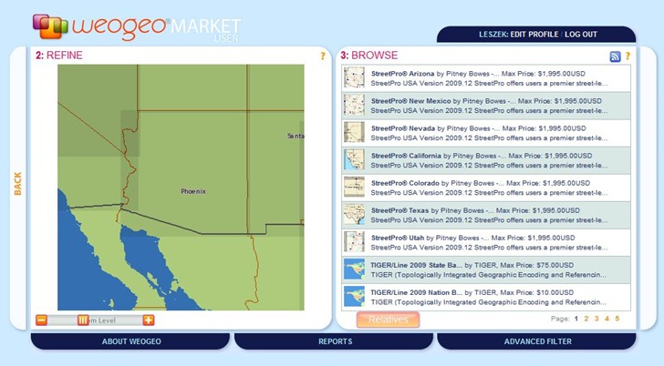
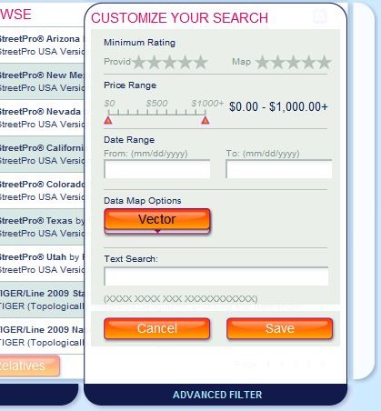
The Browse pane shows all datasets that contain any data that lies within the defined geographic area. As you zoom in on the map at left to select a smaller area, this list can actively shrink as datasets outside the selected area are dropped. By default, all vector datasets for an area are displayed. To search for specific datasets, or change the data type to raster, click on the Advanced Filter tab at the bottom.
wg3

Data options are Vector, Raster, Data Types (both vector and raster), and Other. You can also refine the data types by searching by rating, cost, and text terms (no Booleans in text search, as far as I could tell). To search for free datasets only, just move the right cost slider all the way over to the left.
wg4

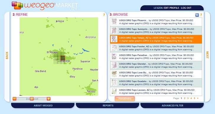
One note on raster data searches. weogeo has all USGS topographic maps (1:24K) available for download, but if you’re zoomed out even a small degree, you’ll get dozens if not hundreds of maps listed in the data browser. Zoom in as close as possible to your target area to reduce the size of this list. In the view above, the darker shaded areas represent the maps listed at right; click on a map listing at right, and it will be highlighted/darkened at left.
wg5

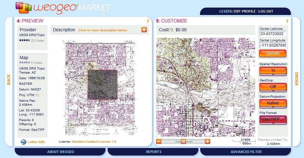
The next two panes provide a preview of the map, and then additional options, including file format (GeoTiff default for topos, but you have the option for others including JPG, ERDAS IMG, and ESRI HD; you can also choose the datum of the output coordinate system (NAD27, NAD83 or WGS84 here).  When ready, click on Order:

wg6

Make sure you check the “Accept Content License” box (and check the Total Charge, to make sure you haven’t chosen a paid dataset in error). Click on Order Now, and in a short period of time, you’ll get an email with a link to the download page for your data.
wg7

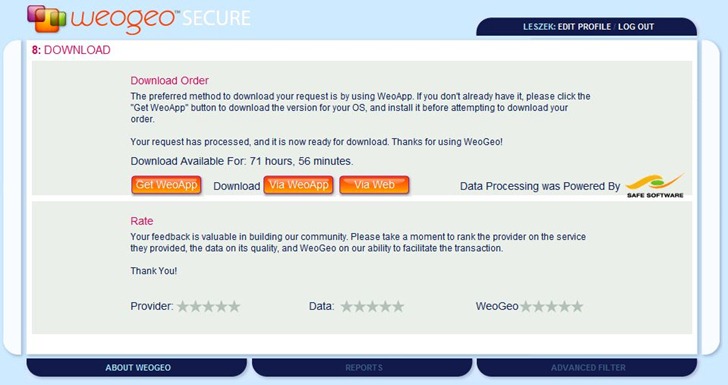
You have two options for downloading the data. weogeo’s preferred method is to use their WeoApp (Windows/Mac/Linux), which manages not only downloads but also uploads if you have a library account. Clicking on the Via WeoApp link will download a .weo file, which you then open with the WeoApp to download the data into a destination folder. Clicking on Via Web takes you to a page with a download link to the data in zipped file format.

They may not have the exact dataset you want, but it’s definitely worth a visit just to check out what they have; much of it looks like it could useful at some point. And keep monitoring the Fiducial Marks blog to see what new datasets get added.